Calm Day before Storms Tomorrow
COLUMBUS, Mississippi (WCBI) – We are ending the week dry and calm, but a cold front move through tomorrow which will bring a severe weather threat.
FRIDAY: A nice day to be outside and soak up some sunshine before scattered clouds begin to push in. The ridge will move off to the east which will change our winds from easterly to southerly. This will bring more moisture into NE Mississippi. The moisture increase will also for more clouds by the evening and mostly overcast for Saturday. Highs will be in the mid 80s to upper 80s.
FRIDAY NIGHT: For any football games tonight it will be dry with lows in the middle 60s if you are walking out the door early in the morning. Clouds will stick around after the evening hours.
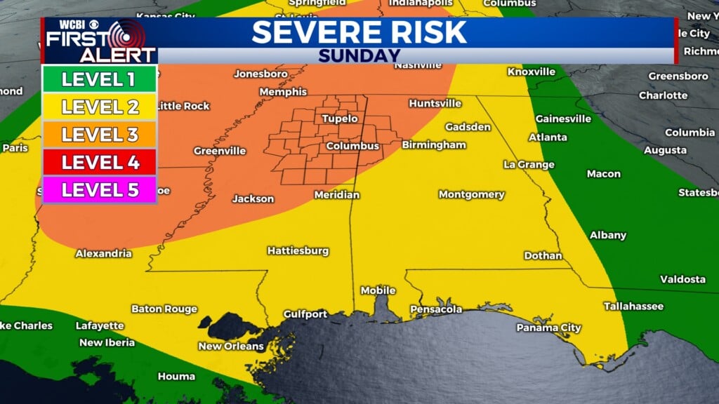
WEEKEND: A strong cold front is expected this weekend. Our area is under a level 1 – Marginal Risk and Level 2 – Slight Risk. The level 2 is for most of our northwestern counties. The main threat will be gusty winds. An isolated tornado cannot be ruled out, so be prepared on where you can seek shelter just in case. The timing is still uncertain as models have not agreed on the exact timing of when the system will pass through our area. The rough timing is around 8PM on Saturday until 5AM Sunday. Make sure your ringer is turned on and you continue to have a way to receive alerts! More to come, so stay with us.