Chances for storms continue, watching Sally in the Gulf
As a cold front approaches the area, we’ll see more chances for hit-or-miss storms over the next several days. Depending on the exact path of what will be Hurricane Sally, we could see more steady rain by the middle of the week before we experience some drier weather.
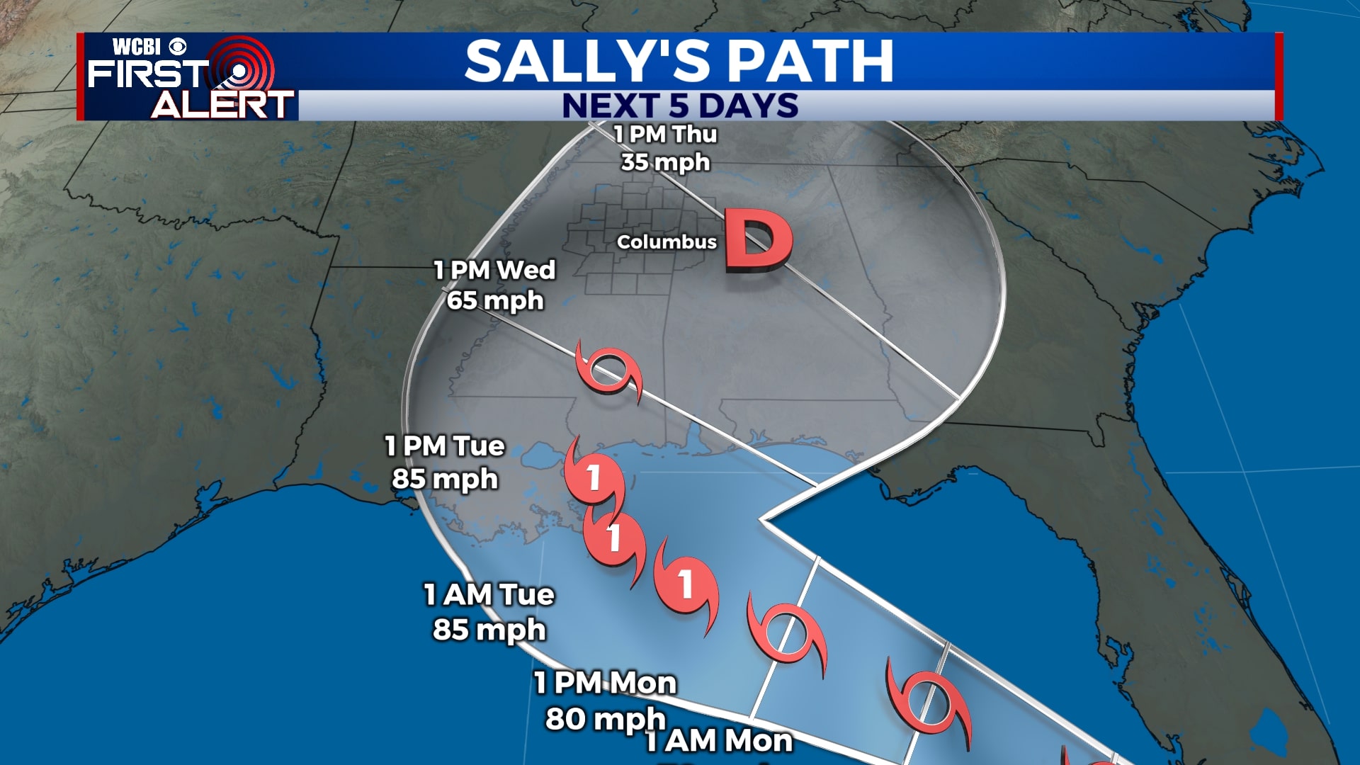
TROPICS: As of 4 pm Saturday, Tropical Storm Sally was located near the Florida Keys with winds of 40 mph. The storm is expected to intensify once it enters the Gulf of Mexico and make landfall late Monday night as a category 1 hurricane. Portions of the Louisiana, Mississippi, Alabama, and Florida coastlines will experience flooding rains, gusty winds, and storm surge. The worst of Sally, as of now, is expected to stay to our south and east.
SATURDAY NIGHT: Areas of showers and a little bit of thunder will continue overnight. Lows will be in the mid 70s under a mostly cloudy sky.
SUNDAY: Another day of scattered storms is in store for Sunday. Not everyone will see rain all day, but the best chance for storms will be north of Highway 82. Still, don’t be surprised if you run into a quick downpour. Highs will be near 90 with a few peeks of sun through the day.
MONDAY-TUESDAY: We’ll keep the chance in for some pop-up storms through Monday and Tuesday, but we’ll still see a little bit of sunshine each day. Temperatures will stay warm and muggy with highs in the upper 80s and overnight lows near 70.
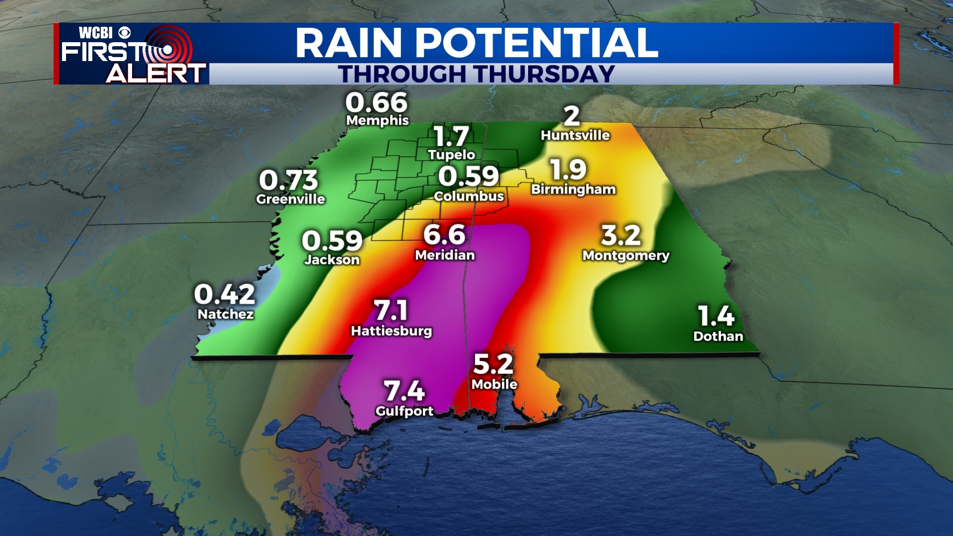
WEDNESDAY-THURSDAY: While most of Sally will remain to our south, we’ll likely still see some periods of rain on Wednesday and Thursday from some of the outer bands. Overall, some areas could see up to 3″ while others don’t get much at all. It’ll all depend on exactly where the storm tracks. Temperatures will be a little lower with highs in the mid 80s and overnight lows in the upper 60s to near 70.
FRIDAY-SATURDAY: Fingers crossed! It looks like we could see some drier and more comfortable weather return for Friday and into the weekend. Rain chances will remain low with a mix of sunshine and clouds. Highs will remain in the mid 80s with overnight lows in the mid 60s.


Leave a Reply