Chilly beginning to the week
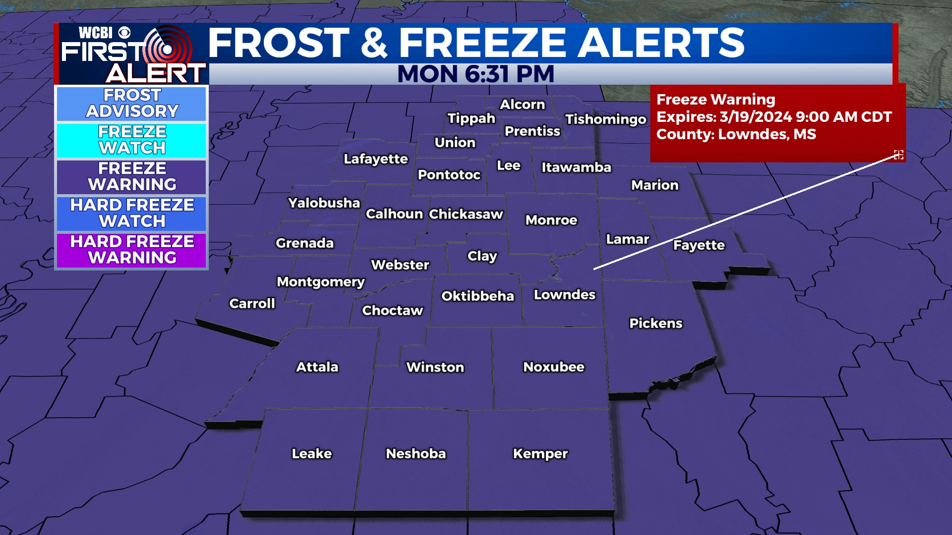
COLUMBUS, Mississippi (WCBI) – Monday began with chilly temperatures and a cold, breezy wind. Dangerous temperatures are expected across the corner tonight, with a Freezing Warning already issued. Looking forward to some mid-week recovery!
MONDAY NIGHT: It is going to be cold. We did spring forward with that time change, right? Temperatures tonight will fall into the middle to upper 20s! These are brutal, sub-freezing temperatures. Remember your 4 Ps – Pipes, Pets, People, and unfortunately those newly bloomed spring-time Plants.
**A Freeze Warning has been issued for 1AM – 9AM Tuesday morning. **
TUESDAY: A cold morning will lead to a comfortable afternoon. Clear conditions will continue, as high temperatures reach into the lower 60s. Low temperatures will be a bit warmer but still cold, dropping into the middle 30s.
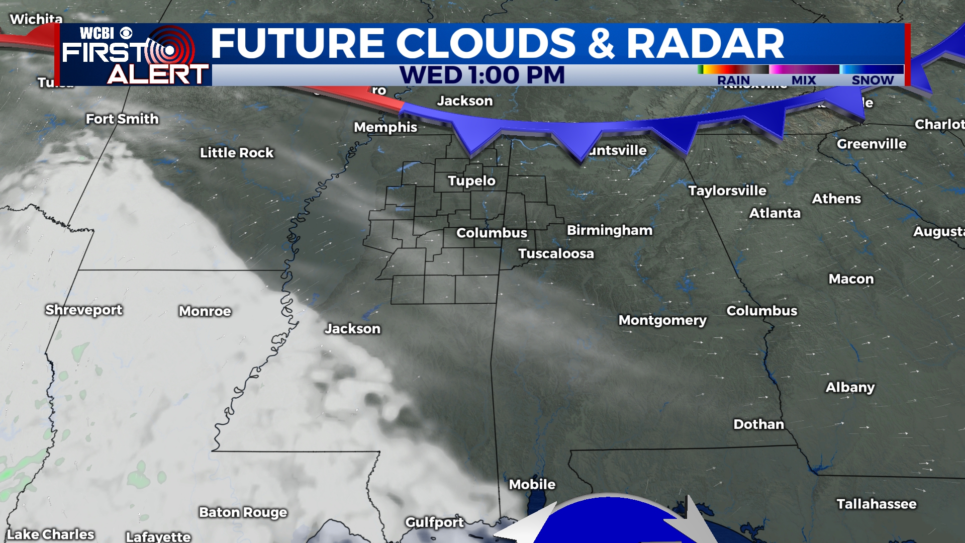
WEDNESDAY: Some recovery! Winds will shift, coming in from the South and SW. This will allow for extra moisture and cloud coverage to build back in to our NE corner. High temperatures will return to the lower 70s though! Low temps will still be cool, in the middle 40s.
END OF THE WEEK: There will be more of an increase in cloud coverage Thursday into Friday. Rain chance is light, but it will be possible for a few isolated showers both days. High temps fall back some, into the upper 60s. Overnight lows a bit more tolerable in the upper 40s.


