Clearing out for the end of the week
COLUMBUS, Mississippi (WCBI)- Rain showers will continue passing through Mississippi tonight, with the severe threat coming to an end. Rain and cloud coverage will clear off to the East through the overnight hours. Temperatures are also going to be colder before they warm back up.
THURSDAY NIGHT: Rain showers will continue through the evening, eventually clearing off to the East. The tornado watch for the rest of NE MS and western AL will expire by 7 and 8 PM. From there, the cloud coverage will start to clear out overnight. Colder air is moving in behind the front and will drop temperatures tonight into the middle 30s.
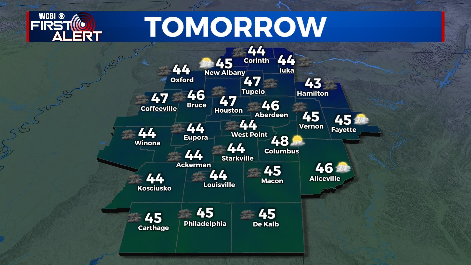
FRIDAY: The end of our week is going to end much nicer. Cloud coverage will continue to clear throughout the morning, becoming mostly clear later in the day. It is still going to be cool though. High temperatures will only be in the upper 40s. Sky conditions remaining clear overnight will allow the low temperatures to drop much further. Overnight temperatures will be in the middle 20s.
WEEKEND: Temperatures are slowly going to be warming up, middle 50s by Saturday and middle 60s for Sunday. Cloud coverage will remain fairly light for Saturday, but will begin filling back in on Sunday. Rain chance will stay at 0% throughout the weekend, perfect for college baseball to get started at MSU! Overnight temperatures will become much more mild.
NEXT WEEK: High temperatures will work their way back into the 70s for the first half of the week. Cloud coverage is going to be building and becoming mostly cloudy by Monday. Light rain chances will also return for Monday. Rain chances will increase through the first couple days of the week, as the next round of showers and storms move in with the newest system. Stay tuned for more details on this next system next week.