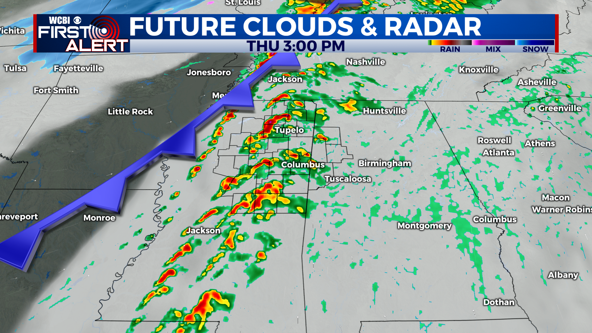
Clouds arrive tomorrow afternoon, then thunderstorms likely Thursday
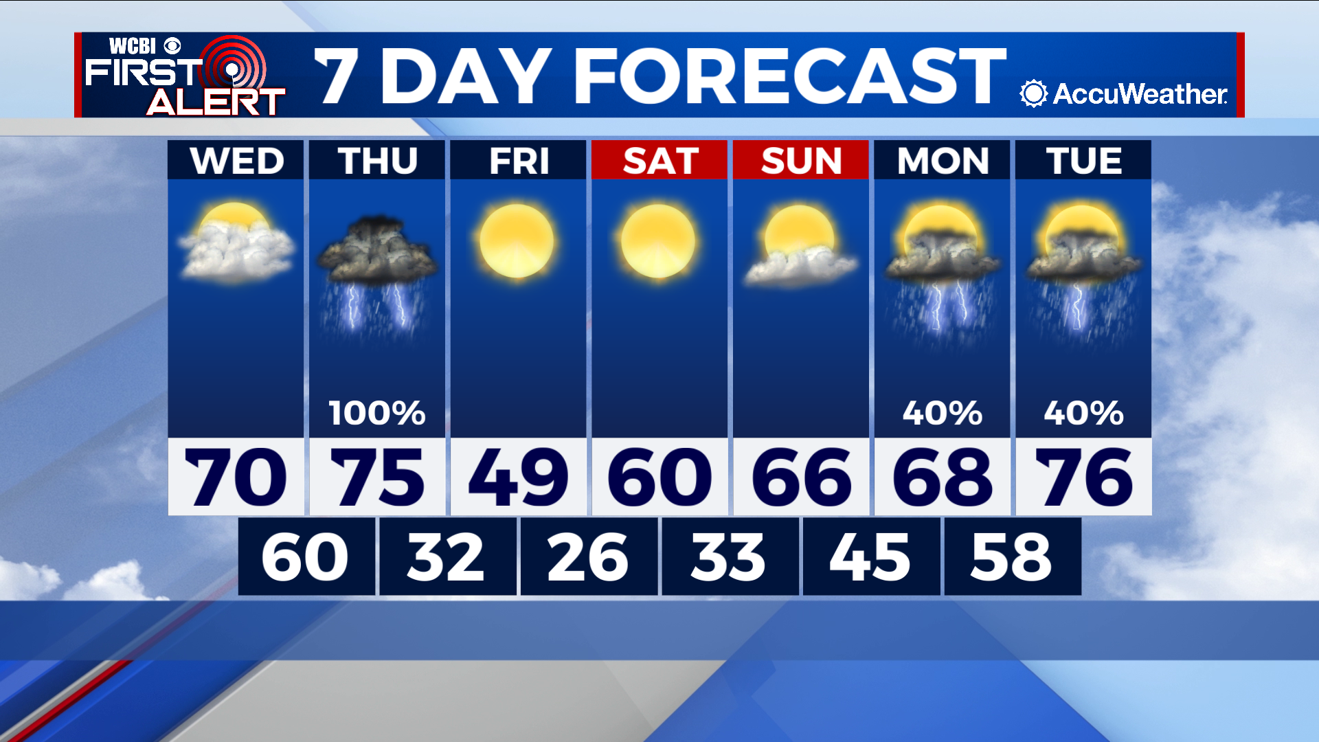
COLUMBUS, Mississippi (WCBI) – SUMMARY: We reached the upper-60s to low-70s across the region today. Warm temperatures will continue the next couple of days ahead of our next system on Thursday.
TONIGHT: Mostly clear with lows in the mid-40s. South wind around 5 mph.
WEDNESDAY: Sunny and warmer with highs in the low-70s. South wind 5-10 mph with gusts up to 20 mph.
WEDNESDAY NIGHT: Mostly clear with lows in the low-60s. South wind 5-10 mph with gusts up to 20 mph.

EXTENDED FORECAST: Showers and thunderstorms are likely Thursday as a strong storm system makes its approach to the region. Some storms may be strong to severe with damaging winds and an isolated tornado or two across the region. Stay tuned for additional updates. Once this system moves through the area, we will clear out and cool down rather quickly. Friday will be mostly sunny with highs in the 40s once again.


Leave a Reply