Clouds stick around, stormy New Year’s Eve
Mostly cloudy skies will continue for the next several days with highs near 60. We’ll be even warmer by Wednesday and Thursday as our next storm system approaches the area.
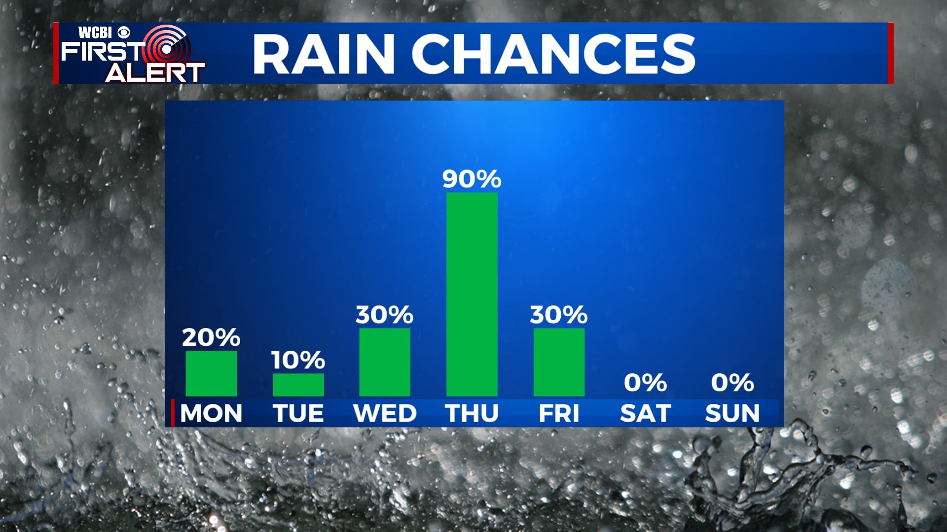
MONDAY: Mostly cloudy with an isolated morning sprinkle possible. Highs will be in the mid to upper 50s with a southerly wind, becoming northerly by the evening.
MONDAY NIGHT: Mostly cloudy but dry. Lows in the low to mid 40s.
TUESDAY: Once again, mostly cloudy skies will continue with highs in the mid to upper 50s. An isolated sprinkle is possible, but most of us won’t see any rain.
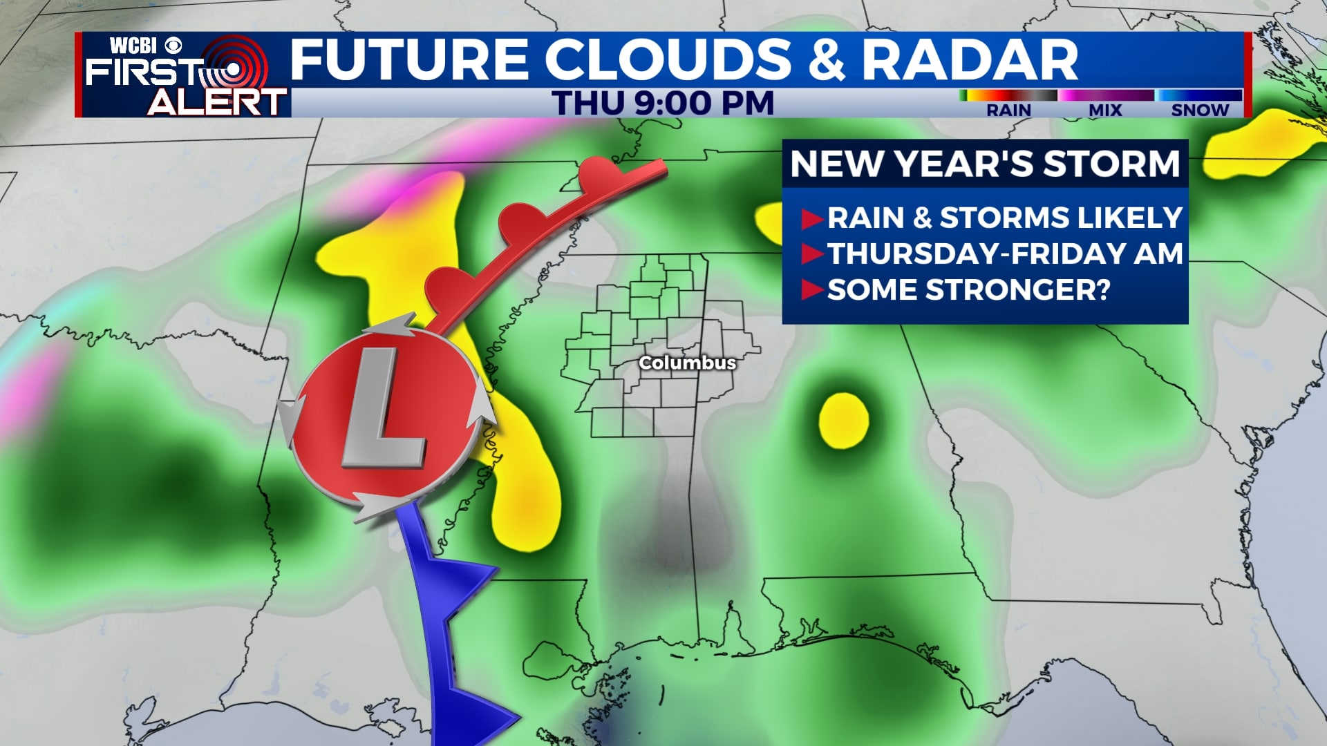
WEDNESDAY: Most of Wednesday will be mostly cloudy and dry, but rain will begin to move in after sunset. Highs will be in the mid 60s and lows will be in the upper 40s.
THURSDAY: New Year’s Eve will be rainy with some afternoon and evening storms. Some storms could be on the stronger side with gusty winds. Many locations will climb to near 70 degrees in the afternoon. Rain showers will likely continue into the overnight hours of New Year’s Eve into New Year’s Day.
FRIDAY: Showers will slowly exit through the morning, leaving us dry and partly cloudy by the afternoon. We’ll be cooler with temperatures in the 50s through the day.
SATURDAY-SUNDAY: The weekend will be drier with some sunshine. Temperatures will remain cool with highs in the mid 50s and lows in the 20s and 30s.
Follow WCBI Weather on Facebook, Twitter, and Instagram
Follow Meteorologist Trevor Birchett on Facebook and Twitter


Leave a Reply