Cloudy and dry Saturday, more rain Sunday
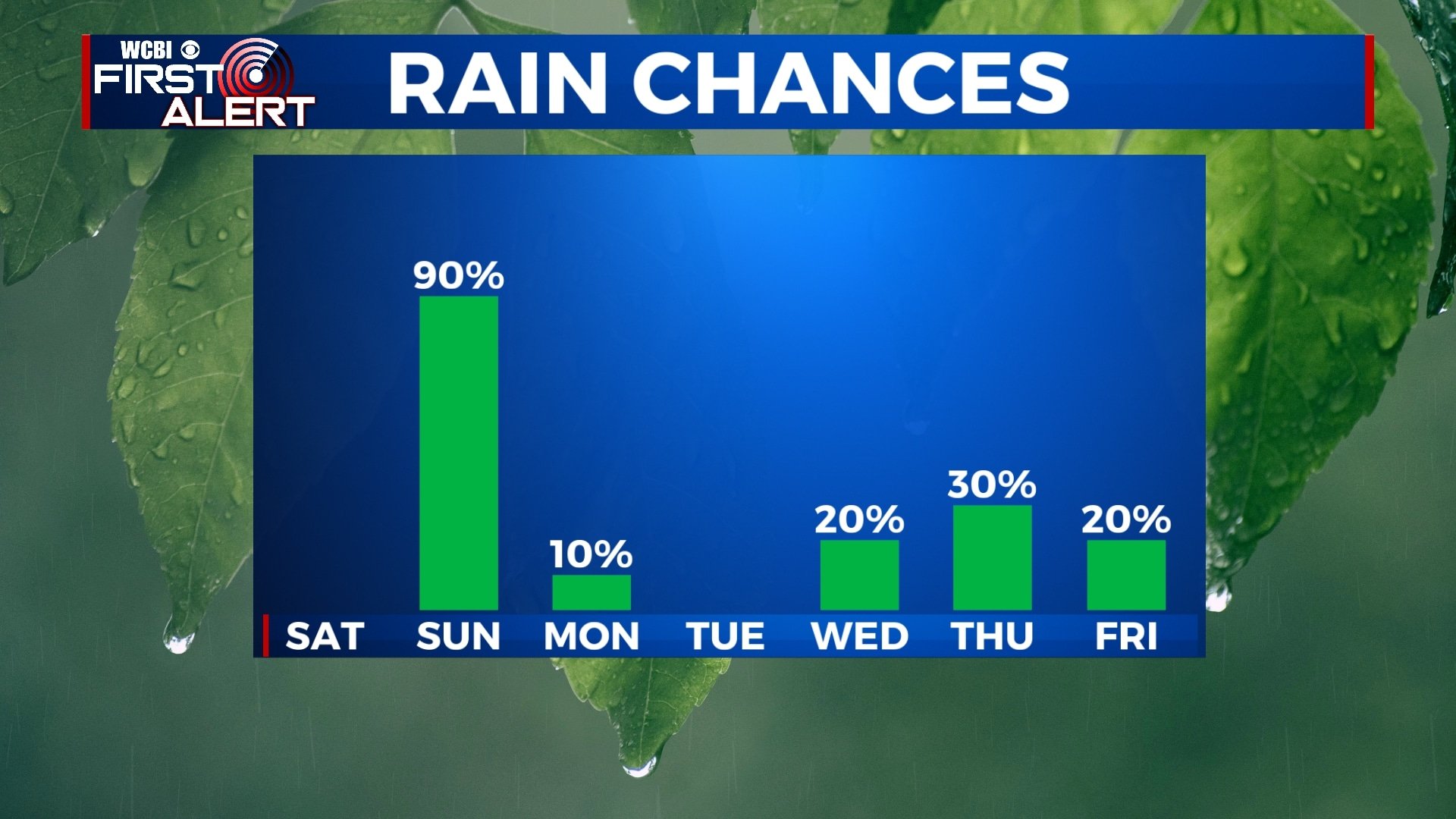
We’ll start off the weekend dry and mostly cloudy, but rain will move back into the area for much of Sunday. After that, temperatures will drop dramatically going into next week.
FRIDAY NIGHT: Off-and-on showers possible before midnight with mostly cloudy skies continuing. Temperatures will fall to the upper 40s with a light northerly wind.
SATURDAY: Aside from some peeks of sun here or there, it looks like clouds will stick around for much of Saturday. Fortunately, we’re not expecting any rain. Highs will be in the mid 60s with northerly winds 5 to 10 mph.
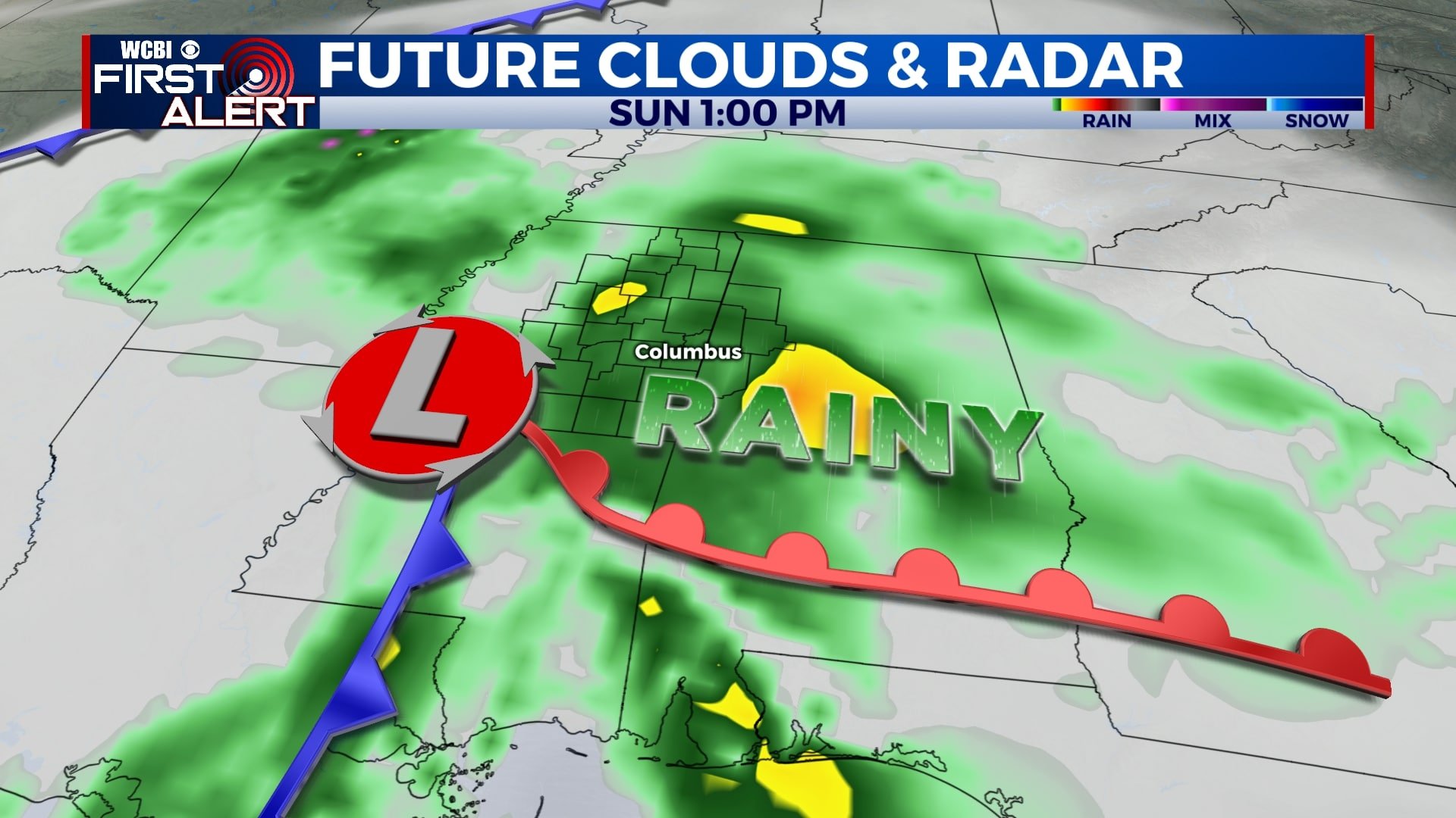
SUNDAY: Rain will begin before sunrise on Sunday with showers and storms likely throughout the day. Rain could last through much of Sunday night as well. Morning lows will be in the mid 40s with afternoon highs in the low 60s.
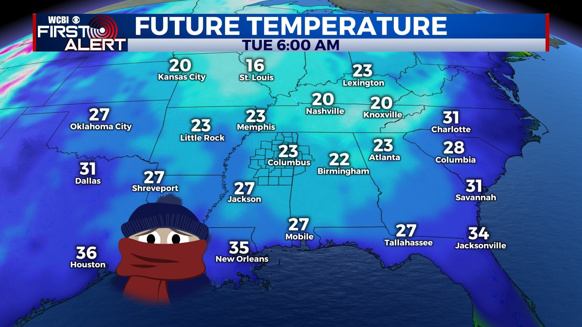
MONDAY-TUESDAY: Once Sunday’s system exits the area, temperatures will fall quickly. Morning lows on Monday will be in the upper 30s with highs only in the mid 40s. A hard freeze is likely Monday night into Tuesday morning as temperatures are expected to fall into the low and mid 20s across the entire area. Skies will remain partly cloudy on Monday with plenty of sunshine Tuesday.
WEDNESDAY-FRIDAY: Temperatures will remain cool for the second half of the week as well with highs in the 40s and 50s and lows in the 20s and 30s. Some showers are possible Wednesday night into Thursday with perhaps a few sprinkles on Friday as well. Otherwise, we’ll see a mix of sunshine and clouds.
Follow WCBI Weather on Facebook, Twitter, and Instagram
Follow Meteorologist Trevor Birchett on Facebook and Twitter


Leave a Reply