Cloudy & warm Sunday, storms on the way
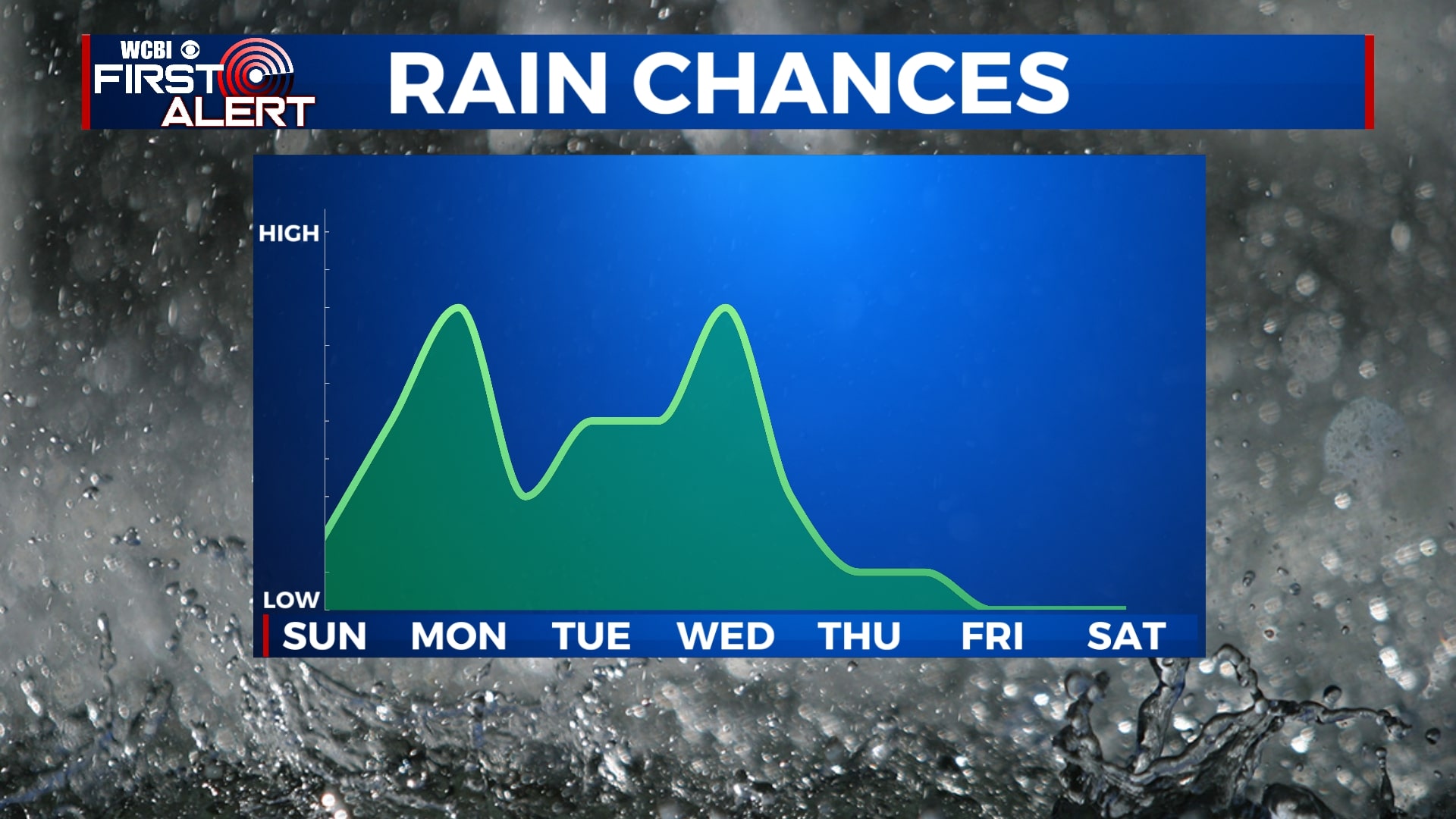
Temperatures will remain warm for Sunday as mostly cloudy skies continue. We will be watching a couple of chances for rain and storms this week, the first of which will be Monday morning and the second on Wednesday. Strong storms are possible, especially on Wednesday.
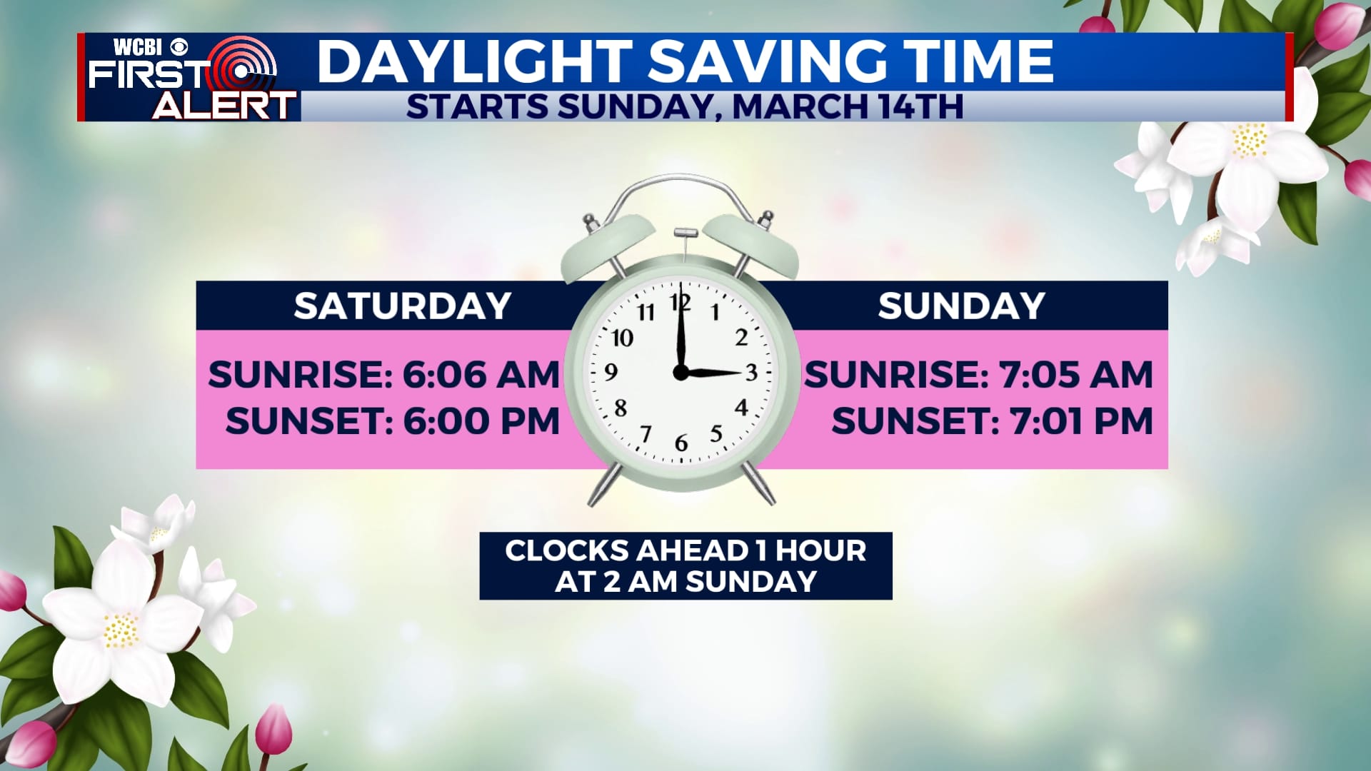
SATURDAY NIGHT: Clouds will continue to move across the area, but some areas of clear sky are possible. Temperatures will fall to the mid 50s with a generally calm wind. Don’t forget to set your clocks ahead one hour!
SUNDAY: Aside from some peeks of sun in the morning, most of Sunday will remain mostly cloudy. Highs will be in the low 80s with a breezy southwesterly wind.
SUNDAY NIGHT: Rain and storms will move into the area after midnight. Some storms could produce brief periods of gusty winds and heavy rain. Lows will be near 60.
MONDAY: We’ll wake up to some showers and storms early Monday morning, but it appears those will exit by lunchtime, leaving us dry for the rest of the day. We could even see a little sunshine. Highs will be in the mid 70s.
TUESDAY: Rain showers are likely off-and-on through the day. Highs will be in the mid 70s with overnight lows near 60.
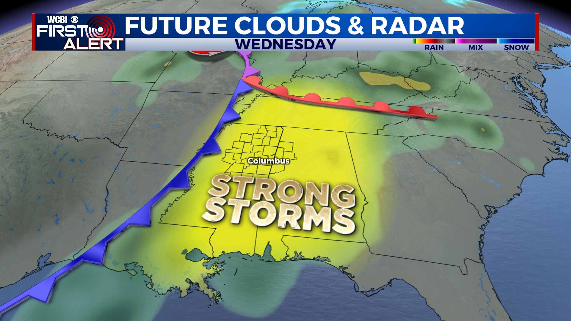
WEDNESDAY: Our second round of storms will arrive on Wednesday. After some morning showers, we could see a little bit of sun before storms develop into the afternoon and evening. While we are still a few days away, we will have to monitor the potential for severe weather on Wednesday. As of now, it appears damaging wind, heavy rain, and tornadoes are possible.
THURSDAY-SATURDAY: The end of the week and next weekend look nice with a mix of sun and clouds and highs in the 60s. Overnight lows will be in the 30s.
Follow WCBI Weather on Facebook, Twitter, and Instagram
Follow Meteorologist Trevor Birchett on Facebook and Twitter


Leave a Reply