Cold front bringing in nicer weather to end the workweek
SUMMARY: A cold front will push through early Wednesday that will bring us some much better changes to our weather late week into the weekend. It’s going to be warm but humidity levels will be much lower and very comfortable to be outside for the month of June.
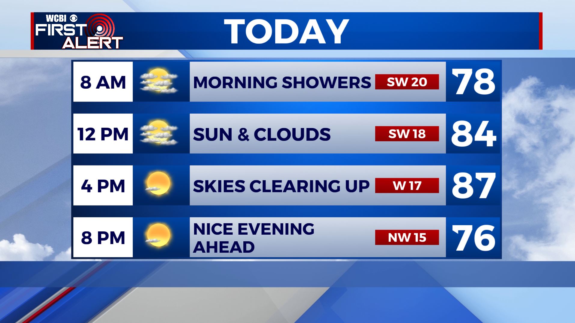
WEDNESDAY: A cold front is pushing through the WCBI Viewing Area this Wednesday morning. Any showers should move out by midday, allowing the sunshine to return & less humid, dry conditions to build in by the afternoon. Highs top out in the mid 80s. SW/NW winds 10-20 mph.
WEDNESDAY NIGHT: Mostly clear and very comfortable. Overnight lows around 60.
THURSDAY: Sunny and clear blue skies. Refreshing with the low humidity. Highs in the lower to mid 80s.
THURSDAY NIGHT: Clear skies and pleasant. Overnight lows in the upper 50s to lower 60s.
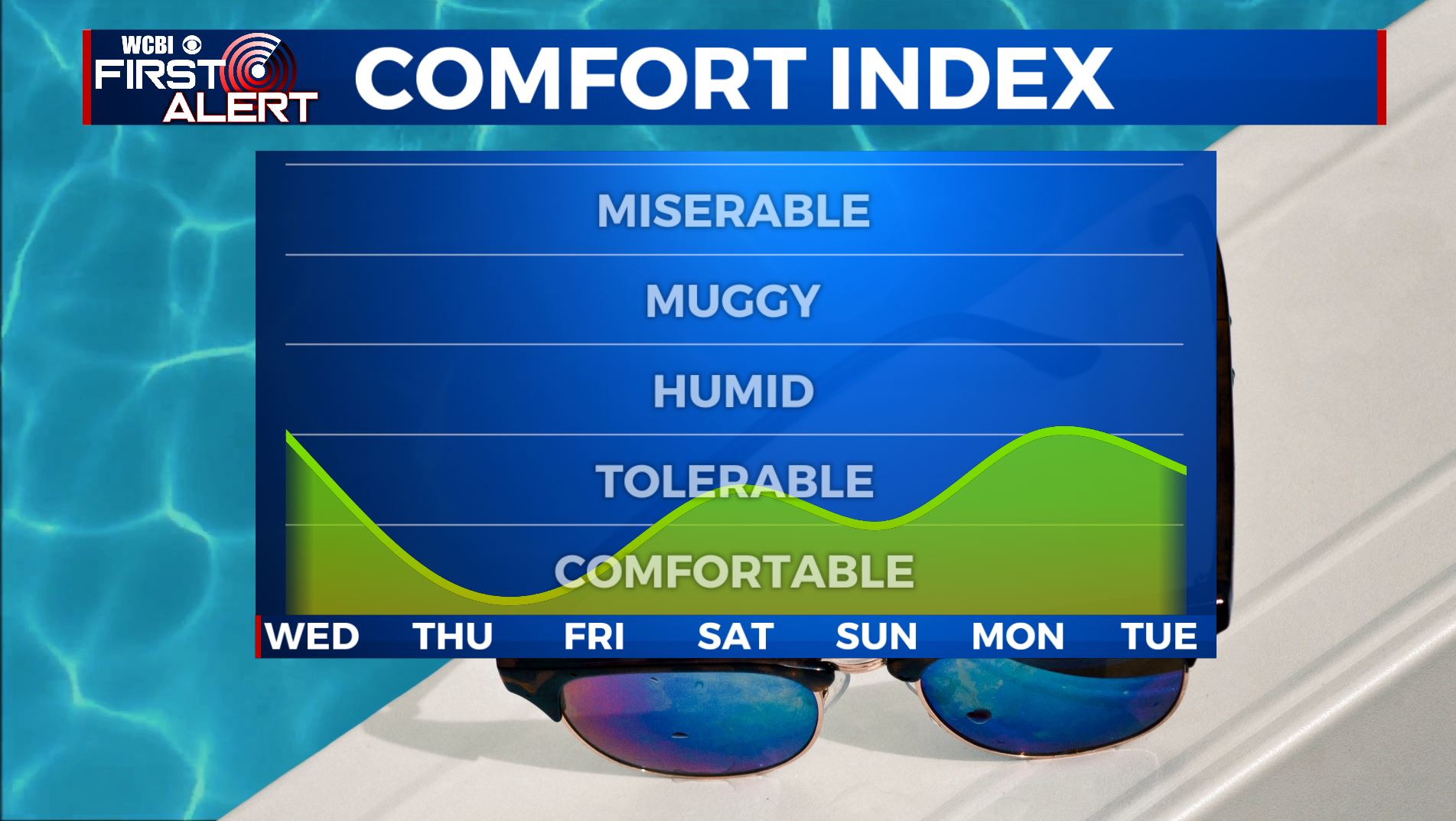
FRIDAY-WEEKEND: Lots of sunshine, dry and staying pleasant for mid June late week and into the weekend. Highs near average in the mid to upper 80s with overnight lows mainly in the lower to mid 60s.
MONDAY: Sunshine mixed in with a few clouds but staying dry to start the new work week. High temperatures remain the the mid 80s.
TUESDAY: We may see a slight chance of rain but a mix of sun & clouds overall. Highs warming back up a bit to upper 80s to near 90 degrees with the humidity making a comeback.
Stay connected with @WCBIWEATHER on Facebook, Twitter, Instagram, and the WCBI News App


Leave a Reply