Cold front knocks highs into low 50s before rain chances ensue later in week
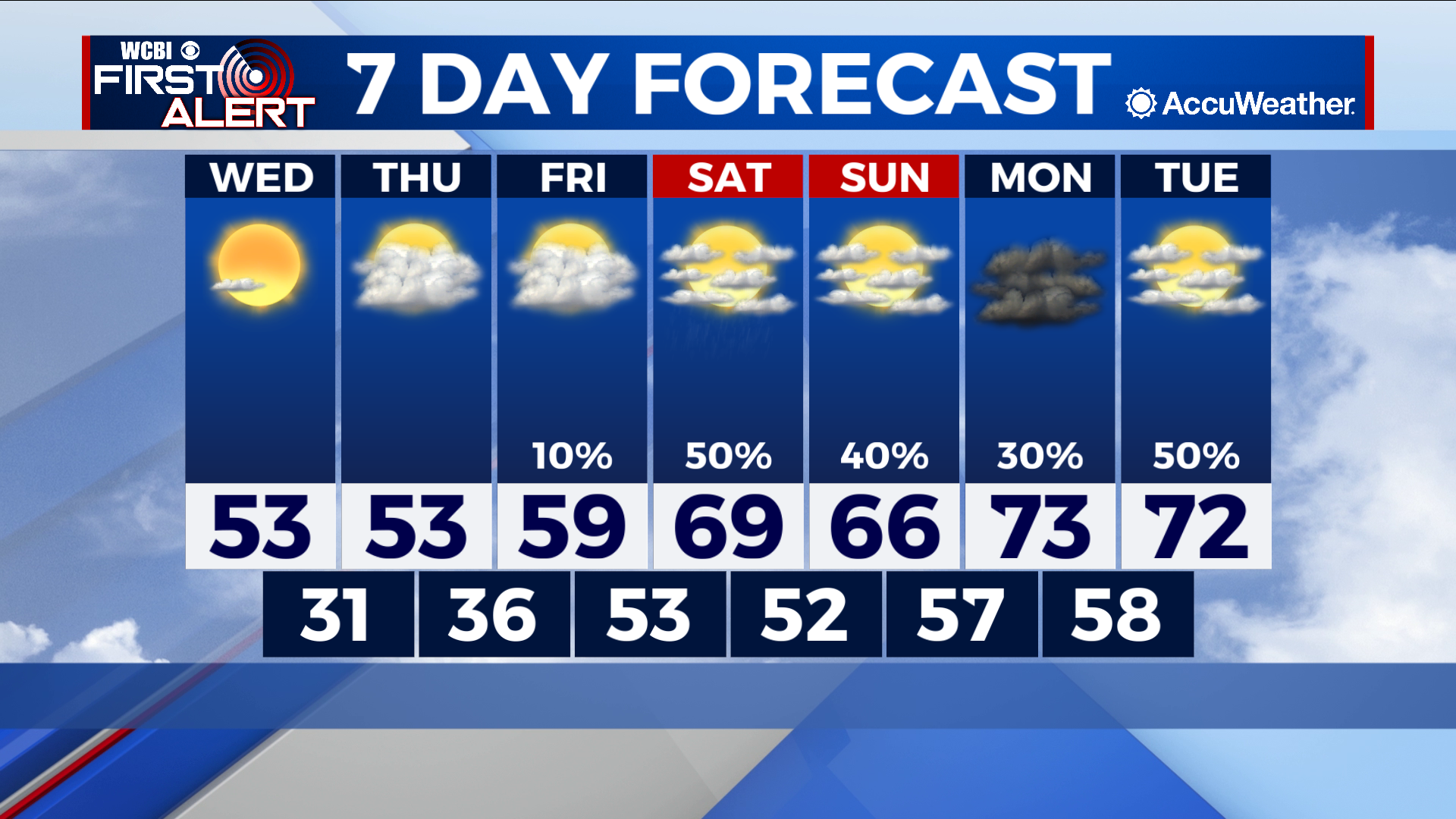
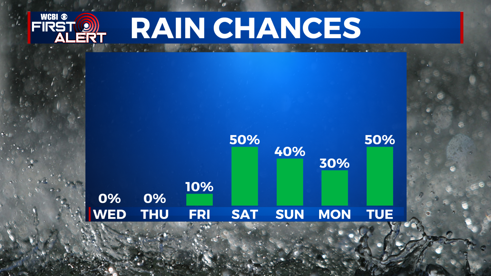
COLUMBUS – SUMMARY: A cold front early Wednesday knocks highs into the low 50s and lows into the low 30s. Multiple rain chances take shape over the weekend into next week.
WEDNESDAY: We only break into the low 50s after a robust cold front makes it’s way into the region early Wednesday morning. Plenty of sunshine accompanies, a welcome change from the storms the night before. Lows bottom out at or below freezing overnight.
THURSDAY: Nearly status quo in terms of temperatures with the exception that the low warm slightly Thursday night into the mid to upper 30s. More cloud cover will make it’s way into the region which should aid in keeping the high down.
NEXT WEEK: While the severe chance has come and gone, the chance for rain remains in a period beginning on Saturday and lasting through next Tuesday. We will keep you updated as the situation evolves each day of course. Highs will climb into the low 70s by next Monday in what will be an extremely mild start to December. Lows likewise, will climb into the upper 50s by overnight Sunday.