Cold Monday, Warmer and Sunny Mid-Week
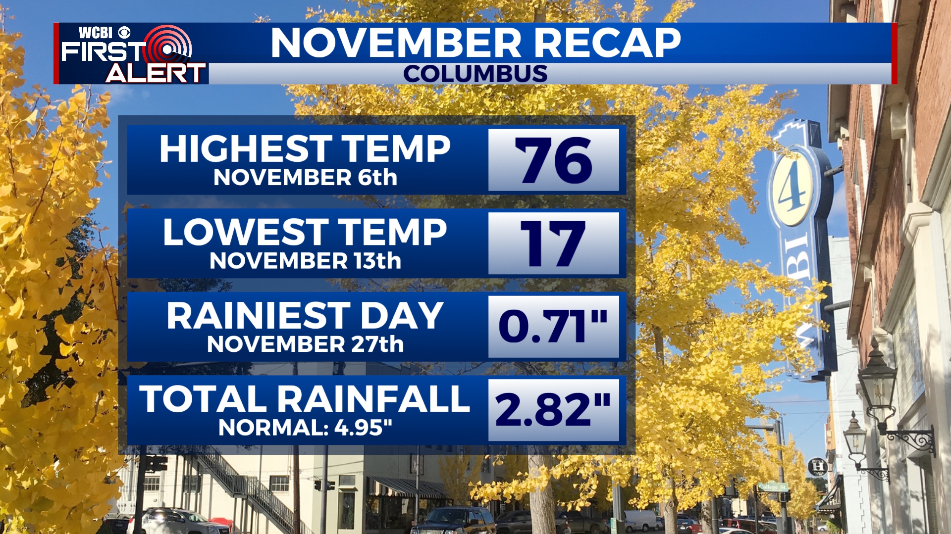
We’ve wrapped up what turned out to be a very active November weather-wise. From record-breaking cold to severe weather, we had it all. As we start December, we’ll be a little on the chilly side before temperatures return to near average. There will be another chance for some rain later in the week.
SUNDAY NIGHT: A cold night is in store with many areas getting close to or just below freezing. Mostly cloudy with winds gusting to near 25 mph out of the northwest.
MONDAY: It’ll be a cold start to the day with temperatures in the 30s and wind chill values below freezing. Breezy conditions will continue with gusts over 20 mph out of the northwest. We’ll see a mix of sun and clouds through the day with a high in the upper 40s.
TUESDAY-WEDNESDAY: A freeze is likely early Tuesday morning with overnight lows in the upper 20s. Highs will be in the mid to upper 50s through the middle of the week with a mix of sun and clouds.
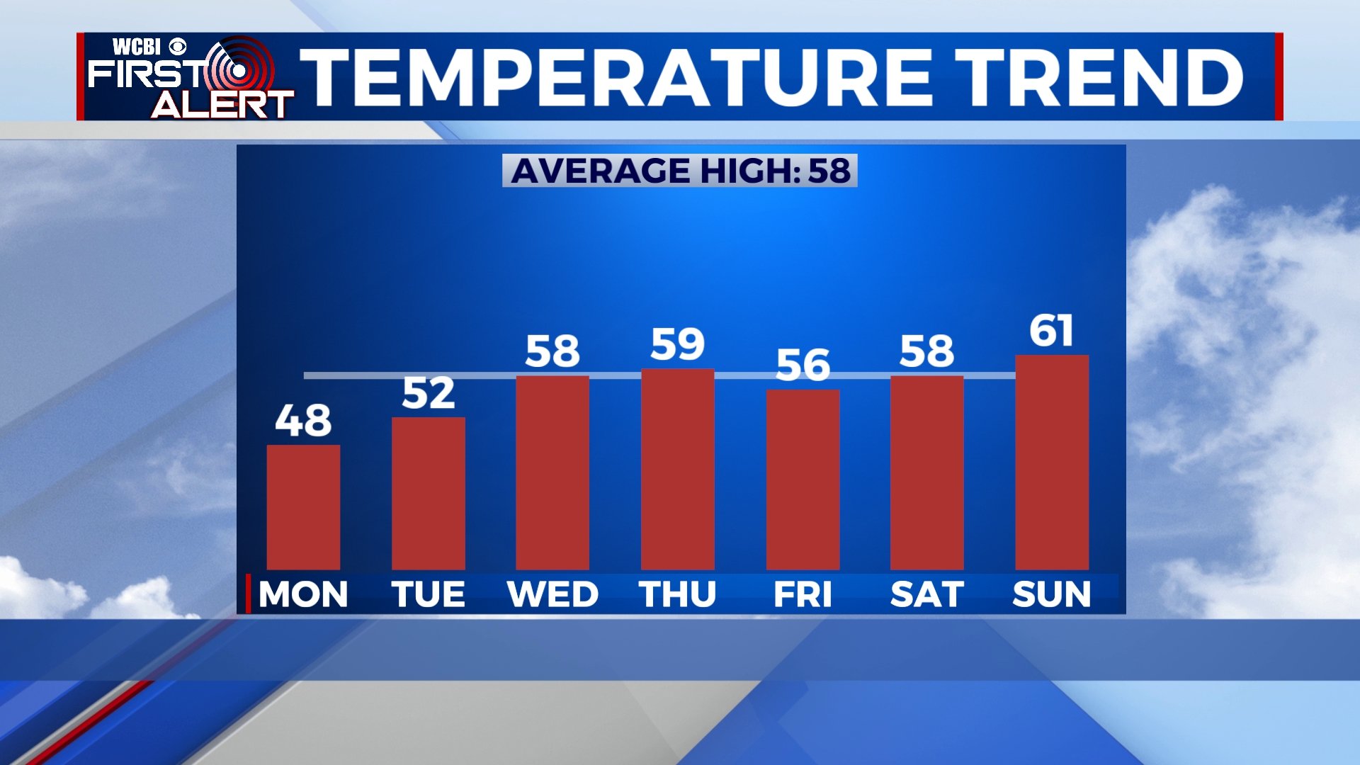
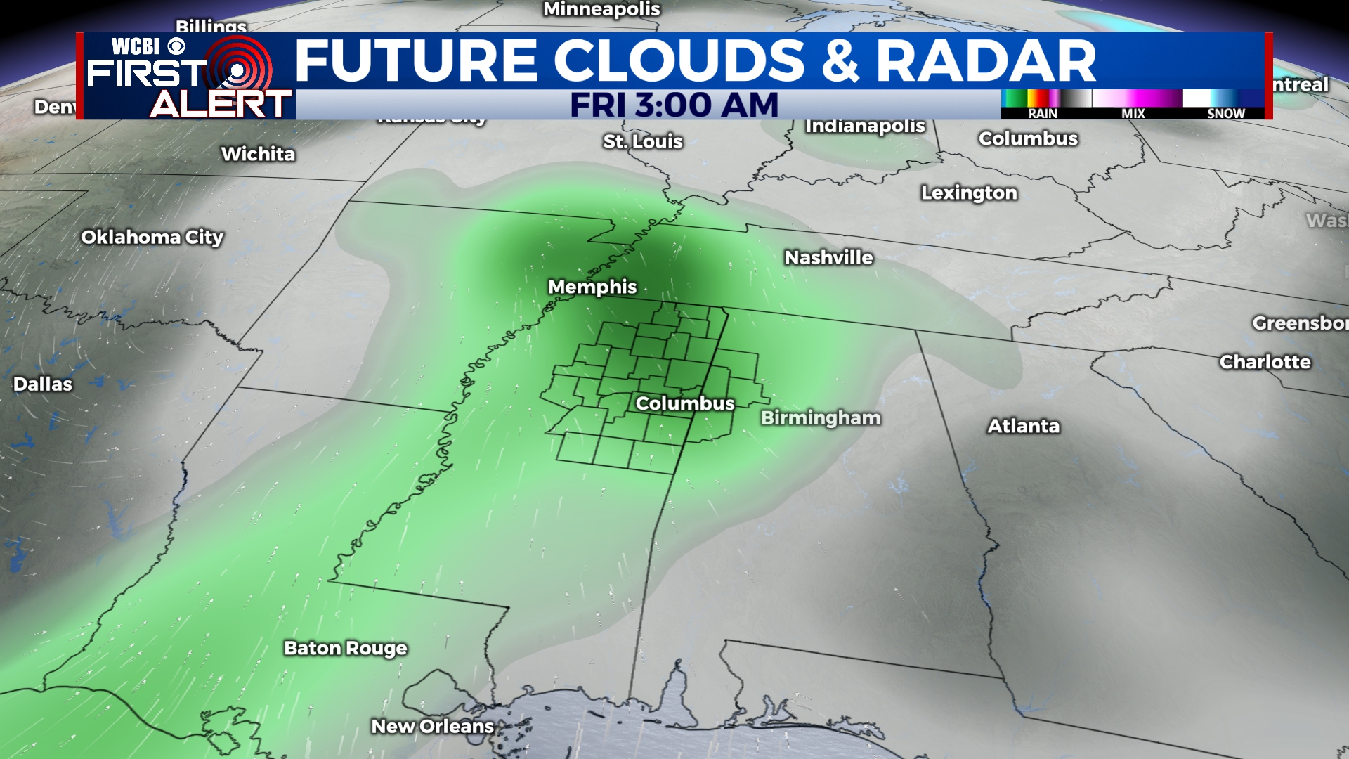
THURSDAY-FRIDAY: Clouds will build through the day on Thursday with highs near 60. Another system will bring the chance for some rain overnight Thursday into the morning on Friday, but most of Friday will be dry. Highs will be in the 50s on Friday.
SATURDAY-SUNDAY: It looks like we’ll be in for a great weekend with highs near 60 and a mix of sun and clouds. Morning lows will be in the 40s.


Leave a Reply