Cold Weather Returns, More Rain By Thursday
It’s certainly feeling more like winter outside with temperatures expected to drop into the 20s overnight tonight. We’ll be dry and sunny for the next few days before rain chances return once again for Thursday and Friday. As of now, the weekend is looking dry and pleasant.
SUNDAY NIGHT: Temperatures will fall into the low to mid 20s overnight with gusty winds continuing. A few clouds will filter in, but generally we’ll stay mostly clear.
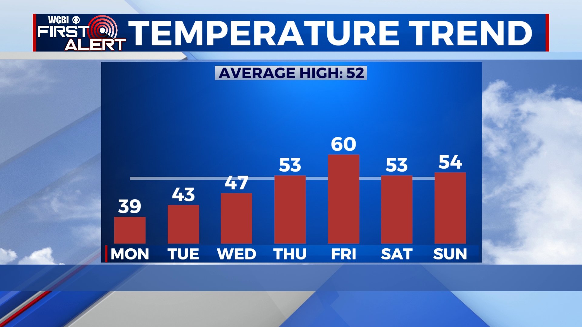
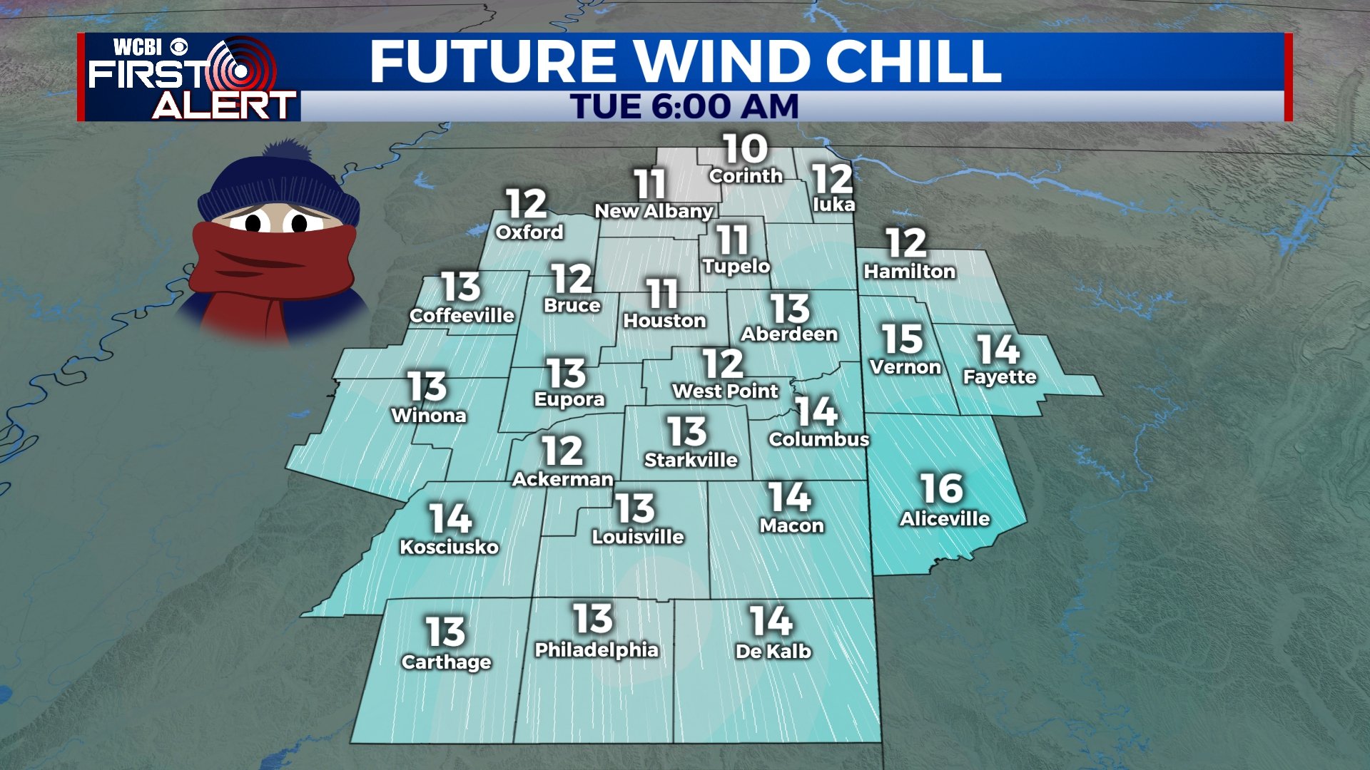
MONDAY-TUESDAY: Cold and sunny weather will continue with highs in the upper 30s on Monday and morning lows on Tuesday in the upper teens and low 20s. Gusty winds could make it feel 10-15 degrees colder than the actual temperature at times. Highs on Tuesday will be just a touch higher as we get into the low 40s in the afternoon, but it’ll still be cold.
WEDNESDAY: Clouds will increase through the day on Wednesday as another system approaches. Morning lows will be in the low 20s with temperatures reaching the upper 40s by the afternoon.
THURSDAY-FRIDAY: Thursday will start off dry, but areas of rain will develop through the afternoon and evening. It’s looking like the best chance for rain will be overnight Thursday, but it’s likely that we see some showers linger into Friday. While some of us could hear a rumble of thunder or two, we’re not expecting any strong to severe storms and rainfall amounts should generally be under an inch. Highs will be in the mid 50s on Thursday and into the low 60s by Friday.
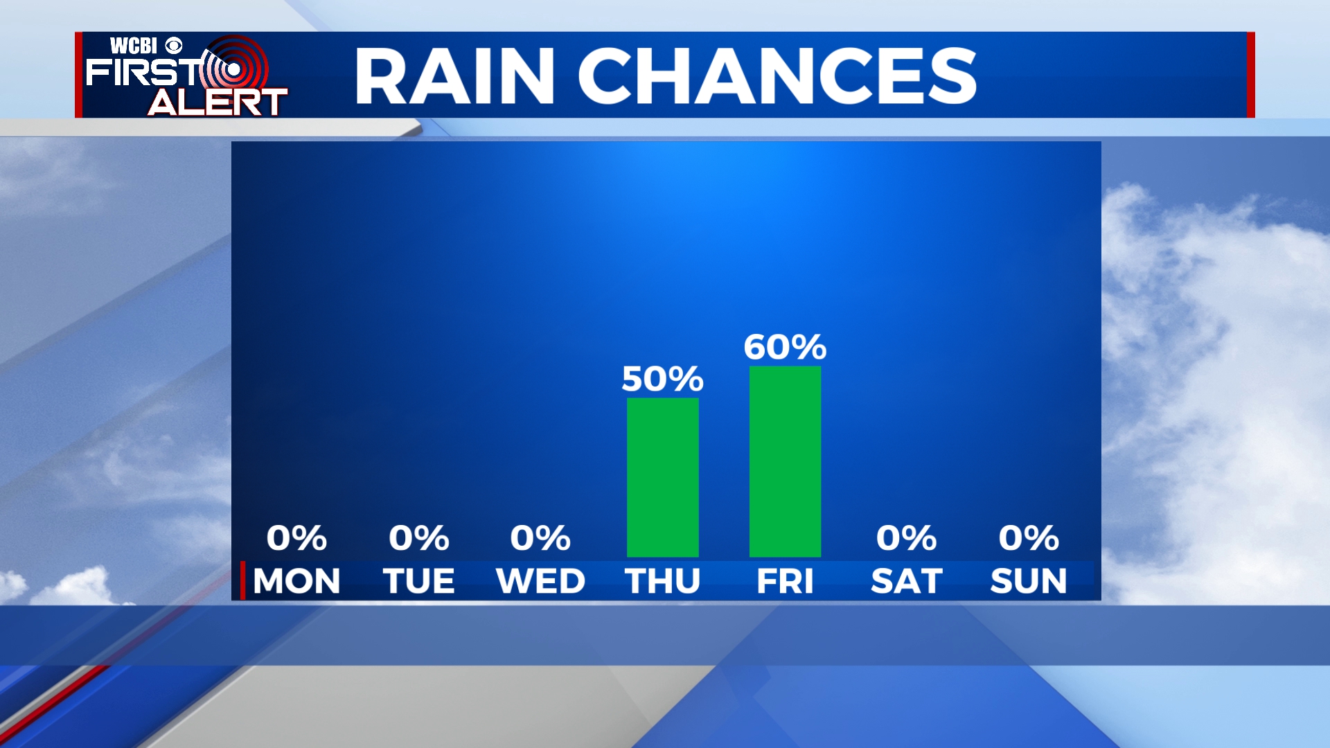
SATURDAY: As of now, it looks like any rain and storm activity will exit by the weekend, but a few clouds could linger. Temperatures will be near average with highs in the 50s and lows in the 30s.


Leave a Reply