Continued severe weather threat
COLUMBUS, Mississippi (WCBI)- The continued trend for a severe weather risk continues throughout the next several hours. By Friday afternoon, conditions will begin to clear to the East leading us towards a beautiful weekend.
THURSDAY NIGHT: There has been a lot of conversation for what could occur tonight. Heavy cloud coverage and the chance for scattered showers will continue through Thursday night and into Thursday evening. There will be possibility for a stronger storm or two throughout the night. Temperatures tonight will be in the lower 60s. What comes overnight Thursday and into Friday morning is what has the attention for the WCBI weather team.
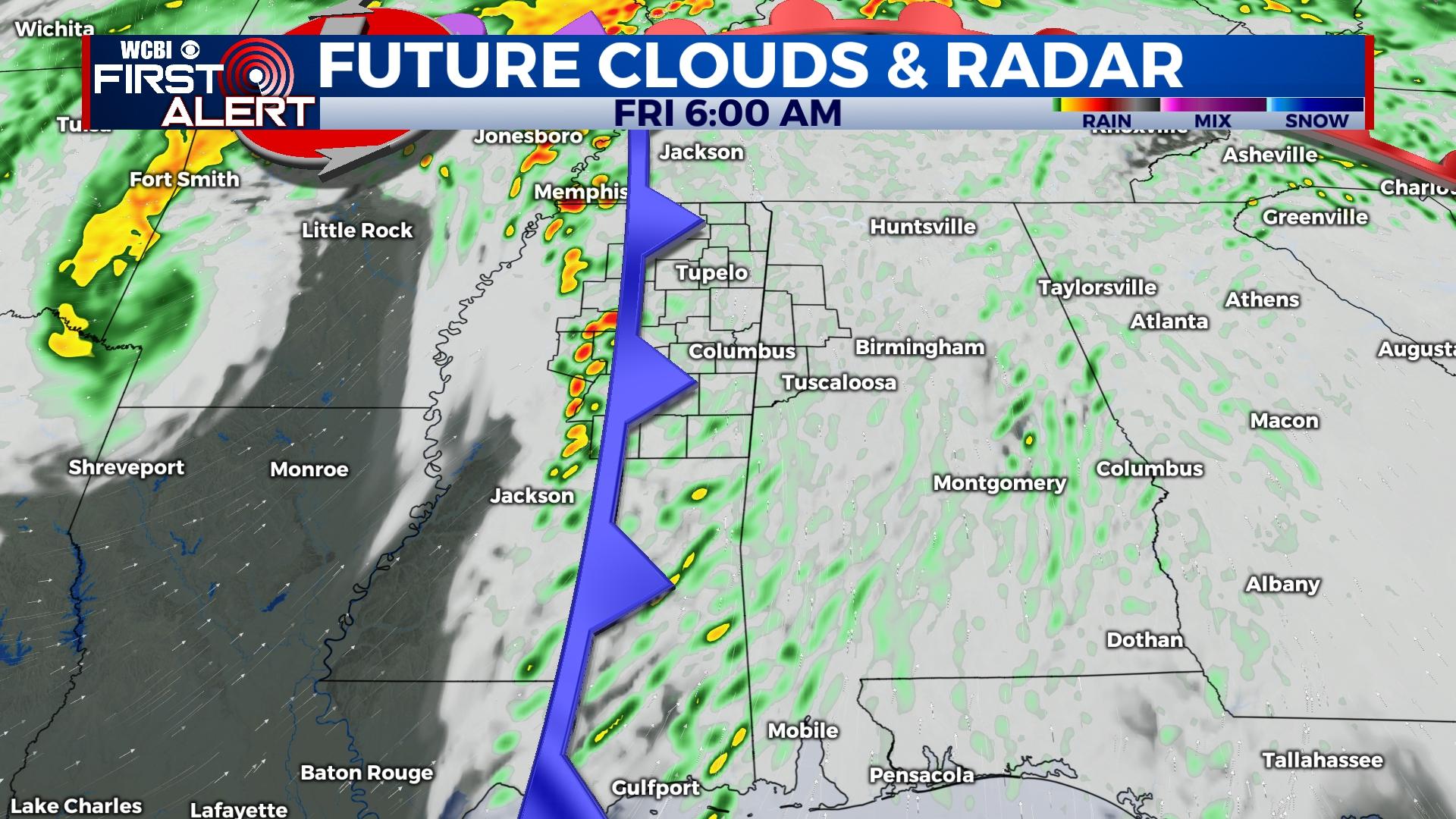
FRIDAY: Late night Thursday into very early morning Friday, a line of storms will move East across Mississippi. Majority of the state is under a Level 2 – Slight risk for severe weather. Within this line of storms, all modes of severe weather will be possible. This includes gusty winds, hail, and the risk for a few tornadoes. By late morning/early afternoon, the system will continue moving off to the East. Rain and cloud coverage will clear out. The sun returns Friday afternoon, allowing temperatures to warm some into the upper 60s. As the cloud coverage continues clearing, overnight temperatures will be able to drop into the low to middle 40s.
WEEKEND: Great conditions continue into the weekend! Expect to have a lot of sun and only a few clouds for your Saturday and Sunday. You will definitely need to pull the sunglasses back out! Temperatures will range from the middle 60s to the lower 70s. With mostly clear sky conditions, overnight temperatures will be in the middle 40s to lower 50s.


