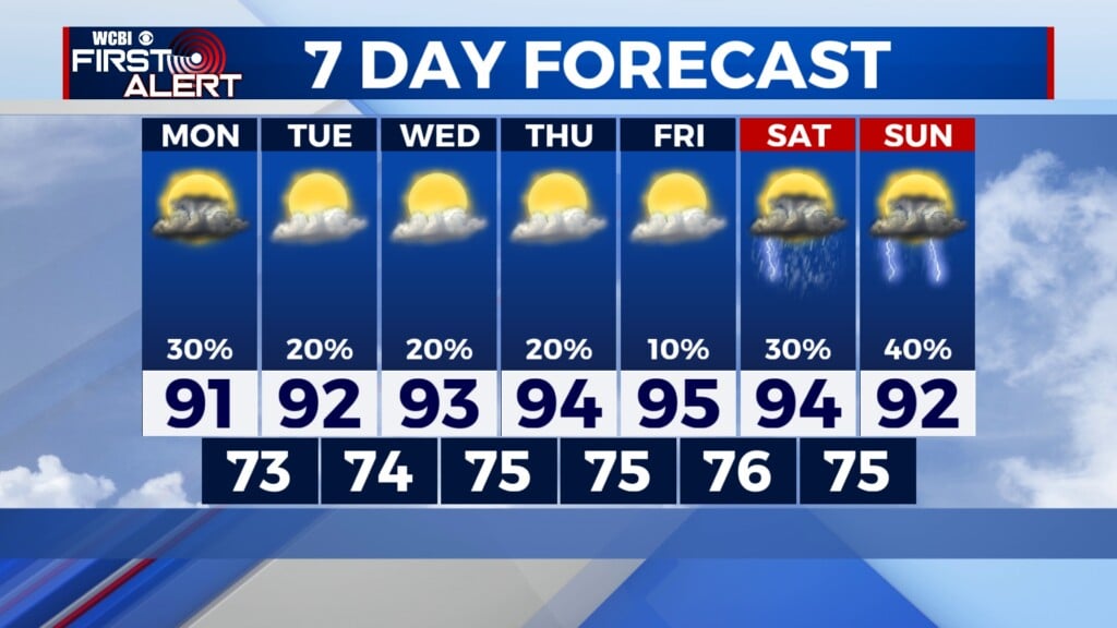
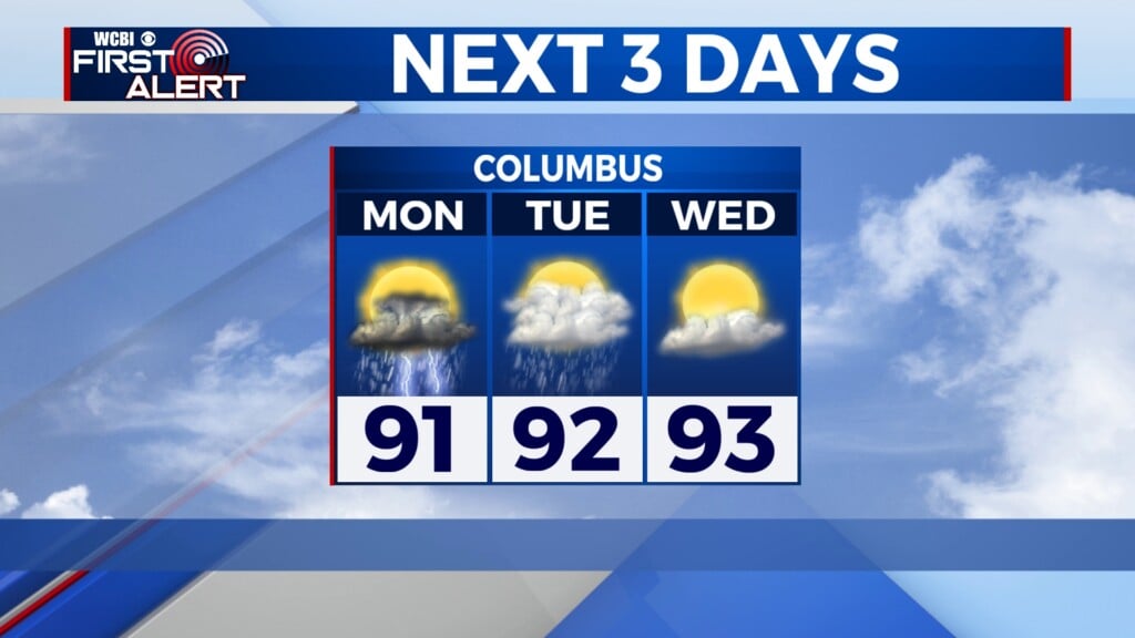
Cool again tomorrow, but warmer temperatures return next week
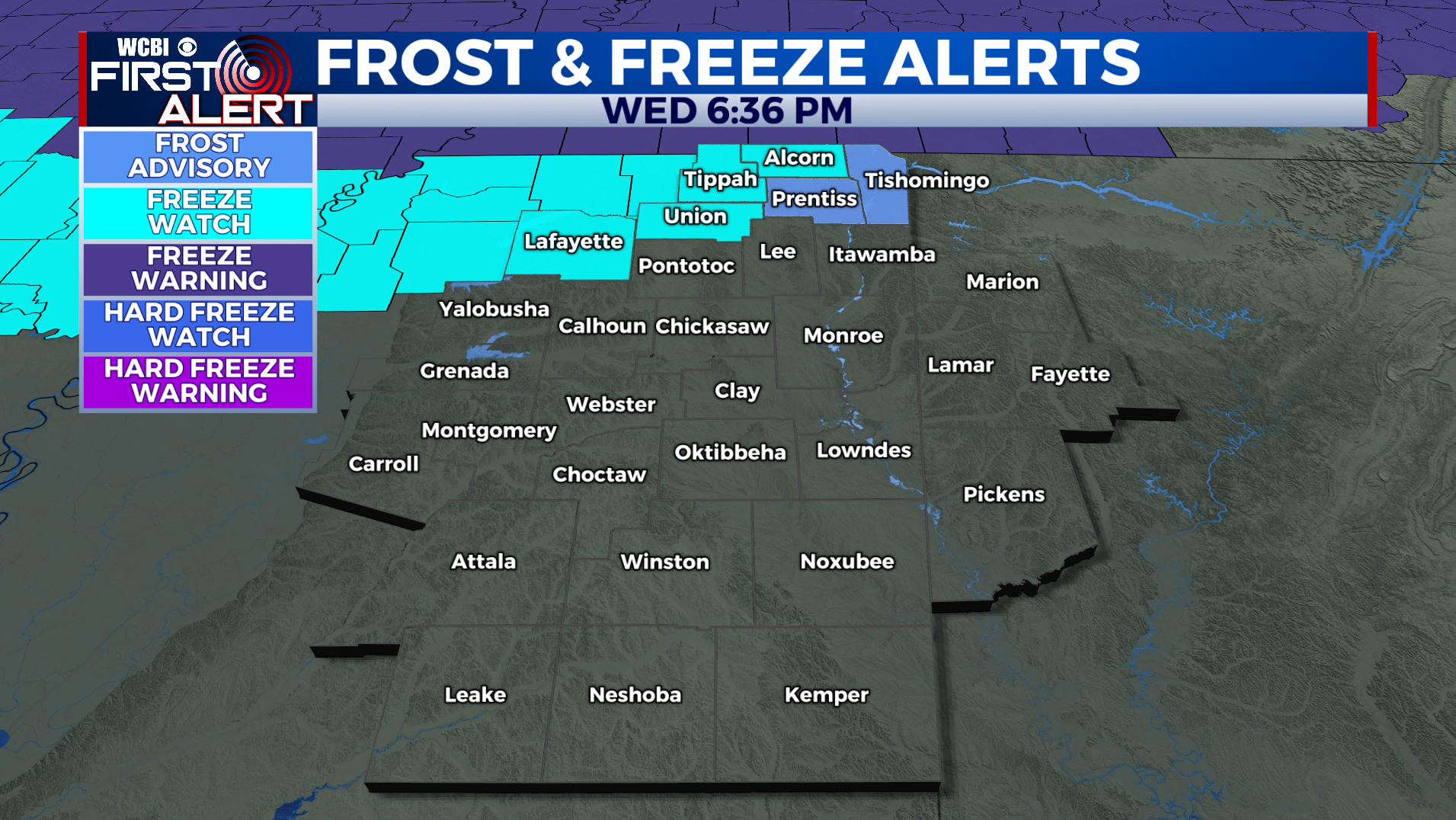
COLUMBUS, Mississippi (WCBI) – SUMMARY: Scattered light rain and drizzle will persist through the evening, but we will dry out by sunrise tomorrow. Some areas of frost are possible tonight across extreme northern Mississippi.
TONIGHT: Scattered light rain and drizzle early, becoming isolated after 10pm. North wind 3-5 mph. Chance of rain: 40%.
THURSDAY: Mostly cloudy to start the day, becoming partly sunny by the late afternoon. Not as cold with afternoon highs in the upper-50s. North wind 3-7 mph.
THURSDAY NIGHT: Partly cloudy with lows in the upper-30s. Areas of frost possible. Northeast wind around 5 mph.
THIS WEEKEND: We begin a warming trend Friday as high pressure settles into the region. This weekend is looking great with afternoon highs in the sixties Saturday and Sunday under a sunny sky each day.

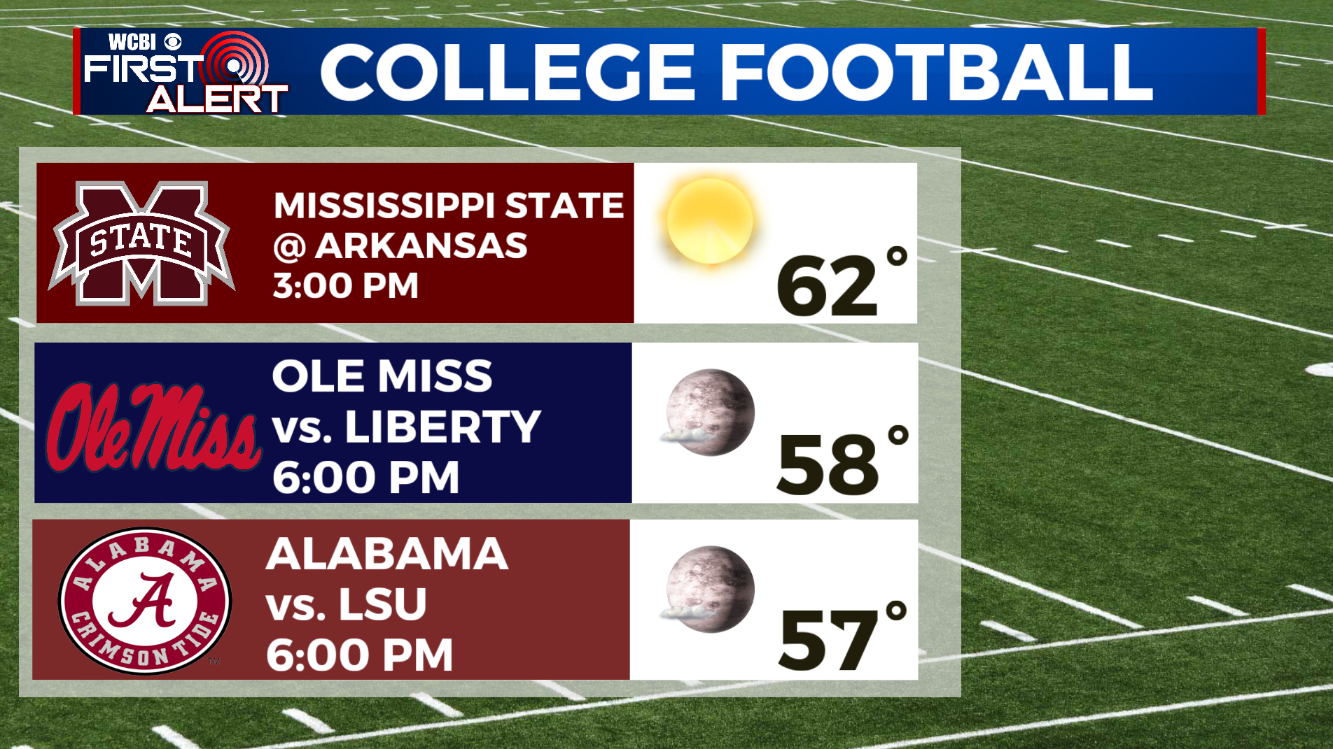
HIGH SCHOOL FOOTBALL: Friday night’s games will be dry with no chance of rain, but still colder than normal. Expect temperatures to be in the low-50s and upper-40s Friday night after kickoff. Bundle up!
TROPICS: Tropical Storm Wanda continues in the North Atlantic. Wanda will be a fish storm and will not impact land anywhere. Elsewhere across the Atlantic and Gulf of Mexico, all is quiet and tropical storm formation is not expected through this weekend.