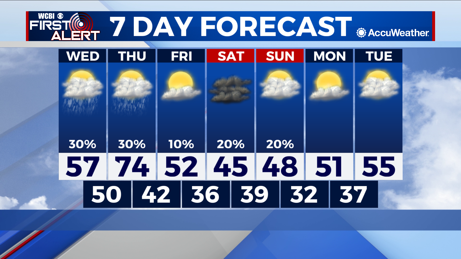
Cool temperatures return as rain chances diminish
COLUMBUS – SUMMARY: Rain chances gradually die off heading into the weekend following two days of steady rain totals earlier this week. A cold front Thursday brings the cool air back to the region, knocking highs down into the 40s and 50s and lows down to the 30s. Cloudy skies will persist through the weekend and into next week, keeping temperatures down.
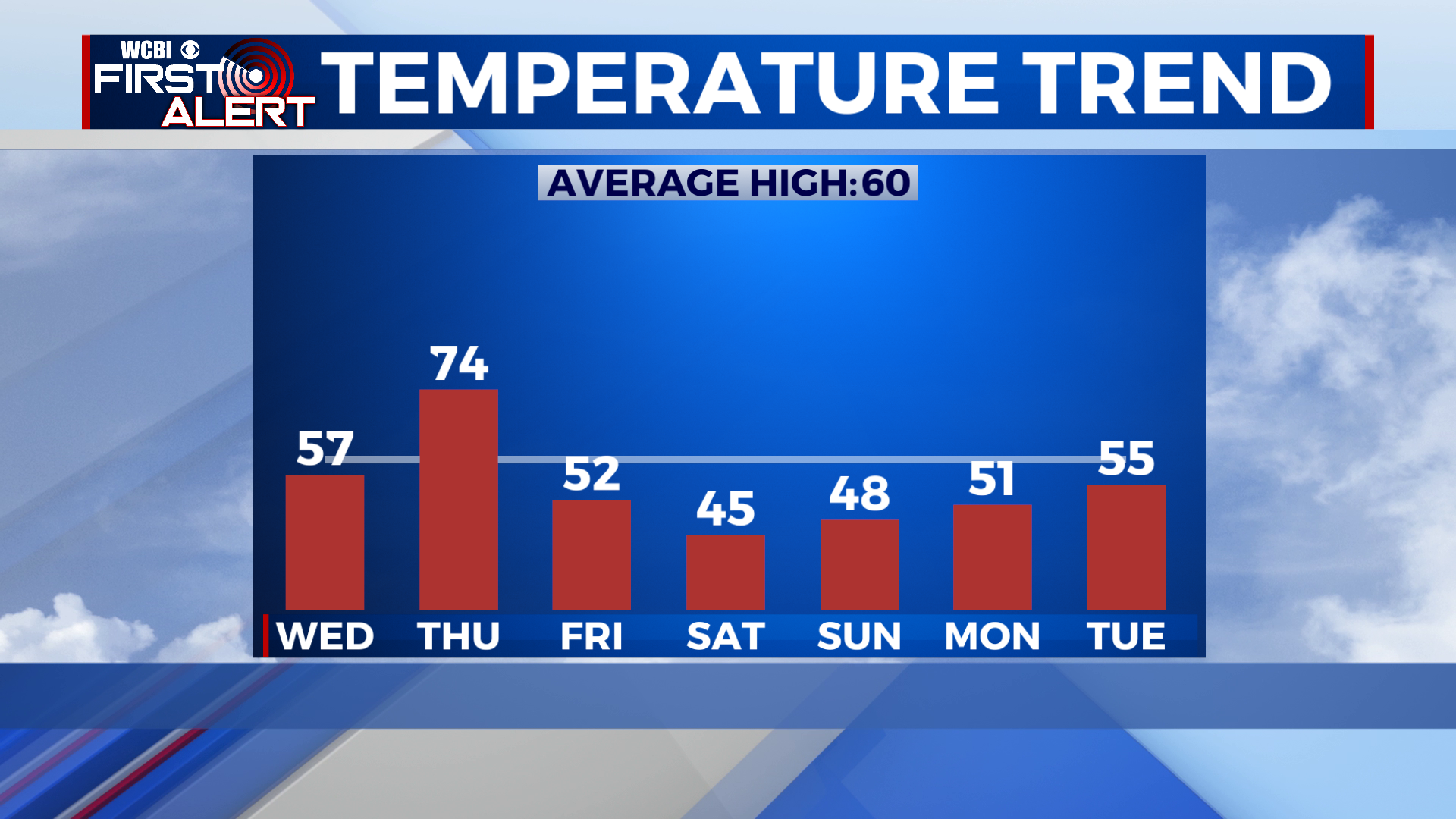
WEDNESDAY: The chance for some scattered showers and thunderstorms still remains after our severe weather day on Tuesday. Any rain that does fall will be mostly concentrated in the afternoon and evening hours, and no storms should be severe. Highs take a huge dip back down into the 50s Thursday afternoon as cooler air rushes back into the region. Lows stay mild in the 50s however.
THURSDAY: Thursday brings yet another big temperature swing with highs improving into the much more comfortable 70 degree range in the afternoon. The chance for scattered showers remains Thursday too, with the odd thunderstorm mixed in. A cold front late in the evening will bring us back to reality as lows take a dip into the 40s.
REST OF THE WEEK: The strong reinforcement of cold air from Thursday’s front means that highs will dive down into the 50s on Friday and down into the mid 40s by Saturday. Plentiful cloud cover through the weekend and into next week means that afternoon temperatures will struggle to break out of the 50s at least through Tuesday. Lows take an equally big hit and will sit in the 30s through the beginning of next week.


Leave a Reply