Cooler temperatures and frost possible for your Wednesday
SUMMARY: Much cooler air is moving in for your Wednesday. We could even deal with a late season freeze or frost on Thursday morning as temperatures fall to the lower to mid 30s across the area. After a round of rain and some thundershowers late Friday night into Saturday, temperatures will climb back above normal into the 70s and 80s early next week.
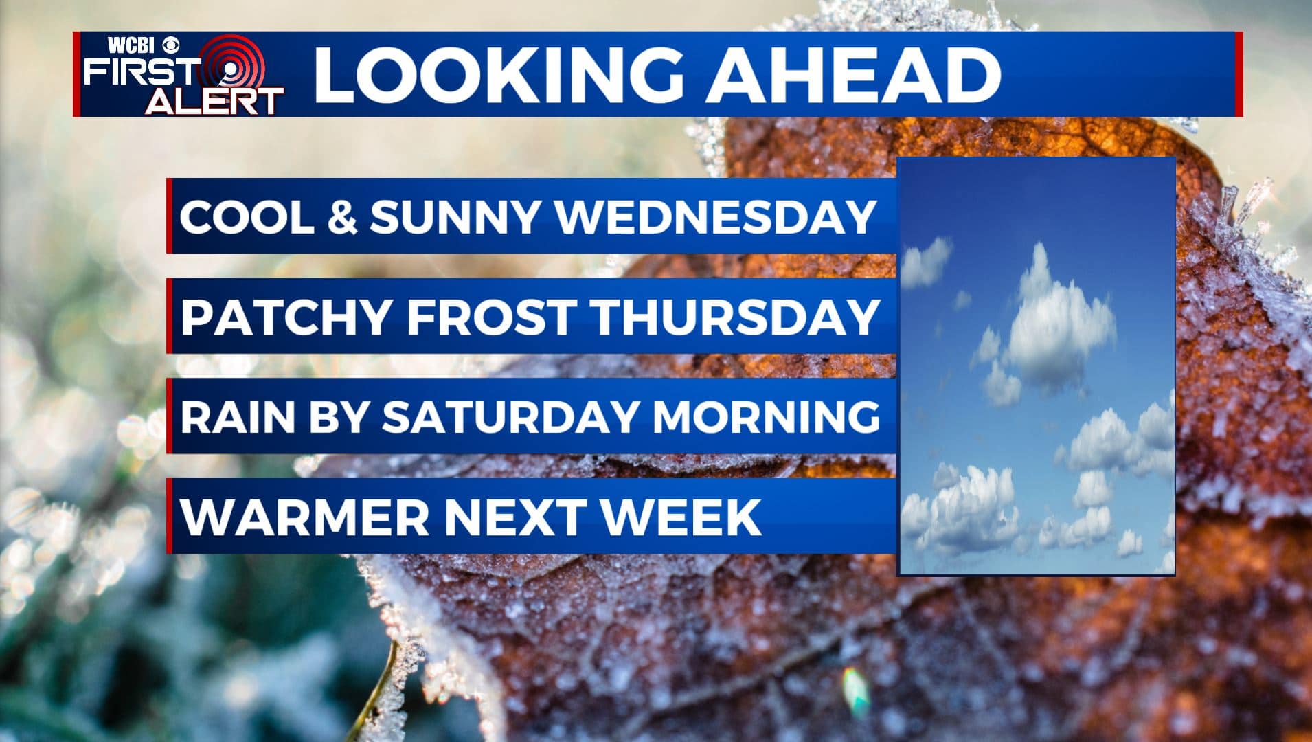
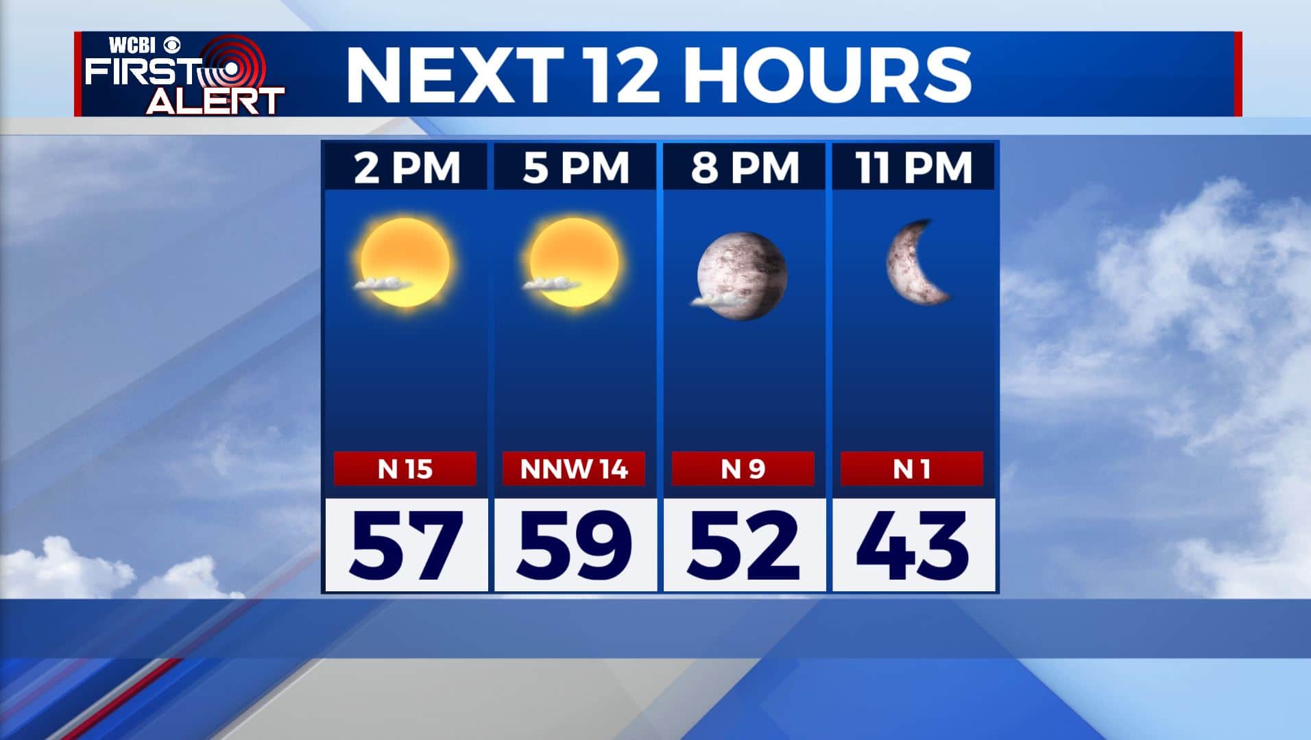
WEDNESDAY: A sunny but much cooler day is ahead for our Wednesday behind our cold front. Highs only reaching the upper 50s to near 60 degrees. Some morning clouds will make way for more sunshine by the afternoon. Winds will be a bit brisk from the NW 10-20 mph.
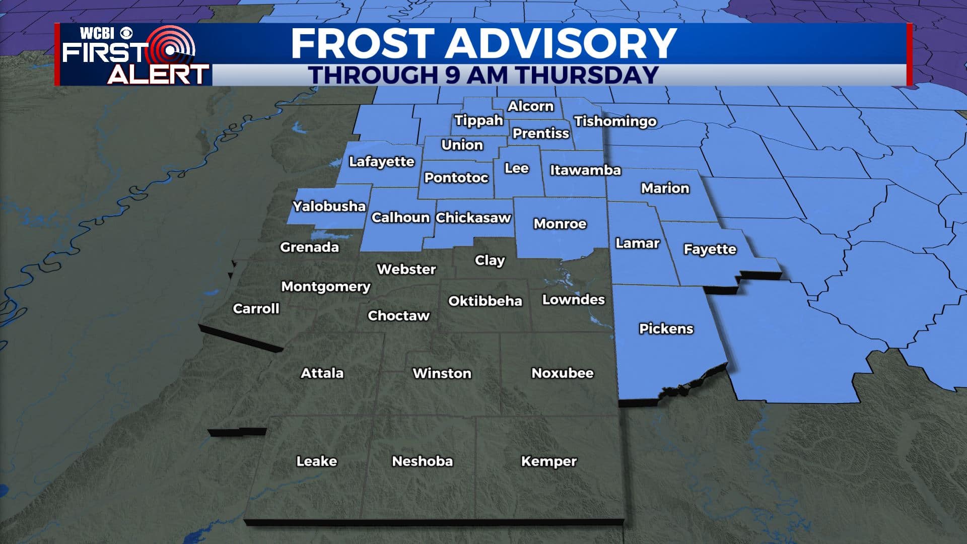
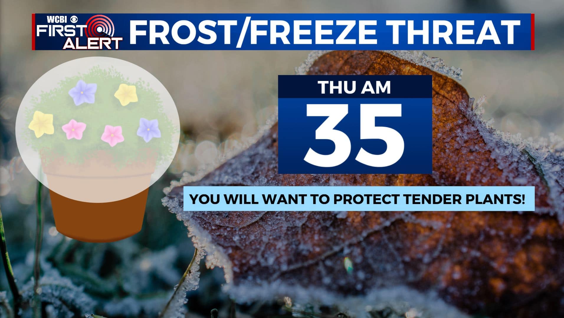
WEDNESDAY NIGHT: Mostly clear skies with areas of frost developing by morning, so cover up or bring in those sensitive spring flowers and plants that could get damaged by the chilly temperatures. Overnight lows in the lower to mid 30s. A Frost Advisory is in effect through 9 am Thursday.
THURSDAY: A mix of sun and clouds with highs in the mid to upper 60s. Overnight lows in the mid 40s.
FRIDAY: Mostly cloudy skies during the day with areas of rain developing after sunset. Highs in the mid to upper 60s.
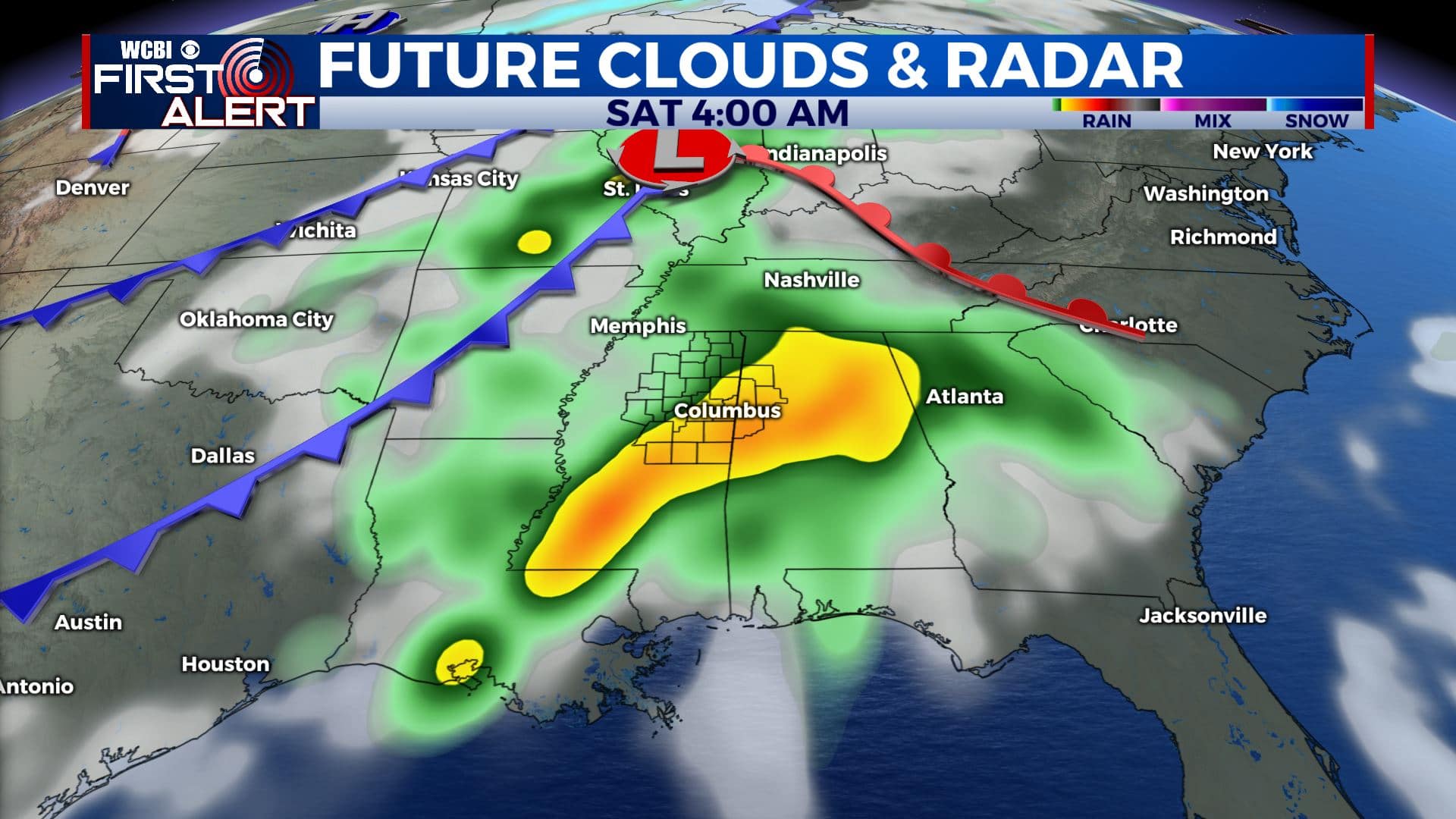
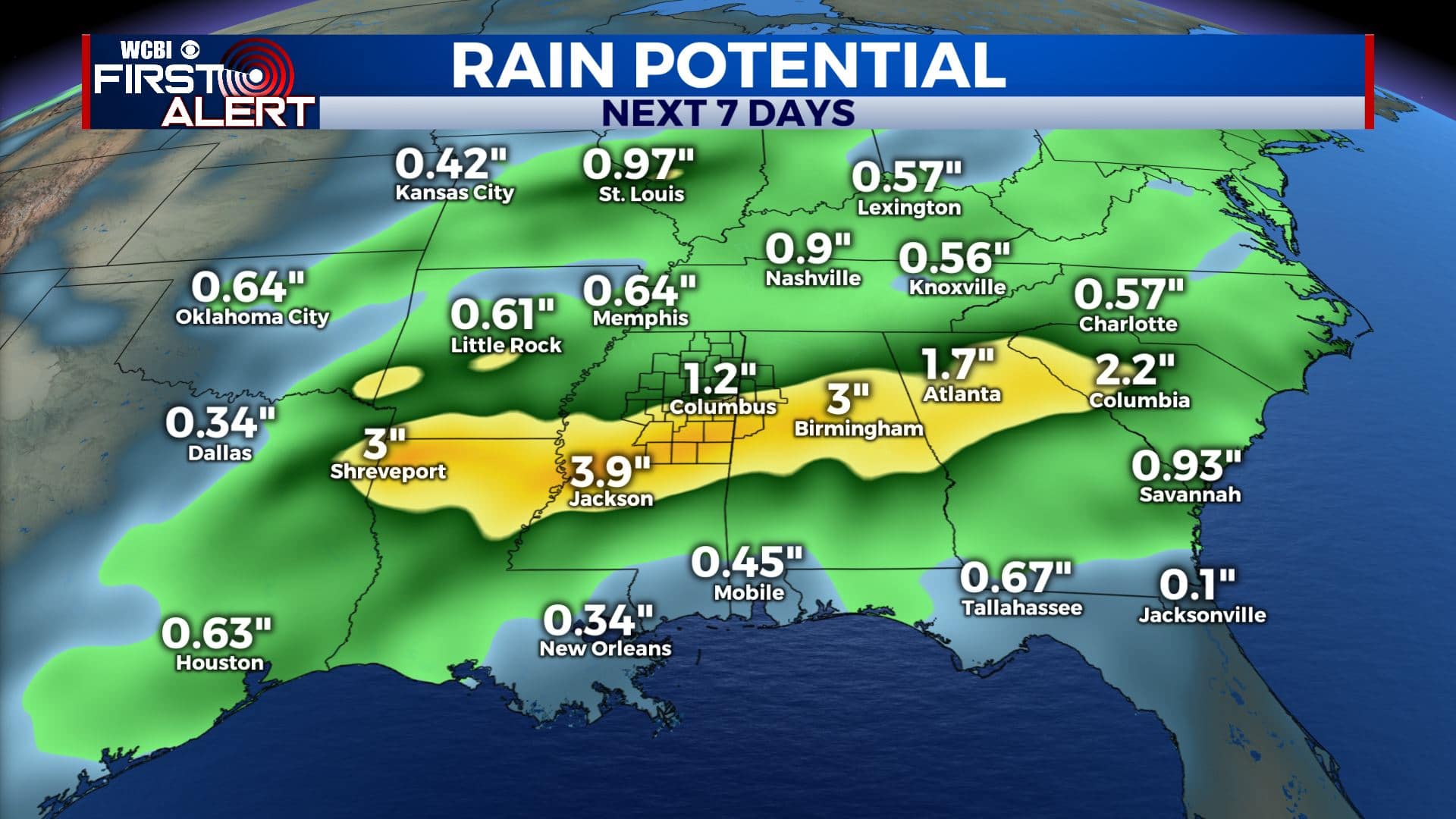
SATURDAY: Showers and thundershowers are likely on Saturday. It appears the severe weather threat will remain along and south of I-20. However, we could see some heavy rain at times. Rainfall amounts could be anywhere from 1-2+ inches. Highs will be in the lower 70s.
SUNDAY: Rain will exit by Sunday morning, leaving us dry for Sunday. We’ll see a mix of sun and clouds in the afternoon with highs in the mid 70s. Overnight lows in the upper 40s.
MONDAY: We’ll see mostly sunny skies with highs continuing to warm up to near 80 degrees. Overnight lows in the 50s.
TUESDAY: A mix of sun and clouds as temperatures continue to warm up into the lower 80s.
Stay connected with @WCBIWEATHER on Facebook, Twitter, Instagram, and the WCBI News App.


Leave a Reply