Cooling off into the weekend
COLUMBUS, Mississippi (WCBI)- An early morning cold front passed through Mississippi, bring rain showers and storms across the Deep South. Into the afternoon, rain shifted to the East and the wind speeds picked up. It was nice to see some more of the sun this afternoon.
THURSDAY NIGHT: Heavy cloud coverage is going to be sticking around tonight. Temperatures are going to drop into the 30s, despite the amount of clouds hanging into the overnight hours.
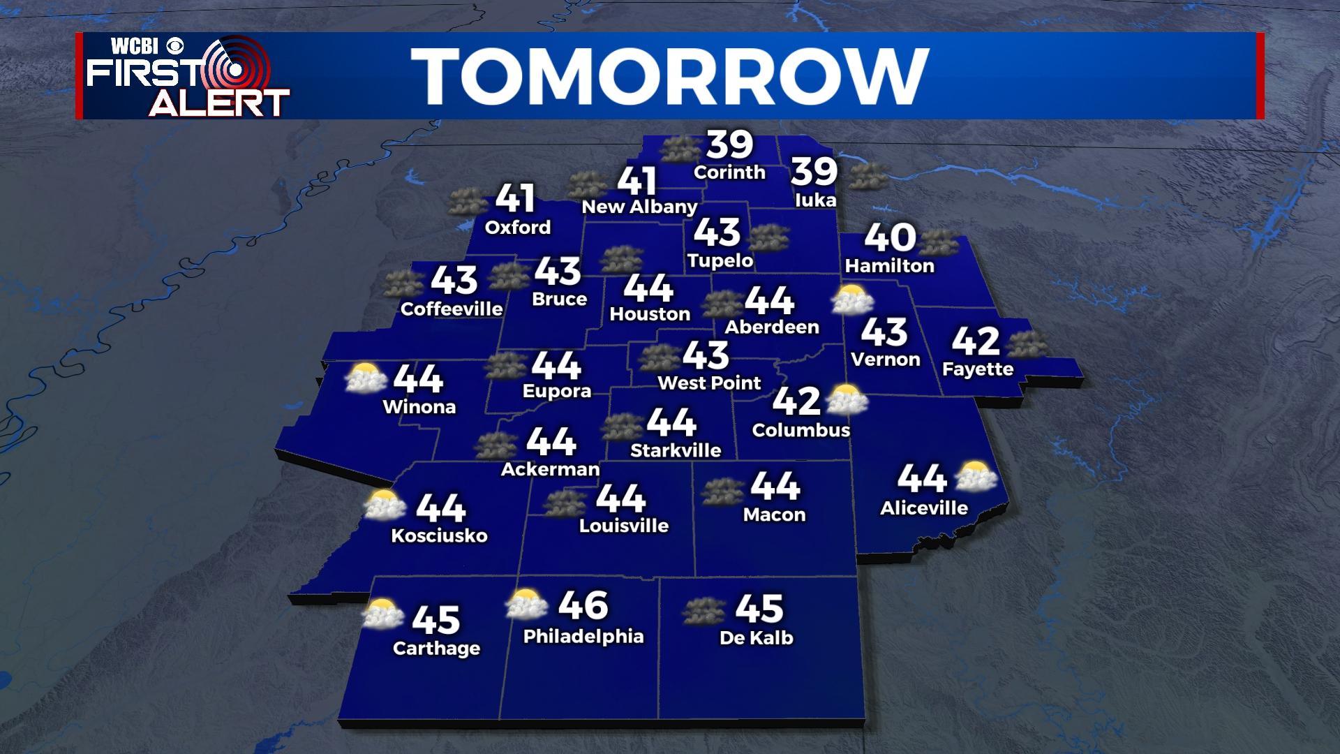
FRIDAY: Cold air behind the front that passed is bringing in colder temperatures. With clouds maintaining into the end of the week, the high temperatures are only making it into the lower 40s. A few flurries are possible throughout the day. Overnight temperatures are dropping into the middle to upper 20s. Frost is expected going into Saturday morning.
WEEKEND: The colder air is going to remain through the weekend, gradually warming up. High temperatures will be in the upper 40s Saturday and to the upper 50s by Sunday. The cloud coverage will clear out some more on Saturday, but slowly return again on Sunday. The overnight temperatures Saturday night continue in the upper 20s, while the low Sunday night warms into the lower 40s.
NEXT WEEK: High temperatures are back in the 60s and 70s. Cloud coverage will continue to build into next week. The rain chances return beginning of the week and will maintain with light percentages for a few days. Mild overnight low temperatures will be in the 40s and 50s.


