Copious sunshine this weekend but storms return Tuesday
COLUMBUS, Mississippi (WCBI) – SUMMARY: After a stormy start to the day, the clouds have cleared the region and we warmed into the 70s!
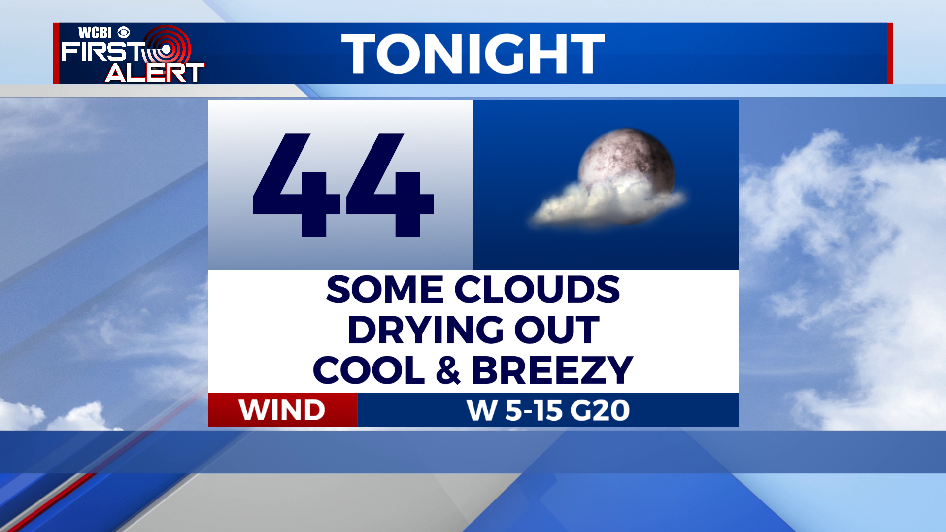
TONIGHT: Mostly clear and breezy. Lows in the mid-40s. Northwest winds 5-15 mph, with gusts to 30 mph.
SATURDAY: Sunny. Highs in the low-60s. Northwest winds 5-15 mph with gusts up to 20 mph.
SATURDAY NIGHT: Mostly clear and cooler with lows in the upper-30s to low-40s. Calm wind.

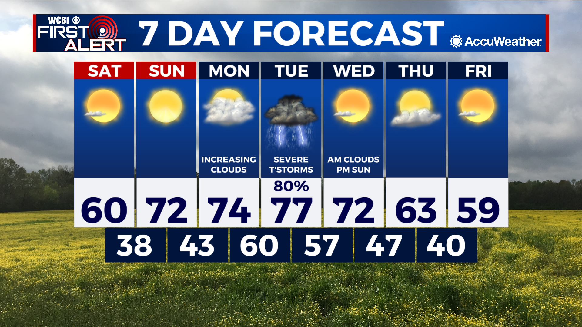
EXTENDED FORECAST: An active weather pattern returns to the region next week. Monday starts off with a mostly sunny sky, then clouds will increase through the afternoon and become overcast by sundown. A few isolated showers or thunderstorms are possible Monday night, but most of the region will stay dry. Widespread showers and thunderstorms arrive late Tuesday. Forecast model data is still inconsistent with the eventual timing, but we are increasingly confident for severe weather potential. This will include the chance for a few isolated tornadoes, so it will be important to remain weather aware Tuesday. Stay tuned for additional updates.