Damp & breezy Tuesday
SUMMARY: A quick moving weather maker will give us wet, breezy, and cool weather on Tuesday. While a few stronger storms are possible early Tuesday the odds of severe weather are much higher along and south of I-20. Nice and quiet weather returns for the middle to end of the week.
MONDAY NIGHT: Cloudy with areas of rain developing. A few locally strong storms with hail can’t be totally ruled out across our southern counties late tonight. Lows in the 50s with NE winds 5-15 mph.
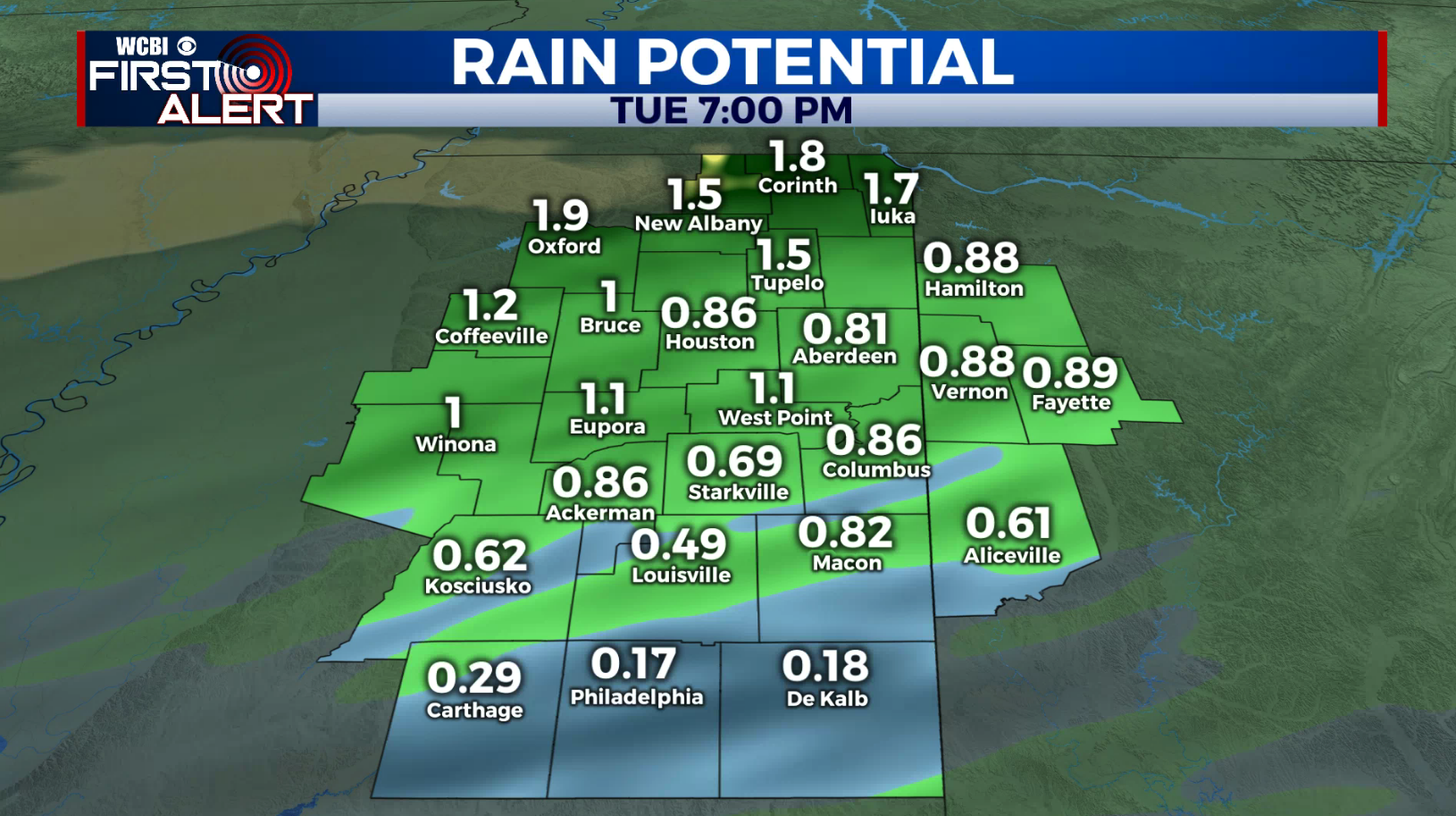
TUESDAY: Areas of rain and thunder in the morning followed by scattered showers in the afternoon. Mostly cloudy and breezy. Winds NNW 10-20 mph with some higher gusts. Highs in the low 60s. Total rainfall may range from 1/4” to over 2”.
TUESDAY NIGHT: Mainly clear and cool. Lows in the lower 40s. Some upper 30s are also possible.
WEDNESDAY: Bright sunshine. Highs in the mid 60s. Light wind.
WEDNESDAY NIGHT: Mainly clear and cool. Lows in the low 40s.
THURSDAY: Partly cloudy and pleasant. Highs in the low 70s. Upper 40s for lows Thursday night.
FRIDAY: Sun & clouds. Just a slight chance of a shower. Highs in the lower 70s. Lows in the 50s Friday night.
SATURDAY: Variably cloudy and mild. Highs in the mid to upper 70s. Some showers are possible but the chance of rain is just 20%.
SUNDAY: Variably cloudy. A few more showers are possible with the rain chance at 30%. Highs in the upper 70s to around 80.
Follow @WCBIWEATHER on Facebook, Twitter, Instagram, and on the WCBI News App


Leave a Reply