Dangerous cold invades north Mississippi and west Alabama
COLUMBUS, Mississippi (WCBI) – The wintry precip has ended, but dangerously cold air will be with us through Wednesday. Another shot of bitter cold air arrives Friday.
TUESDAY: We’ll see a mix of sun & clouds, but highs will range from the upper teens to mid 20s south. Wind gusts of 20-25 mph through the day will create single digit wind chills all day, and sub-zero wind chills are possible at times.
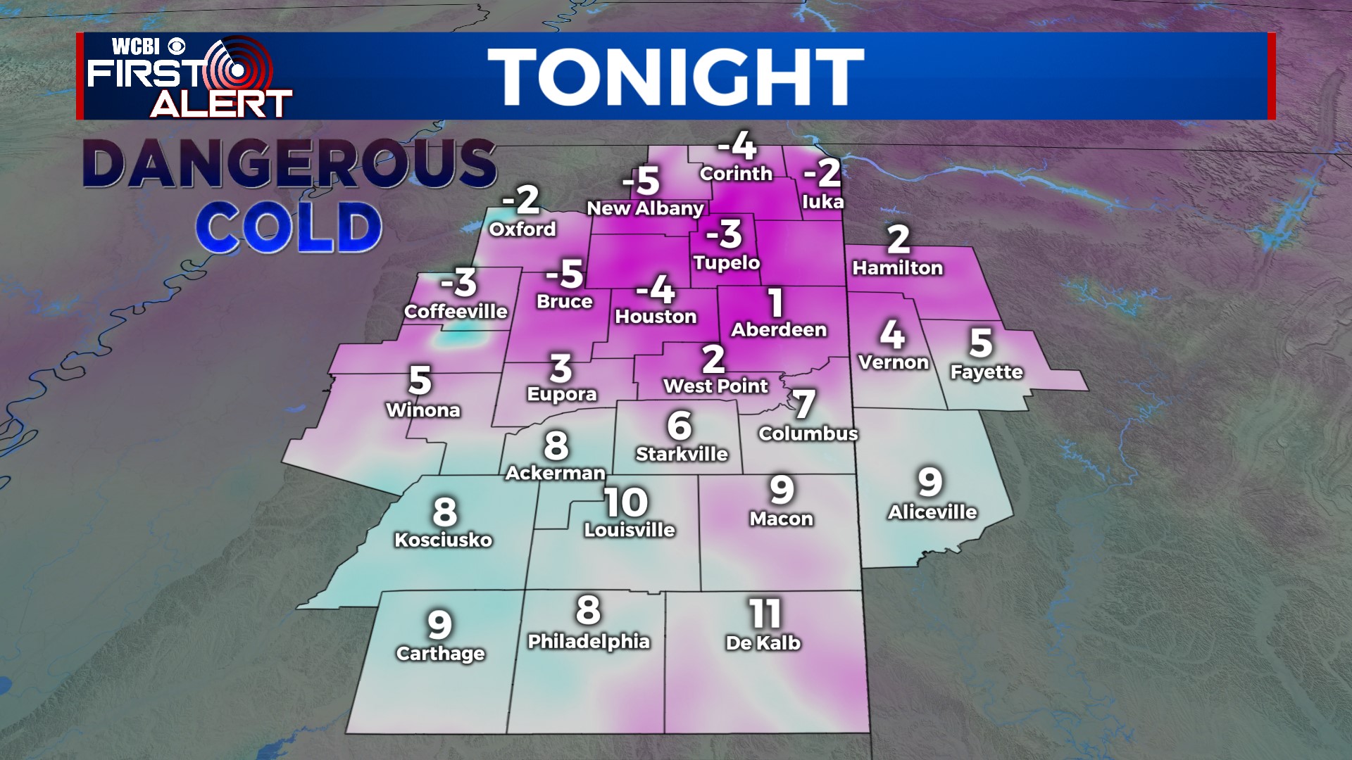
TUESDAY NIGHT: Our coldest night in years! Strong high pressure settles overhead, and with a clear sky & calm winds, overnight lows will drop into the single digits area-wide. Some spots will be close to or below 0 in the north.
WEDNESDAY: We’ll have full sun through the day, but once again highs will struggle to get past freezing in the north. Mid 30s are likely for the Golden Triangle and west Alabama.
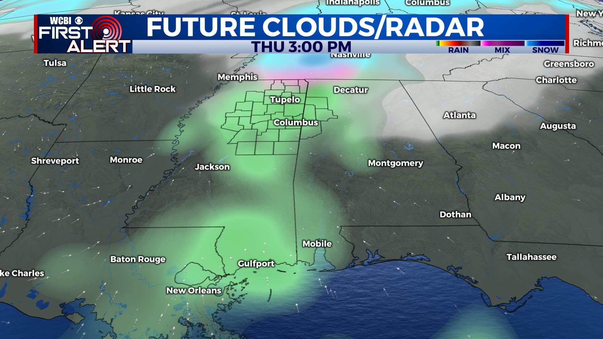
THU/FRI: Another system will swing through Thursday, bringing scattered light rain and potentially a brief wintry mix for far northern areas. Highs will range from the upper 30s to middle 40s, but temperatures will go below freezing yet again by Friday morning. Highs will then struggle to get above freezing Friday afternoon as another surge of Arctic air arrives.
WEEKEND: Sunshine both days, but more dangerous cold! Highs will be in the 20s Saturday, but overnight lows will likely range from the upper single digits to lower 10s area-wide.