Dangerous Heat Wednesday, Still Watching The Gulf
TUESDAY NIGHT: Mainly clear, warm, and muggy. Lows in the mid 70s with calm wind.
WEDNESDAY: Partly cloudy with a 30% chance of pop-up showers and storms. Highs in the mid 90s with the heat index pushing above 105° at times. Limit your exposure to the sun and try to stay indoor in air conditioning if you can. Any storm that pops up may provide some brief relief from the heat but they could contain gusty winds and frequent lightning.
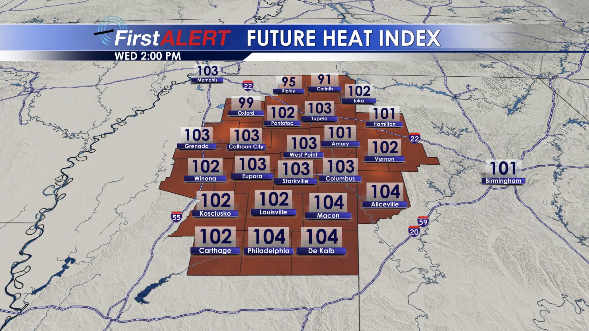
Wednesday Afternoon Heat Index
WEDNESDAY NIGHT: Variably cloudy, warm, and muggy. Lows in the mid 70s.
THURSDAY: Partly cloudy and hot with highs in the 90s. The heat index is still going to be in the 100s. Rain and storm chances go up to around 40%.
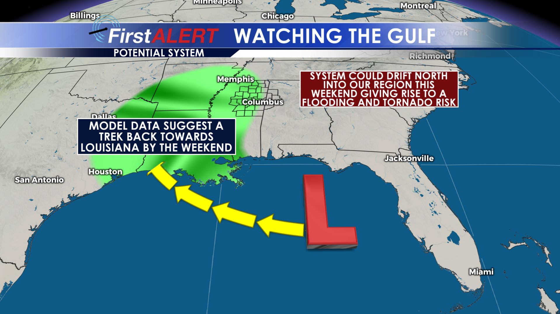
Watching The Gulf
FRIDAY-MONDAY: We’ll be watching a potential tropical system in the Northern Gulf of Mexico. The most recent model data from Tuesday suggest a tropical system moving towards the Louisiana coast by the end of the work week. Will the remnant low get pulled our way after that or will it continue to shift back to our west? That is the big question right now that we still don’t know the answer to. We are adjusting temperatures down and rain chances up for the weekend to hedge on the possibility that our region may be affected by the remnants of whatever develops. Be sure to check in with us each day going forward because the forecast will be changing as new data arrive.
Stay connected with @WCBIWEATHER on Facebook, Twitter, and Instagram


Leave a Reply