Deep Freeze is on the Way!
A reinforcing shot of arctic air is headed to northeast Mississippi and west Alabama next week. Before then, we will see some heavy rain move through.
SATURDAY NIGHT: Clouds will begin to increase as we go through the overnight hours on Saturday, especially after midnight. A Freeze Warning (pictured below) is in effect for the areas in purple until 11 AM on Sunday morning. Temperatures are expected to drop down into the lower 30’s. However, I would not be surprised to see some areas in the upper 20’s Sunday morning.
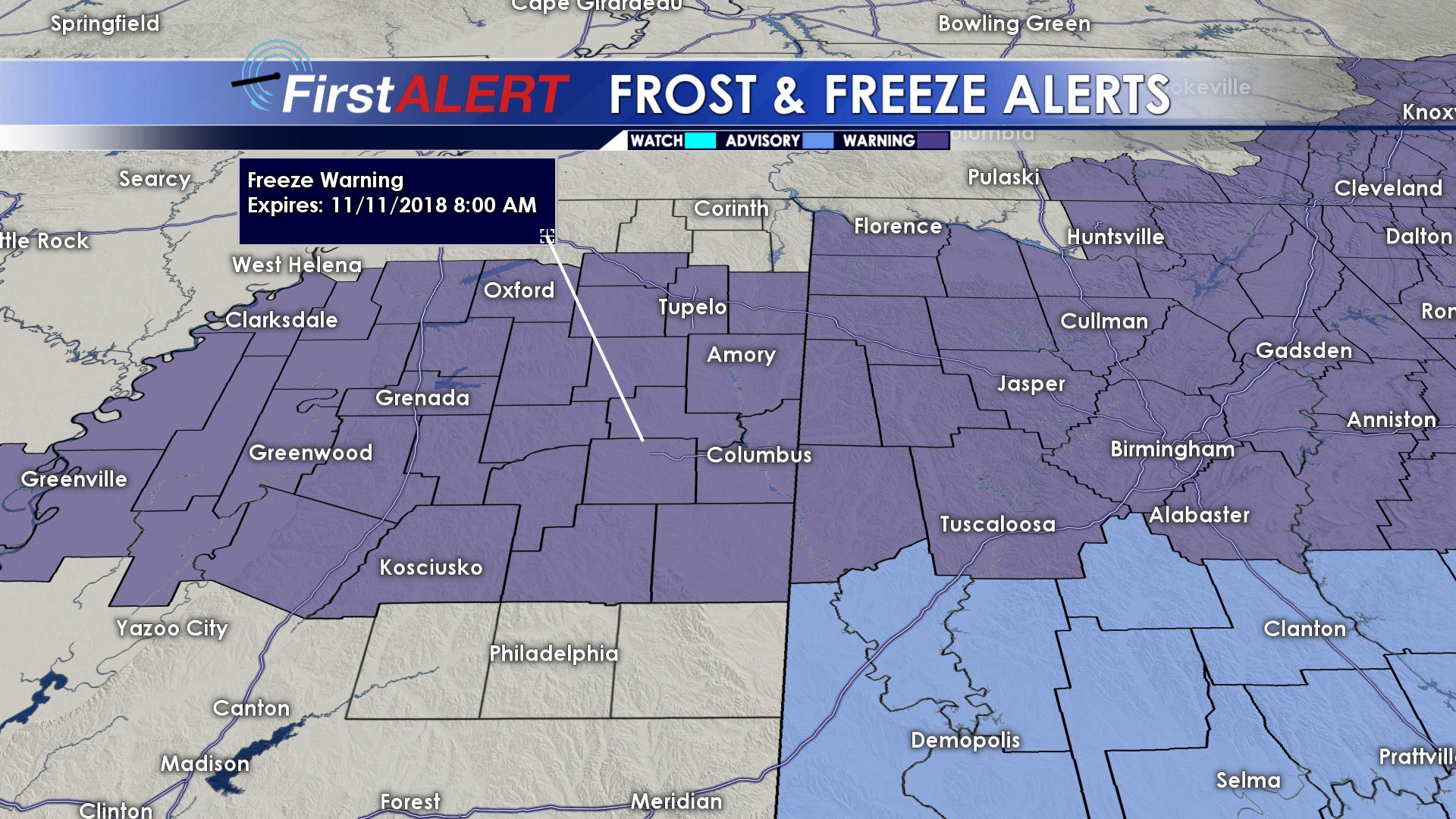
Freeze Warning until 8 AM (11/11/2018)
SUNDAY: Skies will remain mostly cloudy throughout the day Veteran’s Day. It will remain chilly, with highs across the area in the upper 40’s and lower 50’s. As we go throughout the evening hours, into the overnight hours, rain chances will begin to increase from south to north. A cold rain is expected overnight, with lows dropping down into the upper 30’s.
MONDAY: We will start off the week rainy. Rain will last all throughout the day on Monday. As we head into the evening hours, rain will become more isolated, concentrated more over the northern half of the area. Before all is said and done with Monday, most areas will pick up between 1.00′” and 1.50″. Some areas could see over 2 inches! Highs Monday will top out in the lower 50’s.
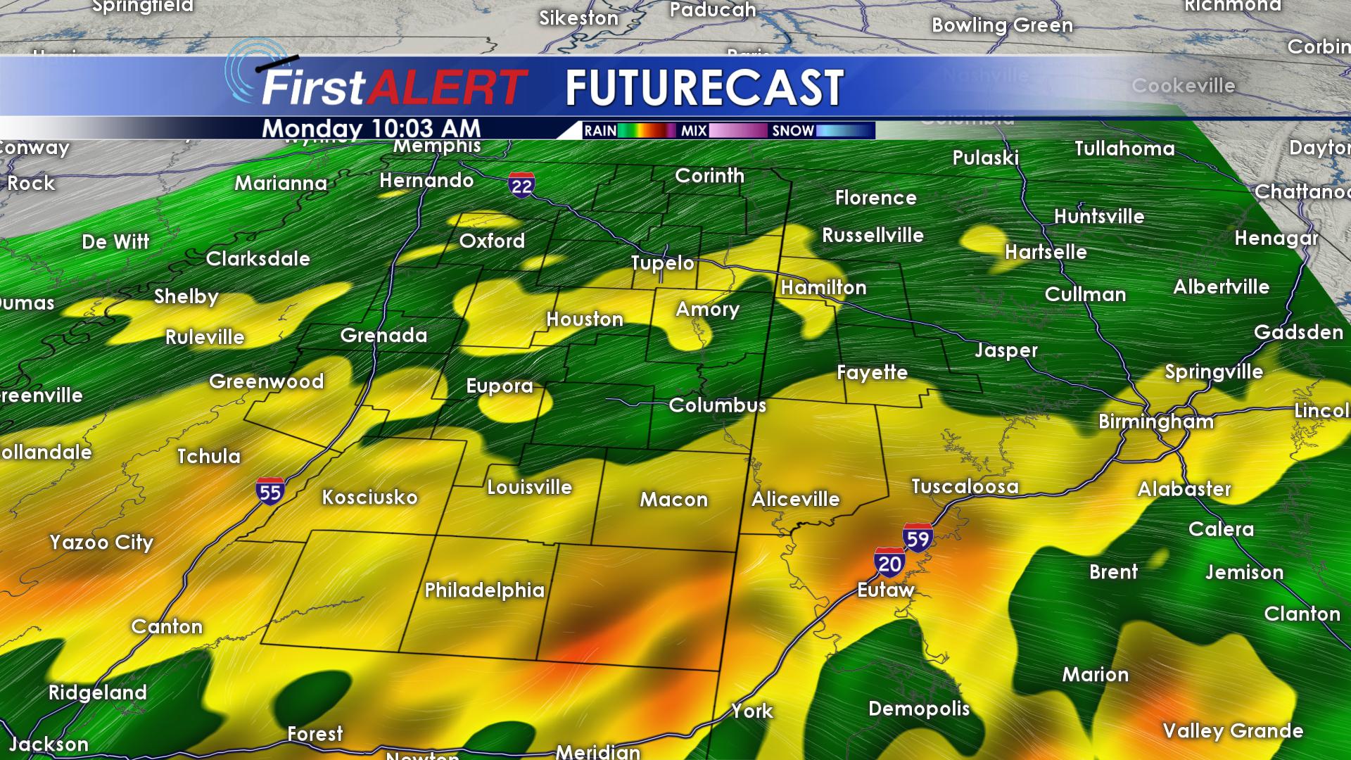
Heavy Rain Monday
TUESDAY/WEDNESDAY: Highs on Tuesday will likely be in the morning hours. A cold front will continue to push through our area on Tuesday, bringing a reinforcing shot of arctic air to our area. Highs on Tuesday and Wednesday will be a good 15-20 degrees below average. Rain will exit our region early on Tuesday morning. No winter weather is expected with this system. Overnight Tuesday, temperatures will plunge into the middle 20’s across the area. Wednesday night, lows will be in the middle 20’s once again. Clouds will hang around through midday on Wednesday, but will eventually clear out late.
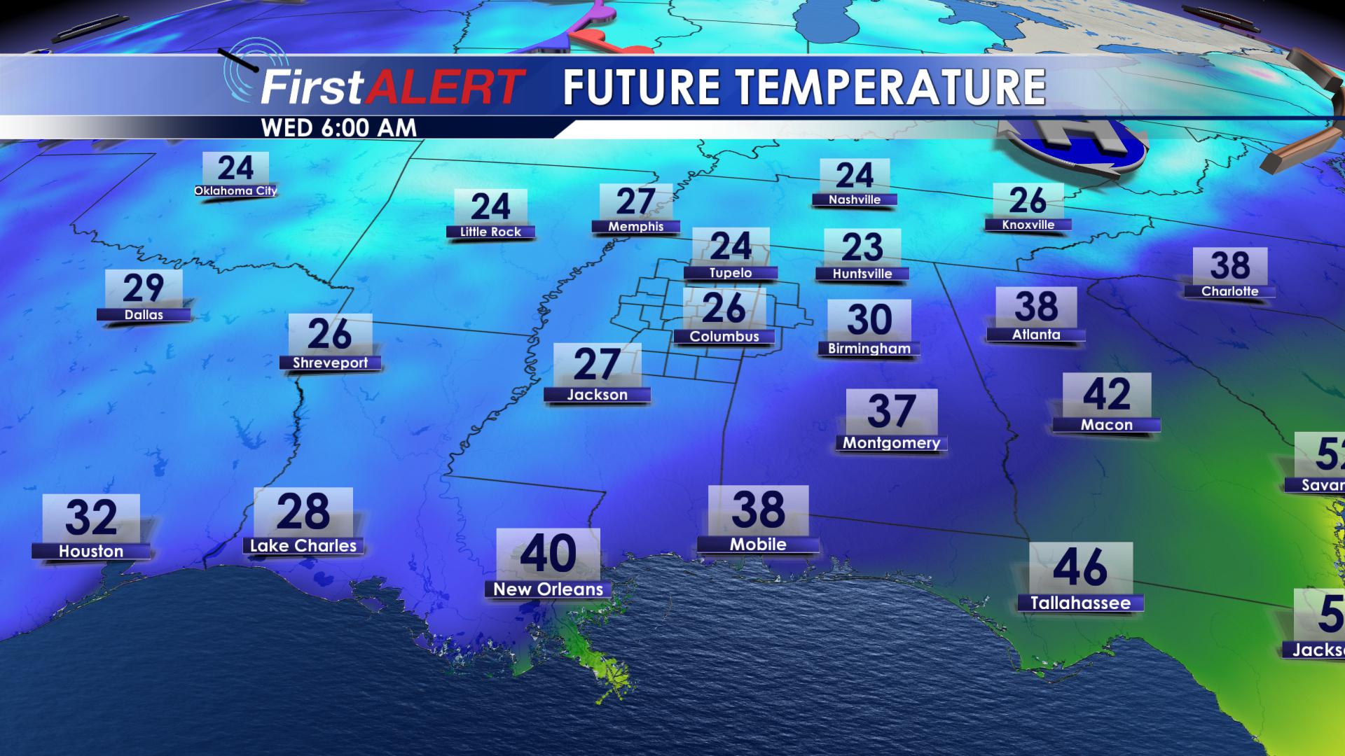
FREEZING Tuesday Morning!
THURSDAY/FRIDAY/SATURDAY: Thursday will be warmer, with highs in the lower 50’s. Skies will be partly cloudy on Thursday, leaving us with more sunshine! Overnight Thursday, we will drop down to freezing once again, with overnight lows in the lower 30’s. Friday, we will continue to warm into the upper 50’s across the area, with mostly sunny skies! No rain to worry about for Friday night, on into Saturday morning. We will drop down into the upper 30’s Friday night, and warm back into the lower 50’s for Saturday, as clouds begin to increase.


Leave a Reply