Drier and nicer weather later this week
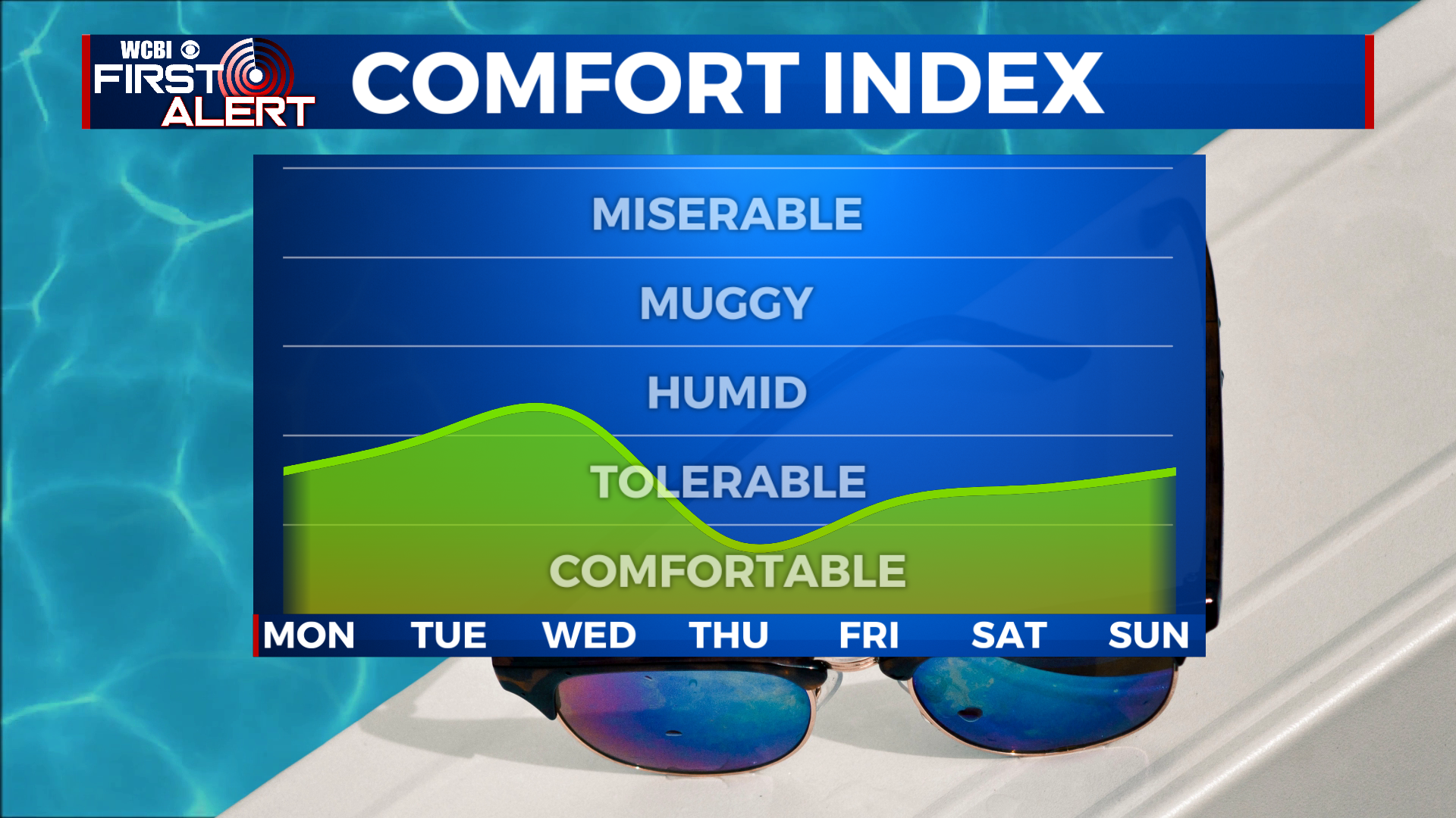
SUMMARY: A cold front will clear the area Sunday night, but linger nearby with remaining moisture through Wednesday. Scattered showers and storms in the forecast for Monday afternoon, with rain chances ramping up again for Tuesday. Rain chances back off quite a bit for Wednesday, and go away entirely for Thursday and the rest of the week. Highs will be in the 70s Tuesday and Wednesday and return to the low 80s for the rest of the week.
SUNDAY NIGHT: Any showers and storms should taper off in the evening hours, but a few lingering overnight showers are not out of the question. Mostly cloudy with a low in the mid 60s, fog could be an issue by Monday morning.
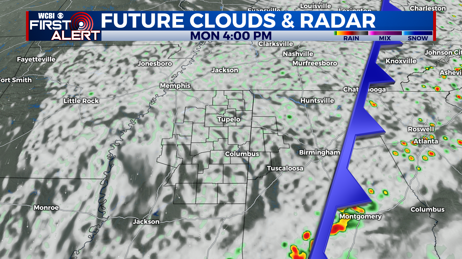
MONDAY: After a foggy start, Monday looks mostly cloudy and slightly drier than Sunday. A few scattered showers and storms are possible, but many of us will stay dry. Highs in the upper 70s or low 80s.
MONDAY NIGHT: Scattered showers continue into Monday night. Skies will be cloudy with a low in the low to mid 60s.
TUESDAY: Due to the front lingering, rain chances ramp back up for Tuesday. Widespread showers and storms look likely, especially in the afternoon. Mostly cloudy skies with a high in the mid to upper 70s expected.
WEDNESDAY TO SUNDAY: Wednesday looks to be the last day with an appreciable rain chance in the near future. Highs will be in the upper 70s Wednesday afternoon with a few showers around. Things really dry out for Thursday, with lots of sunshine and a high near 80 degrees. Highs will slowly climb into the low 80s through the weekend with sunny skies sticking around. Lows will be much more fall like in the upper 50s to low 60s.
CONNECT WITH @WCBIWEATHER ON TWITTER, FACEBOOK AND INSTAGRAM