Drier, Cooler, and Breezy for Wednesday
A cold front will sweep through the area early Wednesday morning which will help to keep temperatures cooler through the day. We’ll stay dry and sunny for the rest of the week before rain chances slowly creep up through the weekend and into early next week.
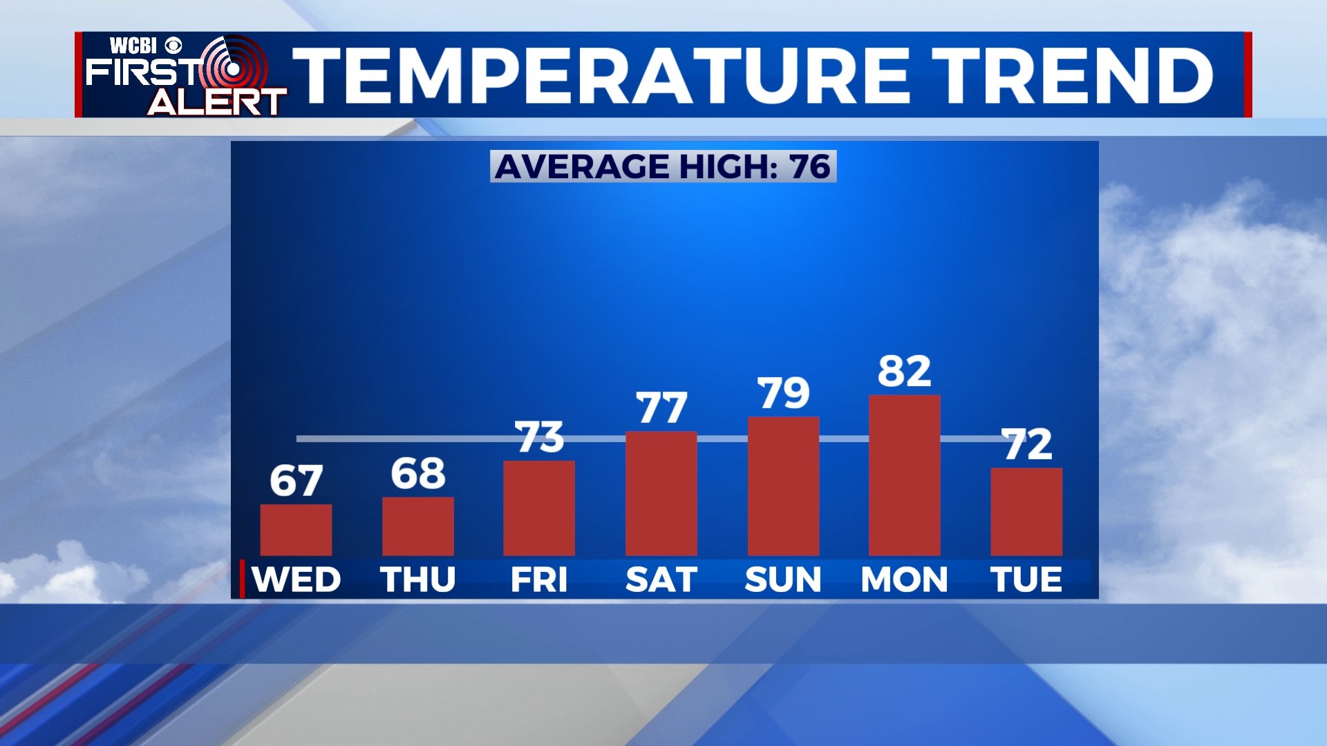
High temperatures will be closer to average by the weekend.
TONIGHT: Steady rain will slowly fade off, but off-and-on showers remain likely overnight. Lows will be near 60 under a mostly cloudy sky.
WEDNESDAY: Any remaining sprinkles or showers should dwindle as the cold front passes in the early morning hours. We’ll see a few peeks of sun by the afternoon hours with highs in the upper 60s. Breezy northerly winds could gust up to 20 mph behind the front.
WEDNESDAY NIGHT: As cooler air continues to pour in, we could be in for our coldest night so far this fall. Lows will be in the low 40s for many, but some areas could dip into the upper 30s. Skies will remain mostly clear.
THURSDAY-SATURDAY: Skies will remain mostly sunny for the end of the week and beginning of the weekend with highs back into the 70s by Friday. A quick shower or storm can’t be ruled out on Saturday, but I think most everyone will stay dry.
SUNDAY-TUESDAY: Rain chances slowly increase as we get into Sunday and early next week. A few showers are possible on Sunday before a chance of showers and storms on Monday as a cold front passes through. Highs will be in the low 80s on Monday before temperatures fall and sunny skies return for Tuesday.


Leave a Reply