Dry and Hot to Start October
Abnormally dry and hot weather will continue for the end of September and first week of October. Burn bans are in place for some areas as most of us haven’t seen measurable rainfall in over a month. Temperatures could be closer to average by next weekend as a cold front looks to pass through the area.
SUNDAY NIGHT: Temperatures will be fairly mild overnight with lows only around 70. Skies will remain mostly clear with a light southeasterly wind.
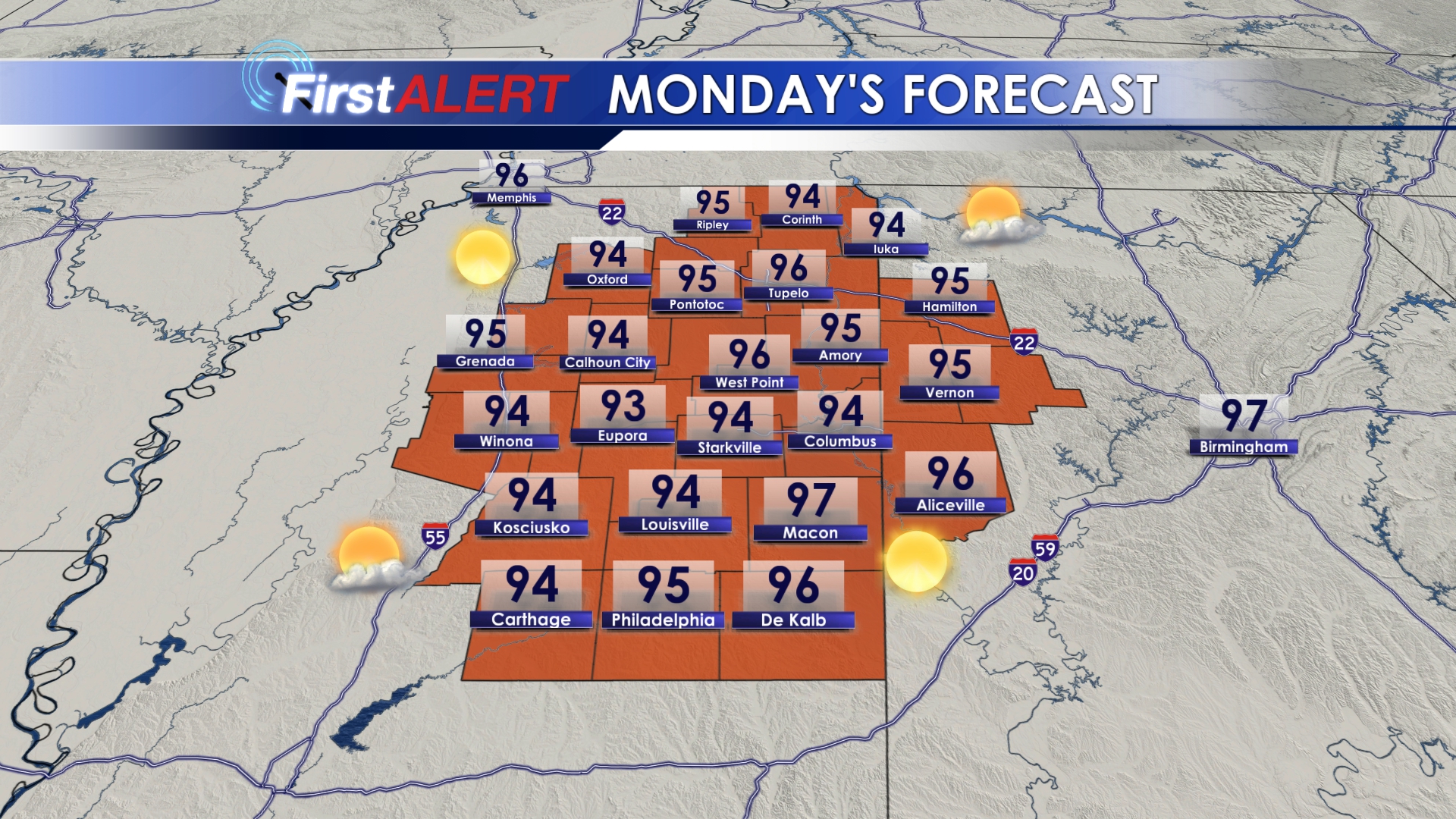
MONDAY-WEDNESDAY: We’re going to continue feeling more like mid-July as we start the week with highs staying in the mid 90s. Heat index values will be near 100°, so drink plenty of water and stay in the shade if you can. Our dry spell will continue with no rain in sight.
THURSDAY-FRIDAY: A weak cold front looks to get close to our area on Thursday which could spark an isolated shower or storm. However, I don’t think this will result in any meaningful rainfall with most areas staying dry. This front also won’t help us much in the way of cooler temperatures with highs still in the lower 90s to end the week.
SATURDAY-SUNDAY: Plenty of sunshine and a tad “cooler” for Saturday with highs around 90. Another cold front looks to follow close behind and pass through the area on Sunday, which again may cause an isolated shower or storm to pop up. This front could lower temperatures a bit more, and it looks like highs will be in the 80s for Sunday and into early next week.
Follow @WCBIWEATHER on Facebook, Twitter, and Instagram


Leave a Reply