Dry and Sunny Weather Returns
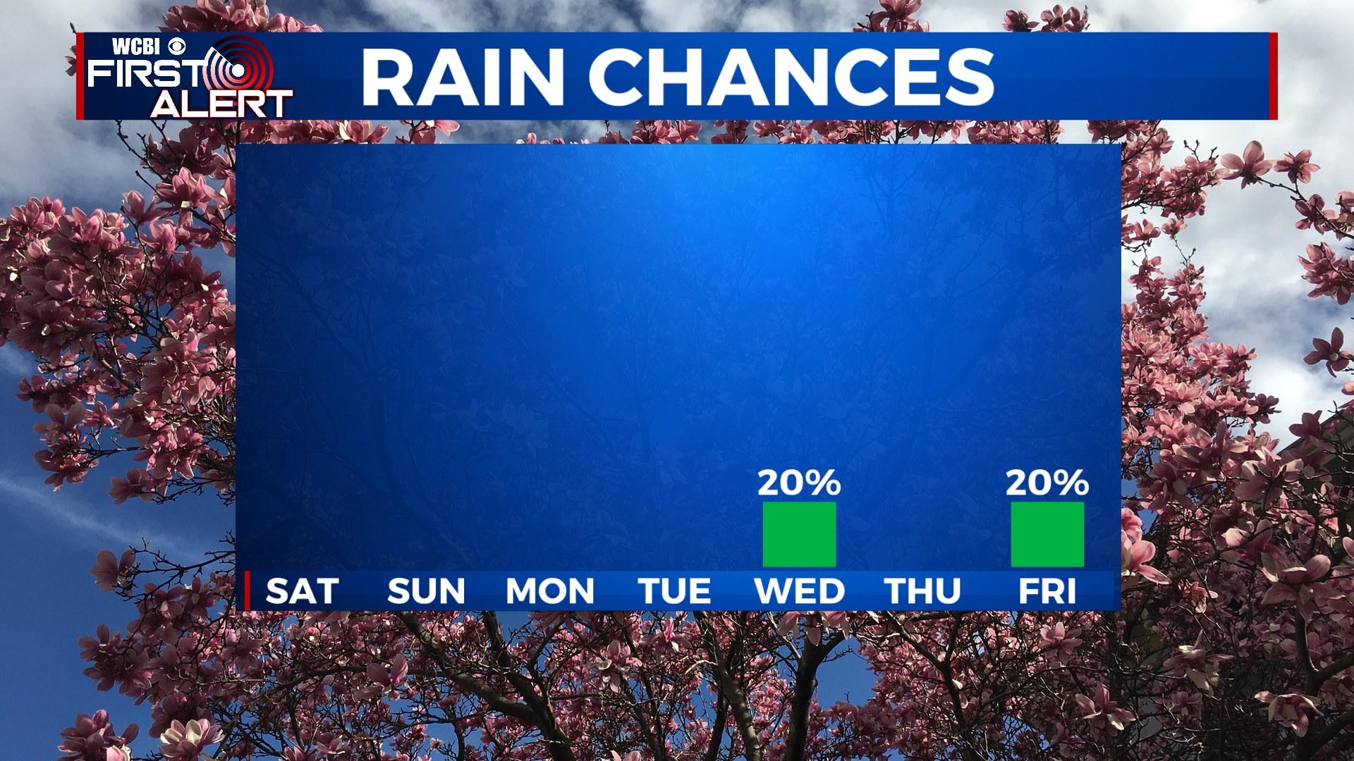
After a rainy and dreary Friday, drier and cooler weather is in store for Mother’s Day weekend. Some spots could see record low temperatures on Saturday and Sunday morning. Temperatures will warm up through the week with rain chances remaining minimal.
FRIDAY NIGHT: Cloud cover will exit the area overnight, leaving us mostly clear by sunrise. This will allow our temperatures to fall to near 40. Northerly winds could be breezy at times from 5 to 15 mph.
SATURDAY-SUNDAY: Great weather returns for the weekend, but we’ll be cooler than usual. Highs on Saturday will be in the 60s with temperatures returning to the mid 70s by Sunday. Overnight lows could be as low as the upper 30s, which could break record lows across the area. Some patchy frost is also possible. Skies will remain mostly sunny for the weekend.
MONDAY-TUESDAY: We’ll remain mostly sunny for Monday and Tuesday with a few high clouds passing through. Temperatures will also be on the increase, with highs back into the 70s. Overnight lows will remain in the mid 40s.
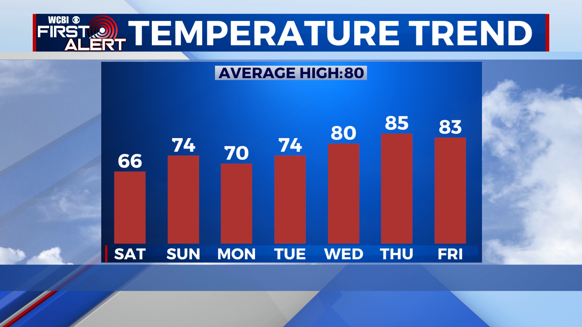
WEDNESDAY-FRIDAY: Aside from a stray shower on Wednesday, most of us will remain dry for the middle portion of the week. We could see a little bit more in the way of cloud cover, but we should still see plenty of sun. Highs will be back into the 80s. We’ll see a mix of sun and clouds on Friday as well with the chance of a stray afternoon shower.
Follow WCBI Weather on Facebook, Twitter, and Instagram


Leave a Reply