Early December warmth continues ahead of Sunday night rain
COLUMBUS, Mississippi (WCBI) – SUMMARY: Unseasonably warm air sticks around through the weekend as rain becomes likely Sunday night.
THURSDAY: Expect plenty of sun through the day with highs easily into the 70s.
FRIDAY: A few more clouds could move through, but enough sunshine will peek through to get highs back in the middle 70s.
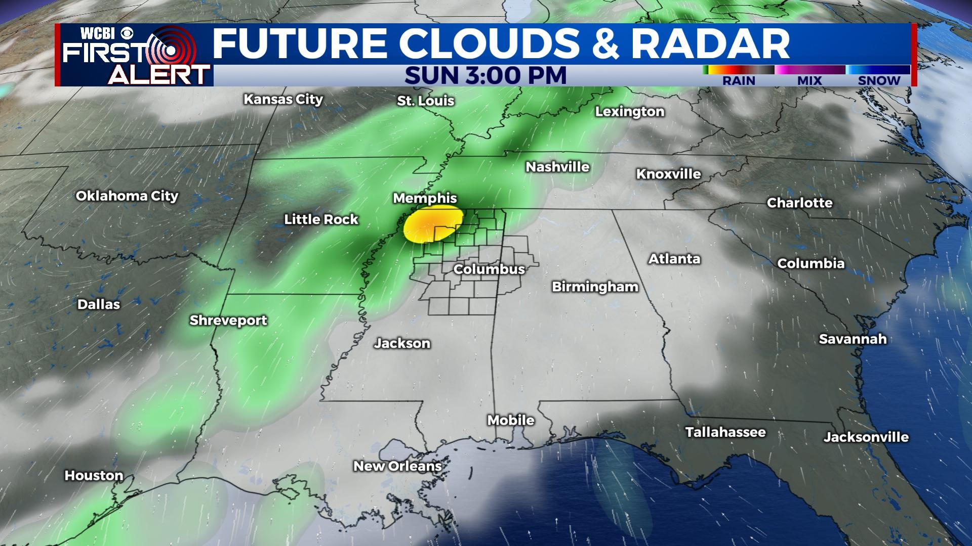
WEEKEND: Expect an increase in cloud cover Saturday, and spotty and occasional showers are possible through the day. The overall probability of rain is low, however. Highs will stay in the lower 70s. Sunday brings a much better chance for rain, especially Sunday night. Models are trending up on intensity, so heavier rain appears more likely Sunday night along with a few rumbles. Still, no severe weather is expected.
NEXT WEEK: A sharp cold front will pass through the region early Monday, bringing a return of winter-like conditions to the Twin States. Highs will struggle to reach the low 50s, and temperatures will fall to near freezing Tuesday morning. A rather quick recovery is still on tap by Wednesday ahead of the next front, and this front could bring the threat for stronger storms Wednesday afternoon.


