Early-week severe threat keeps us on our overnight toes
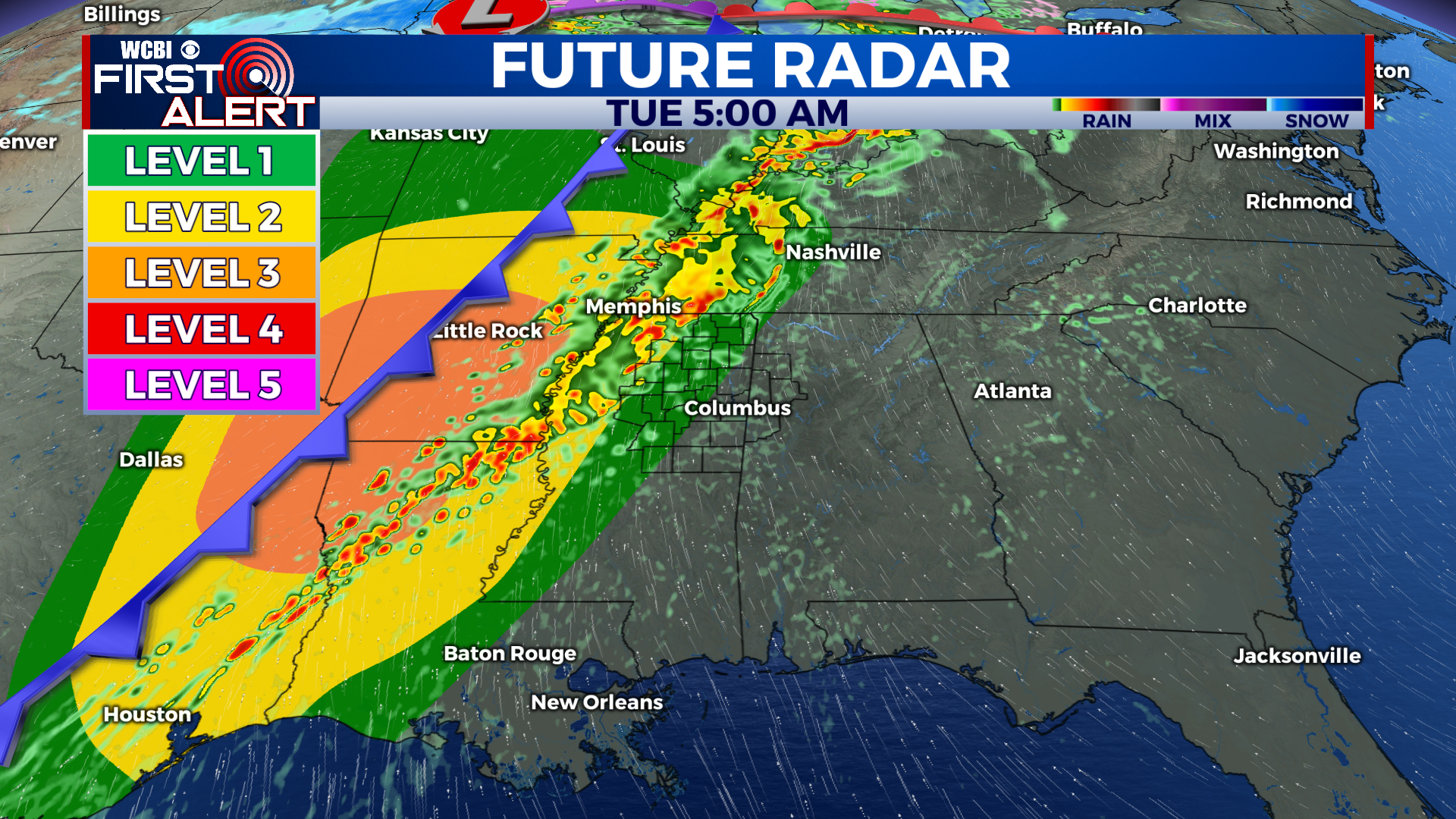
MONDAY: Highs hit the low 70s as scattered showers and thunderstorms take shape across the region. Showers are possible as early as around sunrise before activity is projected to increase in the afternoon. Later in the evening, the potential for severe weather increases and continues throughout the evening and into Tuesday morning. Lows hang around in the mid to upper 60s overnight.
TUESDAY: A brief lull will ensue in the very early hours Tuesday before another line of storms will make it’s way through the region leading up to and a bit after sunrise. Severe potential with this second round of storms is also a possibility, and we will keep you updated as the situation evolves. Highs top out in the low 70s once again while lows take a drop into the mid to upper 50s as our cold front finally arrives in the area.
REST OF THE WEEK: Highs will steadily drop into the 60s Wednesday and then into the low 50s Thursday and Friday as cooler air settles into the area. Lows will also take a hit from the mid to upper 60s overnight Monday to close to or at freezing by overnight Thursday. Thankfully, the skies remain dry during this period, and the next potential for any rain comes into view next Sunday.


