Easter Sunday Severe Outbreak
SEVERE WEATHER OUTBREAK POSSIBLE SUNDAY
Summary: Cool and quiet weather Saturday will become potentially violent on Easter Sunday as a significant storm system moves through the region. The potential for large hail, damaging wind gusts, and tornadoes (some strong and long-tracked) exists for the entire WCBI-TV coverage area. Heavy rainfall between 1 and 4” may also lead to flooding.
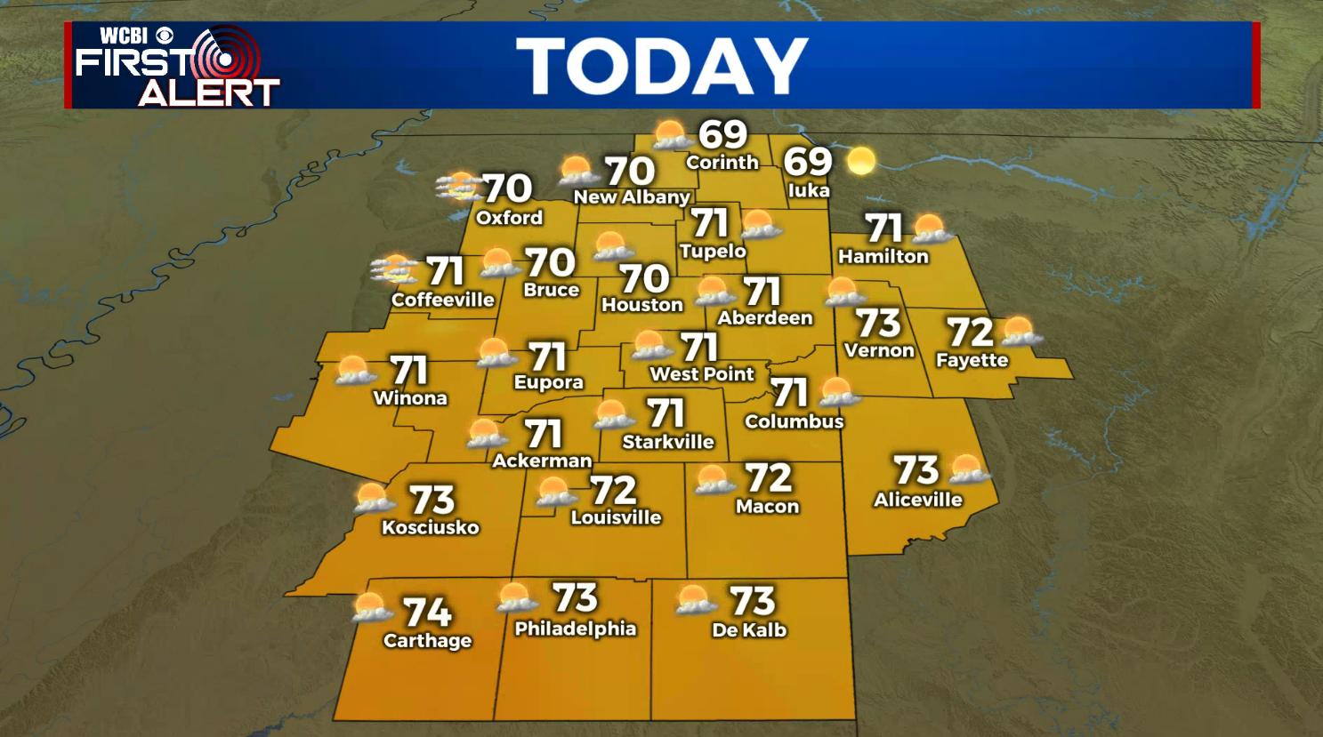
SATURDAY: Mostly sunny to start with increasing clouds during the afternoon. Highs in the lower 70s. Winds SE 5-15 mph.
SATURDAY NIGHT: Becoming cloudy with areas of rain and storms developing. Lows in the mid to upper 50s.
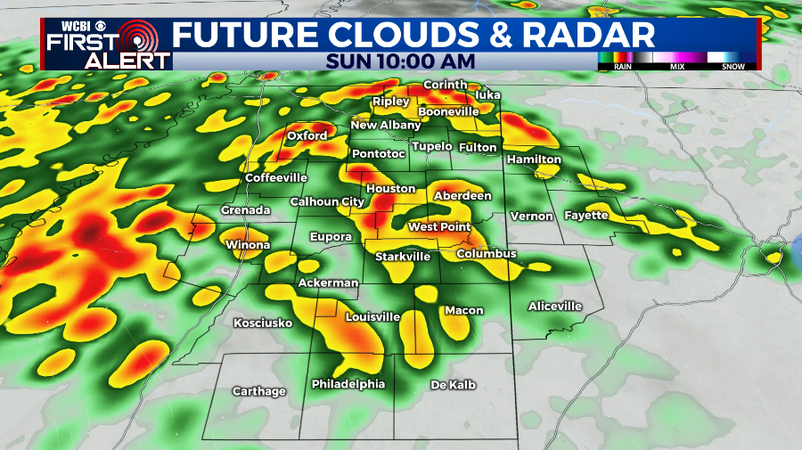
SUNDAY MORNING: Areas of rain and storms. While there could be some isolated strong storms with hail and gusty winds most activity will remain on the tame side. SE winds increase between 10-20 mph as temperatures warm into the 60s.
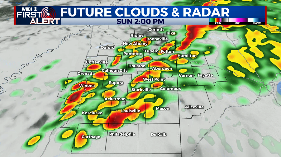
SUNDAY AFTERNOON & EVENING: This is the prime window for severe weather in our area. Storms that develop could quickly become severe with large hail, damaging wind gusts, and tornadoes. Individual storm cells will need to be watched closely for tornado development. Winds will be gusty from the south at times over 30 mph even outside of any storm. Highs top out in the 70s.

SUNDAY NIGHT: The strong storms should be leaving our area by midnight with quiet weather returning. Lows in the 50s.
NEXT WEEK: Generally quiet and unseasonably cool weather builds back in. Where there could be a few showers from time to time no major weather maker is expected. Highs look to be mainly in the 60s with lows in the 40s and 30s.
Follow @WCBIWEATHER on Facebook, Twitter, Instagram, and on the WCBI News App


Leave a Reply