Ending 2020 on a stormy note
2020 will be going out like a lion with a round of storms moving through just as we ring in 2021. A few of the storms could be on the stronger side.
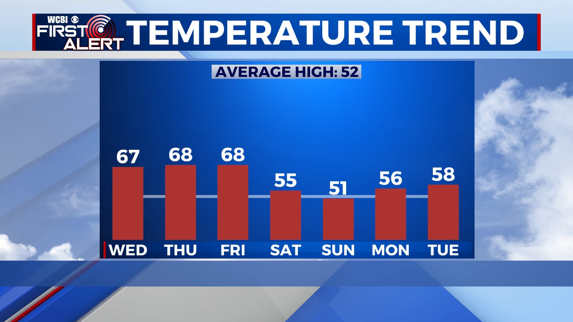
WEDNESDAY: Mostly cloudy skies will continue through much of the day with some showers developing in the afternoon and evening. Highs in the mid 60s with a breezy southeasterly wind.
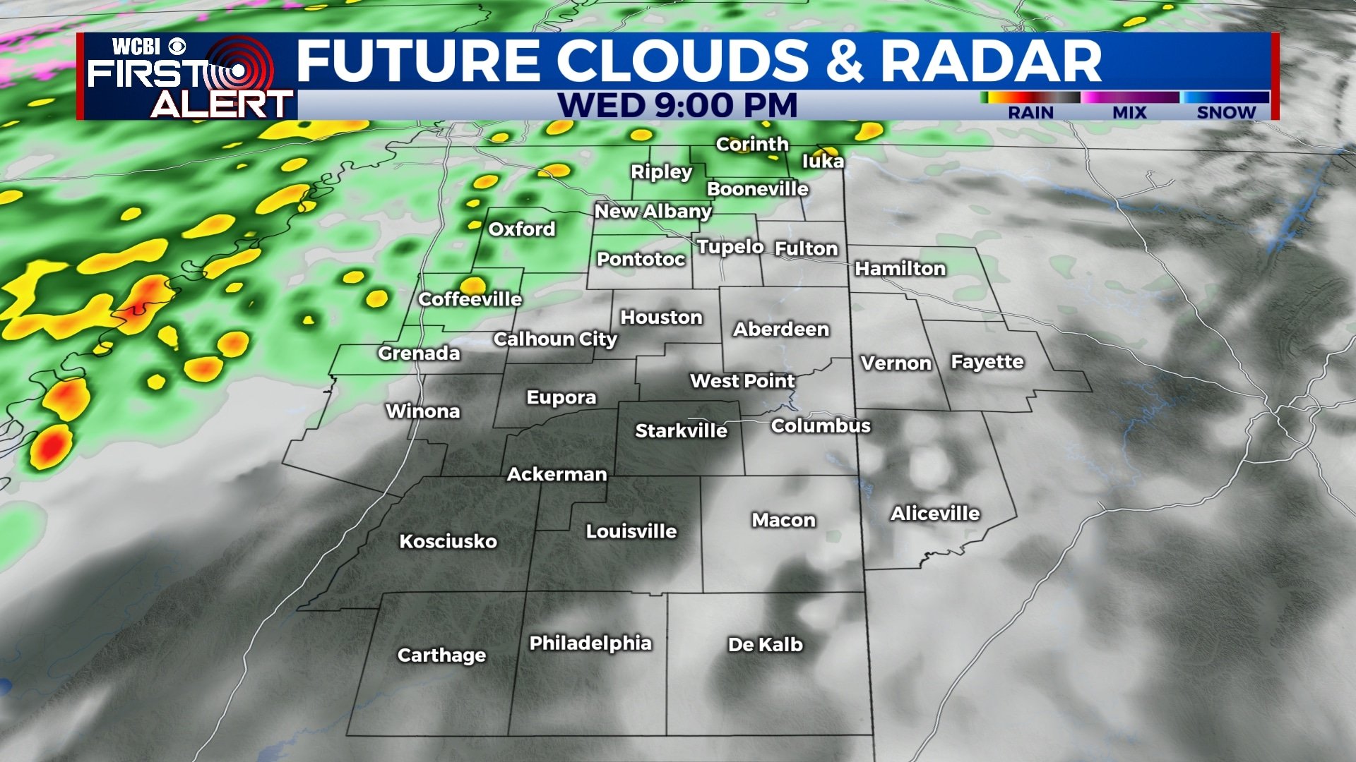
WEDNESDAY NIGHT: Chances for showers will continue tonight as skies remain mostly cloudy. Lows in the mid 50s.
THURSDAY: Showers will be possible through the day on Thursday, but storms will be more likely by the evening. Highs will be in the mid to upper 60s with some spots even getting close to 70.
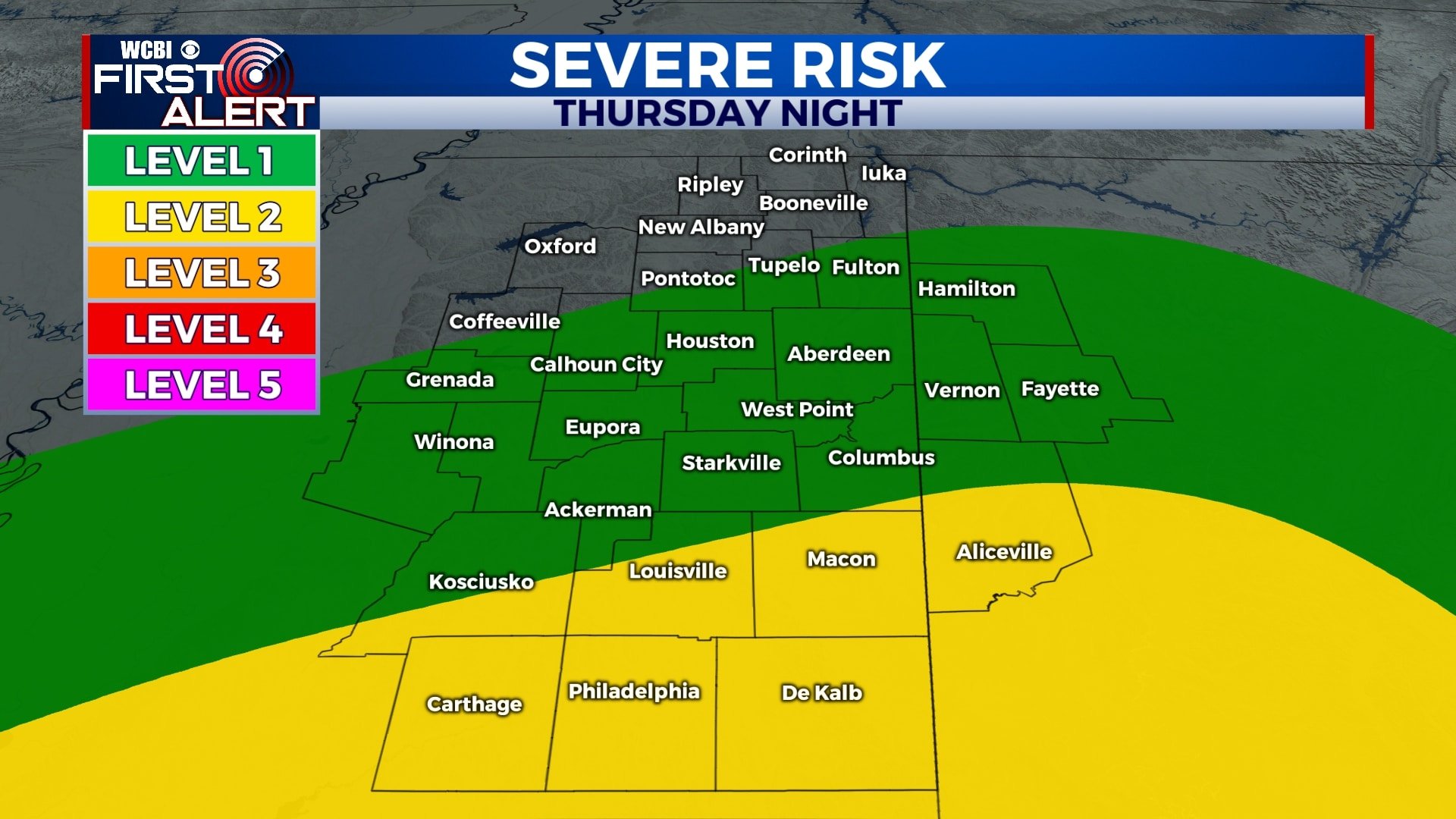
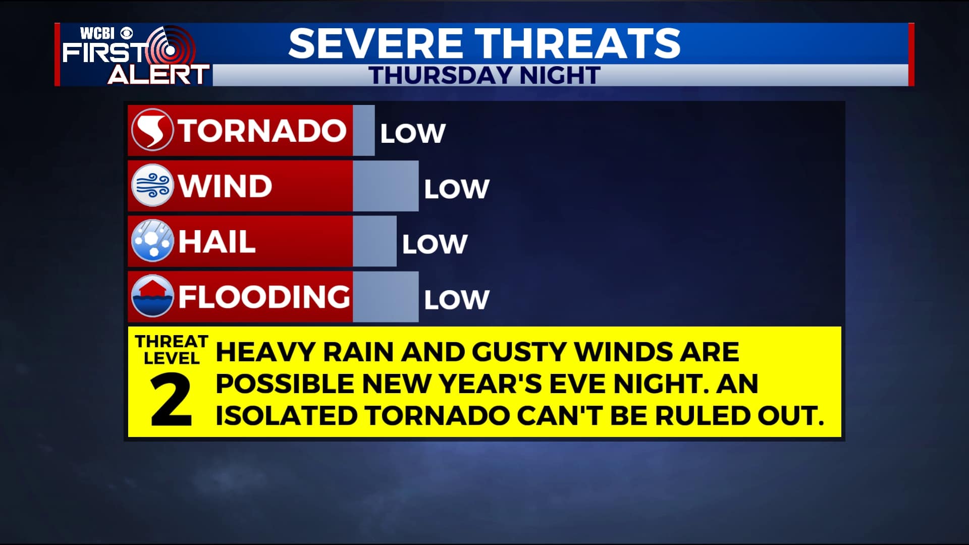
THURSDAY NIGHT: The best chance for storms will be from 9pm Thursday to 6am Friday. This means any New Year’s Eve plans will likely feature some storms. There is a chance for some of these storms to be on the stronger side with damaging winds and heavy rain. While it doesn’t appear to be our primary threat, we also can’t rule out an isolated tornado.
FRIDAY: Rain and storms will begin to exit by sunrise and, aside from a few morning showers, most of New Year’s Day itself will be dry. Temperatures will remain warm with highs in the mid to upper 60s. We’ll start out mostly cloudy, but we could see some peeks of sun by the afternoon.
SATURDAY-TUESDAY: The first weekend of 2021 and into next week will be cooler and drier. Highs will be back into the 50s under a mostly sunny to partly cloudy sky. Overnight lows will be in the 30s in most locations.
Follow WCBI Weather on Facebook, Twitter, and Instagram
Follow Meteorologist Trevor Birchett on Facebook and Twitter


Leave a Reply