Extra clouds, bringing the rain
COLUMBUS, Mississippi (WCBI) – Finishing off the week, temperatures will continue in the upper 60s. Heavier cloud coverage will move in, bringing our next chance for rain out of the week and into the weekend.
THURSDAY NIGHT: There will be partly cloudy conditions tonight that become mostly cloudy overnight. Clouds will continue pushing in from the South and SW. Thanks to the cloud coverage, temperatures will be a bit warmer tonight in the middle 40s.
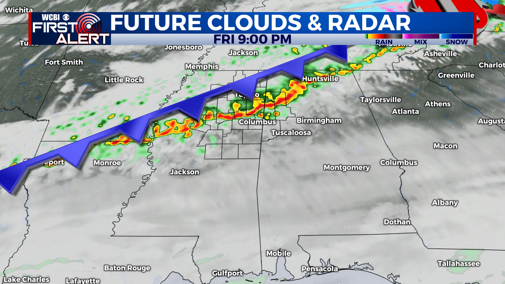
FRIDAY: Heavier cloud coverage will continue filling in throughout the morning and afternoon. Temperatures will reach back into the upper 60s and potentially lower 70s. A cold front will be moving through Friday night. By the evening, the rain chance will increase, riding that frontal passage. Showers and some thunderstorms are possible. There is no severe threat with this system. Overnight lows will be cool, in the lower 50s.
SATURDAY: Rain showers will continue from overnight into Saturday morning. By the afternoon, most of the rain should be cleared out. High temperatures will be only reaching in to the middle 40s. Any college baseball fans may want to be prepared with some layers, if there are plans to go to Saturday’s game. COLD conditions overnight. Cloud coverage will be clearing out, allowing low temps to drop into the middle 20s.