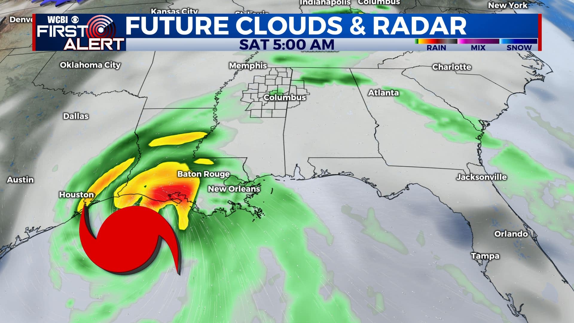
All eyes on Hurricane Delta
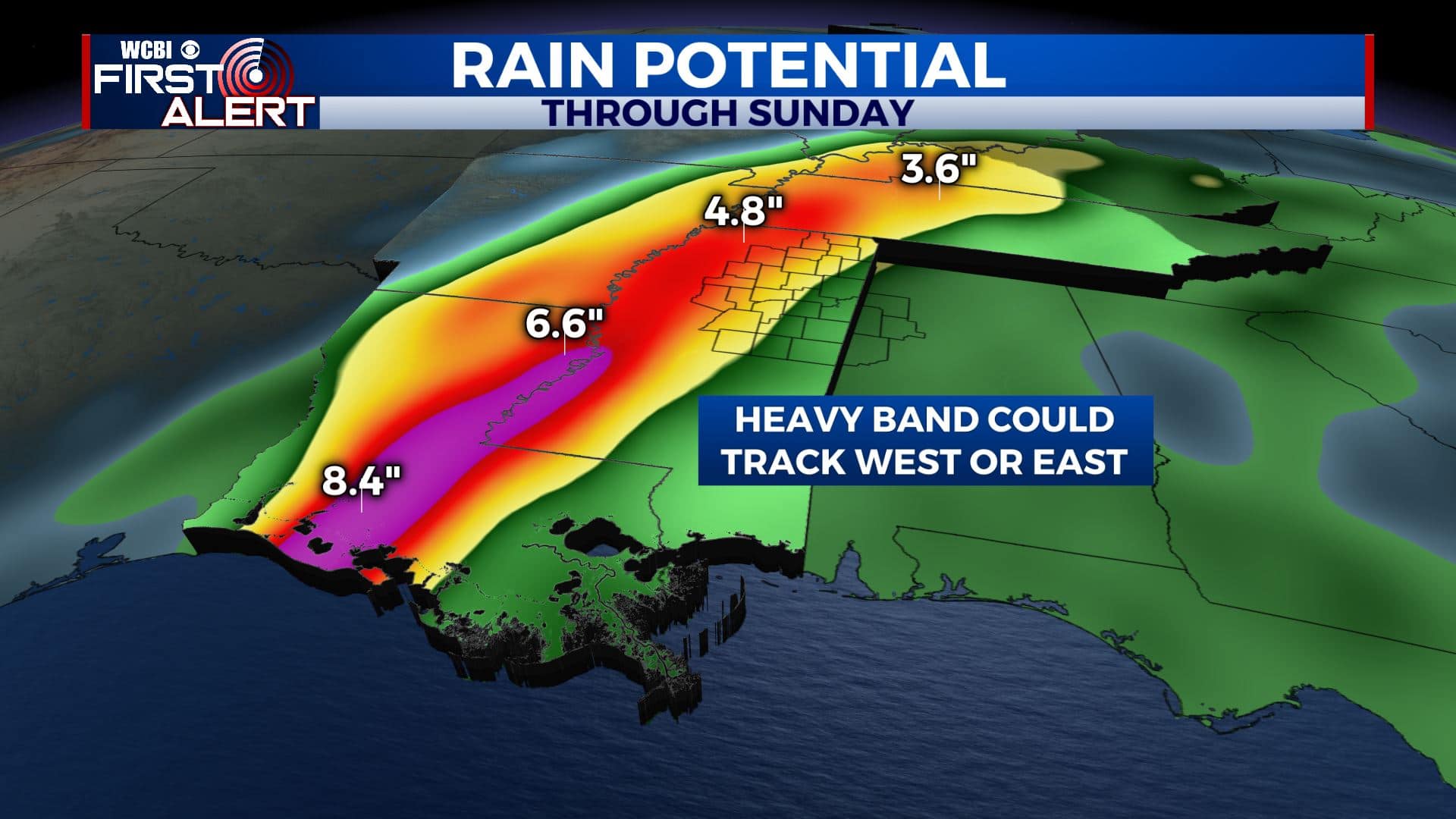
HURRICANE DELTA: A very dangerous and destructive storm will move into the southern Gulf of Mexico by Thursday. It is expected to take a northerly turn and make landfall somewhere along the Louisiana coastline late Friday or early Saturday. The remnant low center should move somewhere into north Mississippi during the course of the weekend. It’s still too early to pinpoint the exact time frame for the greatest impacts but some issues are possible anytime Saturday and/or Sunday. Stay tuned…
TUESDAY NIGHT: Clear, quiet, and comfy. Lows in the low 50s. Calm wind.
WEDNESDAY: Bright sunshine and seasonably warm highs in the low to mid 80s. Light northerly breezes.
WEDNESDAY NIGHT: Mostly clear and continued quiet. Lows in the 50s.
THURSDAY: A mix of sun and clouds. Highs in the 80s.
FRIDAY: Partly to mostly cloudy with a 40% chance of rain showers. Highs in the upper 70s.
SATURDAY & SUNDAY: The remnants of Delta are expected to swirl through the region. Rainfall between 2 & 6″ (or more) is possible, along with some wind gusts in the 30-40+ mph range. An isolated tornado risk is going to continue for areas east of the circulation center. Plan on highs in the 70s with humid lows in the upper 60s.
NEXT WEEK: Mild 80s continue Monday and Tuesday. Some rain and thunder could develop along a cold front Tuesday.
Follow @WCBIWEATHER on Facebook, Twitter, Instagram, and the WCBI News App


Leave a Reply