Fall Fronts Coming
SUMMARY: A pattern change is coming! We have a few more warm days this weekend with much more seasonable weather next week. Two cold fronts, one Monday and one next Friday, will usher in bursts of cooler air and rain. The wild fire risk remains elevated so be sure to follow the burn bans in effect.
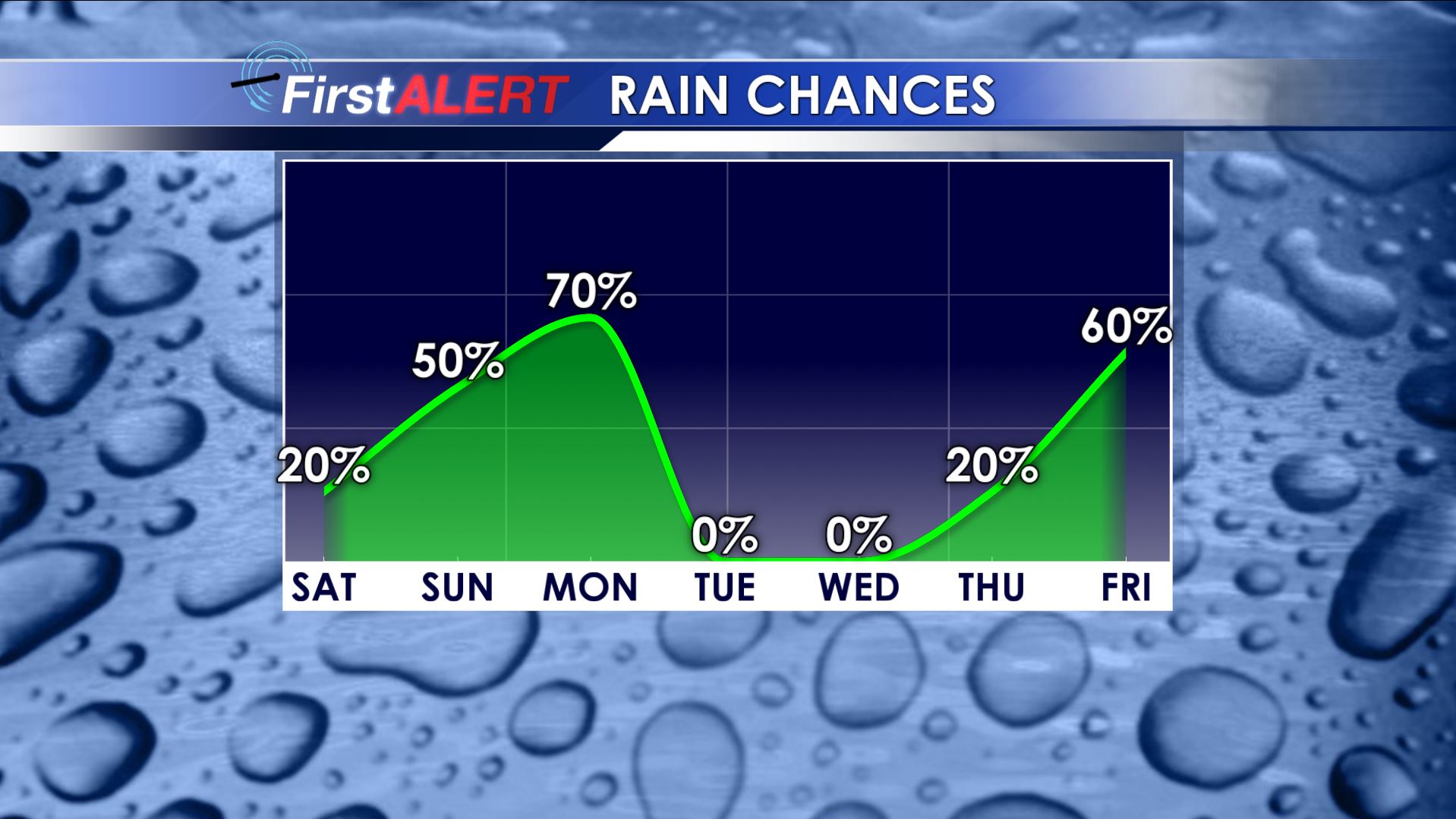
Rain Chances
FRIDAY NIGHT: Mainly clear and quiet. Lows will be much cooler in the upper 50s (north) to low/mid 60s (south). Northern winds between 3-8 mph.
SATURDAY: Partly cloudy and still warm. Highs in the low to mid 90s. There is a 20% chance of a few stray afternoon showers and storms. Conditions look good for the evening football game in Oxford.
SUNDAY: Scattered showers and storms are possible, especially during the afternoon. Highs look to only top out in the upper 80s for a change. The chance of rain is 40-50%.
MONDAY: A strong cold front will move through the region. Expect cooler highs in the low 70s along with a 60-70% chance of rain. Total rainfall with this evening may range from about 1/4″ to over 1″ if we’re lucky.
MONDAY NIGHT: Clear and cool. Lows in the low 50s.
TUESDAY-THURSDAY: A fair amount of sunshine with highs in the 80s. Lows will be in the 50s Tuesday night but moderate later in the week.
FRIDAY: Another strong fall cold front may give the region more rain and storms along with cooler temperatures.
Follow @WCBIWEATHER on Facebook, Twitter, and Instagram


Leave a Reply