Fall in full swing
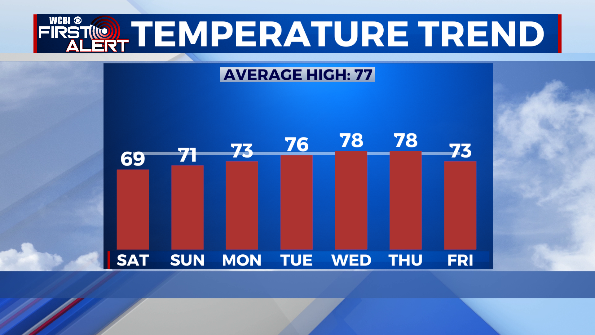
SUMMARY: Finally, at last, fall has arrived for MS and west AL! After the muggy and very warm weather the past couple weeks I’m sure many of you will greatly appreciate the return of cooler temps! Saturday many locations will not get out of the 60s, and lows will be in the upper 30s to low 40s on Saturday night. A stellar week of weather is ahead, with highs in the 70s, very dry air, and lows in the 40s and 50s. Rain chances return to the forecast for Thursday, but it won’t be a washout by any means. Dry weather will return by Friday.
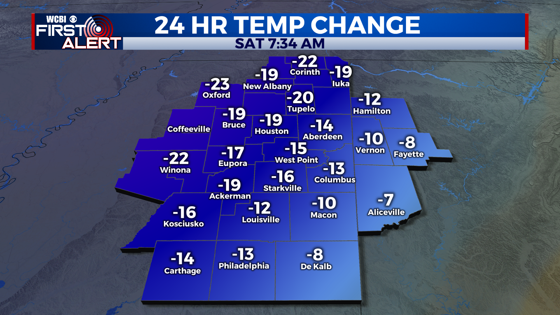
SATURDAY: A cool, beautiful and breezy day for Saturday with lots of sunshine. Highs will struggle to crack 70 degrees in many spots, with highs in the upper 60s. Just gorgeous for football!
SATURDAY NIGHT: A chilly night in store tonight, with a low in the upper 30s! to near 40 degrees under clear skies. Be sure to grab a jacket if you plan to be outside tonight!
SUNDAY: Slightly warmer for Sunday, but still just as nice. Highs top out near or just above 70 degrees under sunny skies.
SUNDAY NIGHT: Another chilly night in store, but perhaps a couple degrees warmer than Saturday night, with lows in the low to mid 40s. Skies stay clear.
MONDAY TO FRIDAY: A slow warming trend begins as we start the new work week. Monday looks very nice, with sunny skies and highs in the low 70s. Lows will be in the 40s again Monday night. A bit warmer for Tuesday, with highs in the mid to upper 70s, once again with sunny skies. Lows will be near 50 degrees. Wednesday and Thursday look to be the warmest days of the week, with highs in the upper 70s. Skies will be partly cloudy Wednesday, and mostly cloudy Thursday with a chance for scattered showers. Lows will be in the upper 50s. Friday cools down and dries out once again, with sunny skies and a high in the low 70s. Enjoy the beautiful week ahead!
CONNECT WITH @WCBIWEATHER ON TWITTER, FACEBOOK AND INSTAGRAM