FEBRUARY SHOWERS BRING MARCH FLOWERS?
Rain, rain go away! Many across our area are definitely thinking this after seeing several inches of rain over the past few days. Unfortunately, it looks like we will pick up a few more inches of rain through the weekend. We could also see a few strong to severe storms between now and Sunday.
TUESDAY NIGHT: Rain showers and thunderstorms will become less numerous overnight. This break will be short lived. Strong to severe thunderstorms will begin to move into Mississippi during the late overnight hours. Temperatures will actually warm overnight, climbing into the upper 40s and lower 50s.
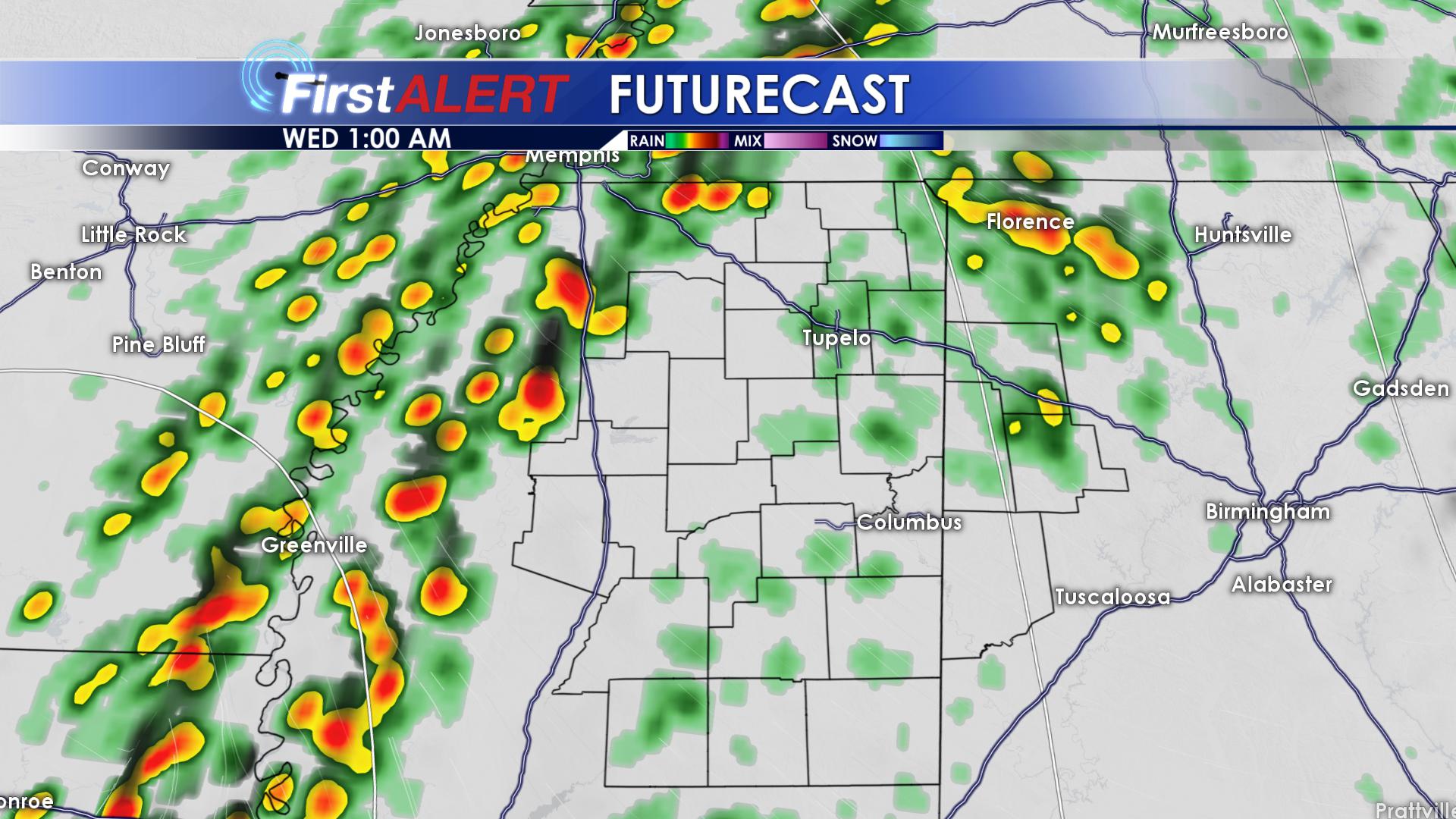
LIGHTER RAIN OVERNIGHT
WEDNESDAY: Stronger storms will move through during the first half of Wednesday. The Storm Prediction Center has issued a marginal risk of severe weather for portions of our area from the GTR and locations to the south. On a scale from 1 to 5, this is a 1. Heavy rainfall is the main threat, with a few damaging wind gusts, small hail and an isolated tornado possible as well. We could see up to one inch of rainfall across the area Wednesday. Temperatures will be warmer with highs in the middle 60’s. Overnight, we will drop down to lows in the upper 40s and lower 50s, with rain showers hanging around.
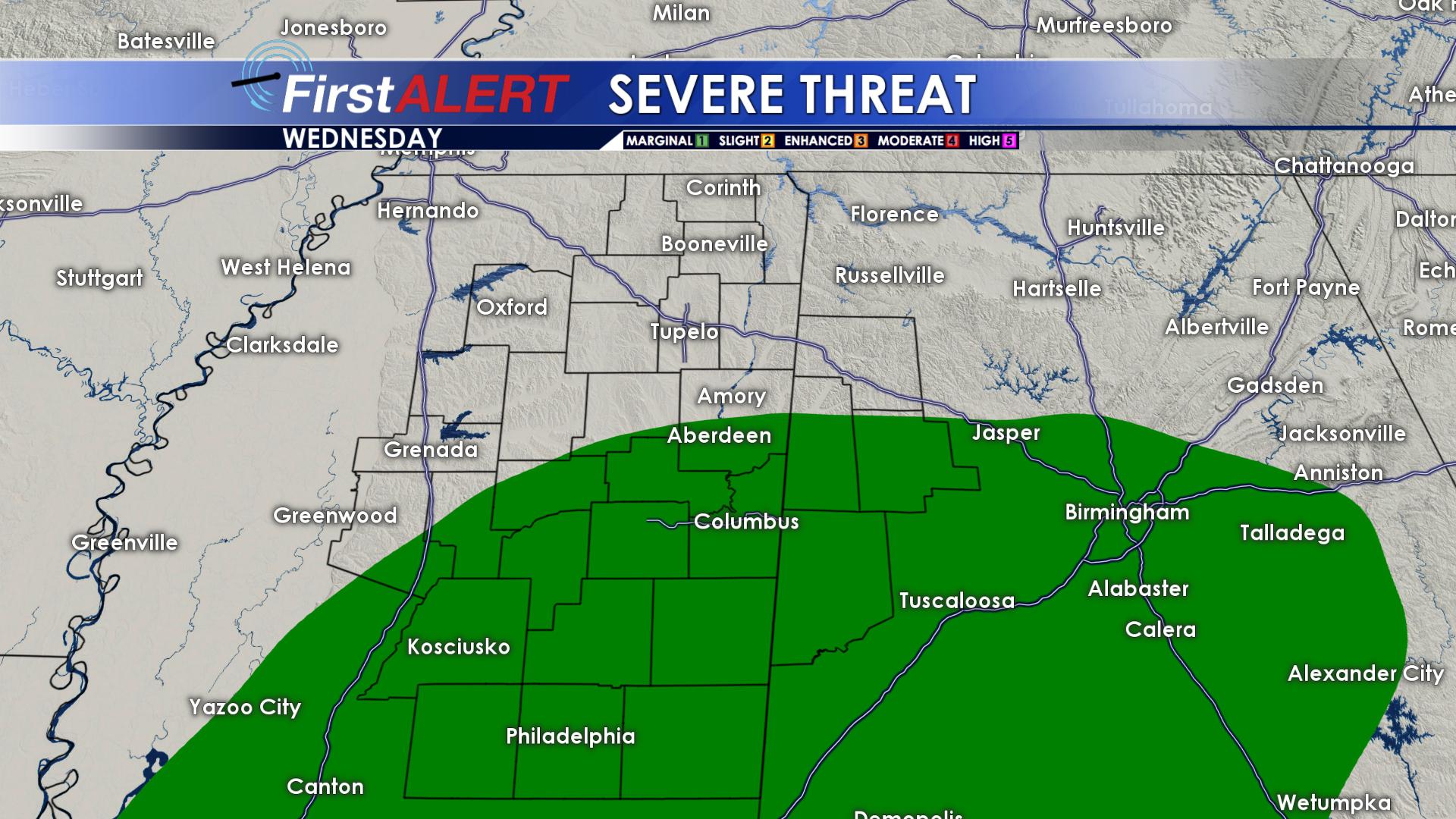
WEDNESDAY’S SEVERE THREAT
THURSDAY: If you guessed rain for Thursday, you guessed right! More heavy rain will move in on Thursday, bringing us around another quarter of an inch. Highs on Thursday will be a tad cooler, only topping out in the upper 50s. Rain showers will increase overnight, bringing us around another quarter of an inch by Friday morning. Overnight lows will remain mild, only getting into the lower 50s.
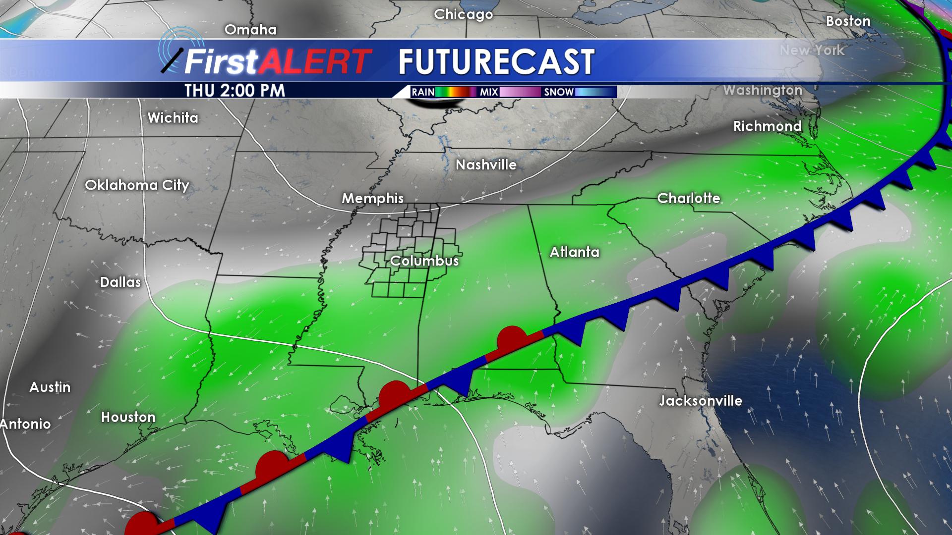
MORE RAIN THURSDAY
FRIDAY: Friday will be another cloudy and wet day. Highs on Friday will approach the lower 70s across southern portions of the area, with many of us topping out in the lower 60s across northern locations.. Rainfall totals near half of an inch are expected on Friday, with up to an additional quarter of an inch falling overnight. Temperatures Friday night will hold steady in the lower 60s!
WARMING FRIDAY NIGHT
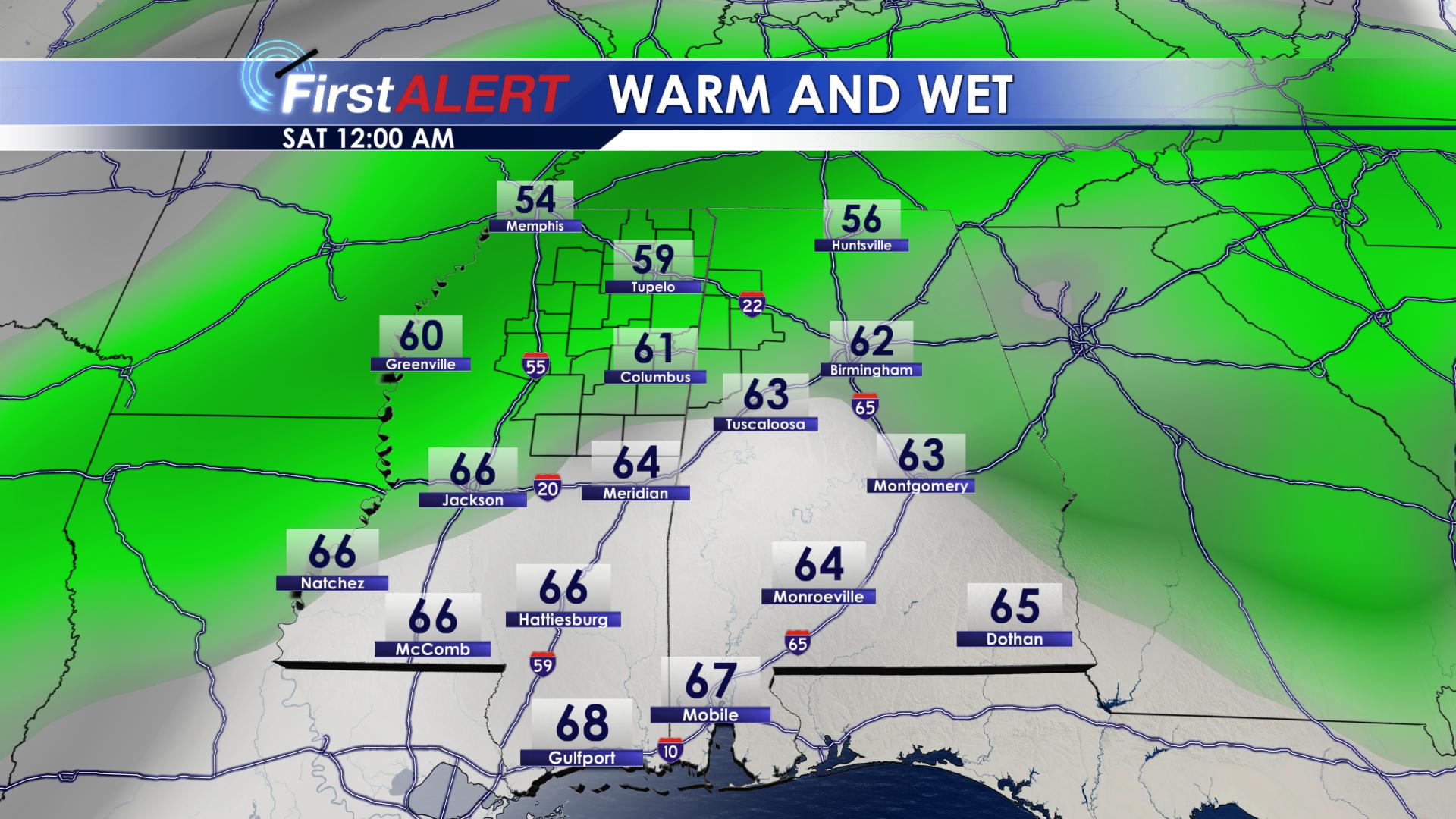
SATURDAY: As of now, it looks like we will see another round of strong to severe storms on Saturday. The National Weather Service is monitoring this event as it gets closer, but as of now, all modes of severe weather look possible. Damaging winds, large hail, flooding rains and a few tornadoes could all be possible on Saturday. Timing with this event looks to be during the afternoon and evening hours. Highs on Saturday will be in the upper 70s, with overnight lows in the lower 50s. Between now and Saturday, many of us could see an additional 1-3 inches of rain, with some of us seeing even more!
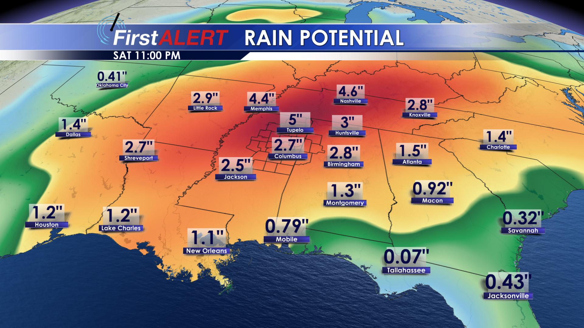
AN ADDITIONAL 1-3″ OF RAIN
SUNDAY: NO RAIN ON SUNDAY!!! As of now, it looks like things should remain dry on Sunday! We will actually remain mostly sunny, with highs in the middle 60s. Overnight lows will be chilly, dropping down into the upper 30s and lower 40s.
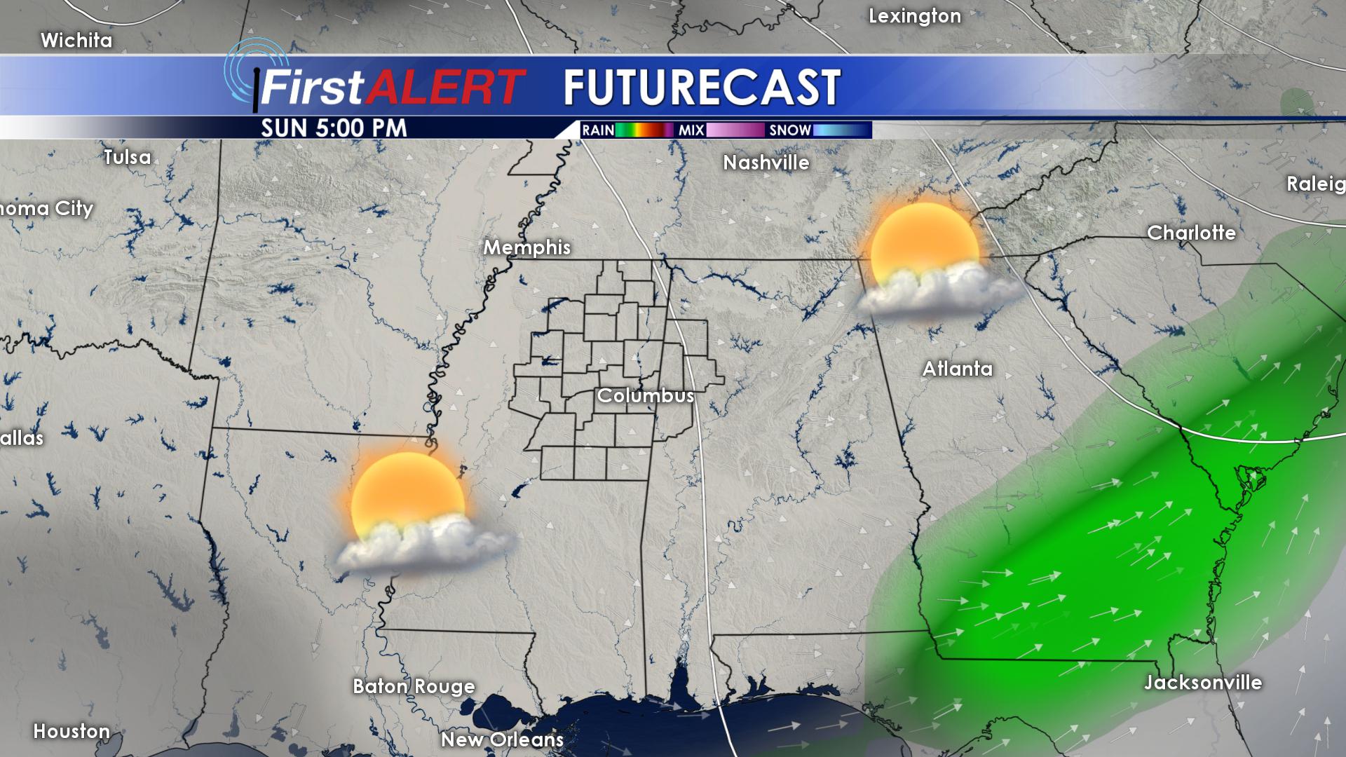
SUNNY SUNDAY
MONDAY: Rain chances will slowly creep their way back into the forecast on Monday. We will remain mostly cloudy throughout the day, with rain chances revving back up as we head into the overnight hours. Highs on Monday will reach the lower 60s, with overnight lows in the middle 40’s.
TUESDAY: Tuesday will be another dreary, rainy day. Scattered rain showers will return to the forecast for Tuesday, with highs in the upper 50s and lower 60s.
BE SURE TO FOLLOW US ON Facebook, Twitter, Instagram and Snapchat @WCBIWEATHER


Leave a Reply