Fred staying to our east; Not looking too bad for our Tuesday
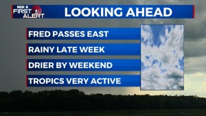
SUMMARY: Fred pass to our east this Tuesday. More scattered to widespread showers & storms move in for the second half of the workweek. The weekend is looking much drier, but warmer with the 90s making a comeback.
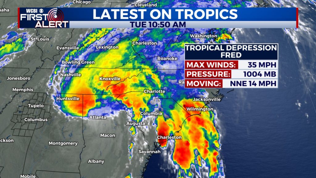
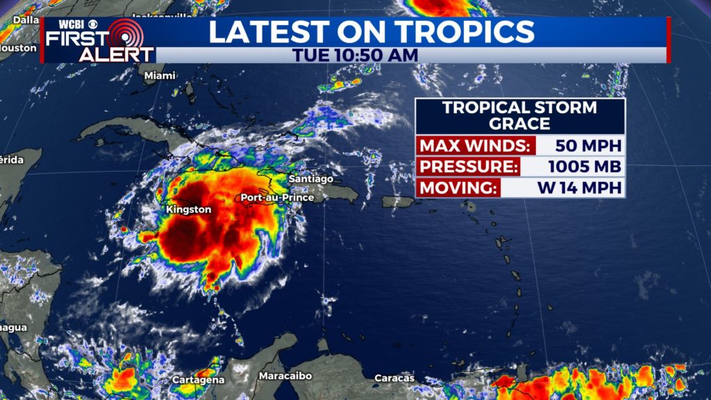
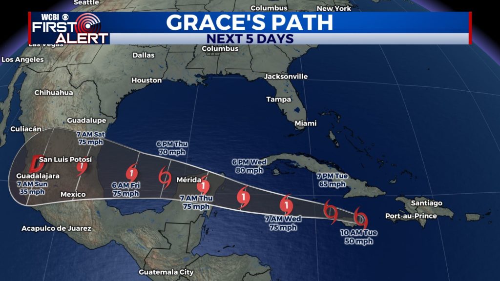
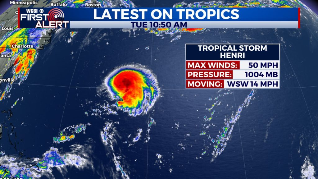
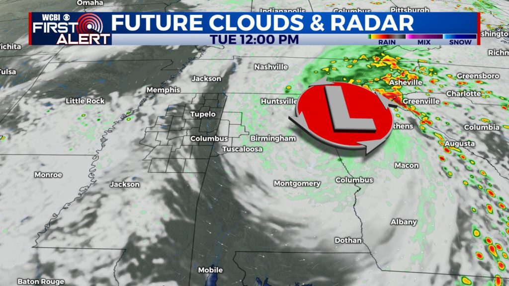
TROPICS: Fred is now a Tropical Depression as it continue to move to the north and east of us. Still not expecting much here from the system, except more clouds than sun and a few isolated showers & storms for our Tuesday.The tropics are continuing to get active with not just Tropical Storm Grace but also Tropical Storm Henri. Henri will stay out in the Atlantic near Bermuda. Grace though is forecast to be an issue for Mexico late week. No immediate threats for us here.

TUESDAY: A mix of clouds with some peaks of sunshine and isolated rain showers are expected throughout the afternoon as Fred passes to our east. Upper 80s to lower 90s for highs.
TUESDAY NIGHT: A quiet night with partly cloudy skies. Overnight lows in the 70s.
WEDNESDAY: Clouds will continue to increase with scattered showers and storms will develop across the area. Highs continue to warm up at around 90 degrees.
THURSDAY-FRIDAY: More scattered to widespread showers and storms expected as we end the workweek. Cloudy skies. Highs in the mid to upper 80s.
WEEKEND-MONDAY: Things should be drier by the weekend. The summer heat & humidity makes a comeback with highs in the lower 90s for Saturday and Sunday. chance of a stray shower or storm. Monday looks very similar, hotter in the low to mid 90s with a mix of sun and clouds skies. Stay tuned!
Stay connected with @WCBIWEATHER on Facebook, Twitter, Instagram and the WCBI News App


