Freezing drizzle north Thursday, Arctic air returns for the weekend
COLUMBUS, Mississippi (WCBI) – Another threat for frozen precip exists for parts of northern MS Thursday. Everyone gets back into the deep freeze for the weekend.
THURSDAY: Expect a cloudy day with areas of freezing drizzle possible north of US 82 up into Tennessee from mid-morning to early afternoon. Additional light ice accumulation is possible, which could further aggravate ongoing travel issues. Otherwise, scattered light rain remains possible w/temps well above freezing in the upper 30s to low 40s.
THURSDAY NIGHT: All precip exits the region after sunset as another front passes. Temperatures will drop into the upper 20s to low 30s as a notable breeze develops. Some fog is likely to develop before the front passes, and some of it could become freezing fog. We still expect potential for patchy black ice into Friday morning, but hopefully it’s not too widespread.
FRIDAY: Cold & blustery! Highs will struggle to reach just above freezing, and likely fall below freezing by afternoon. Gusty northwest winds up to 25-30 mph will create wind chills in the 20s and teens, eventually in the single digits Friday night.
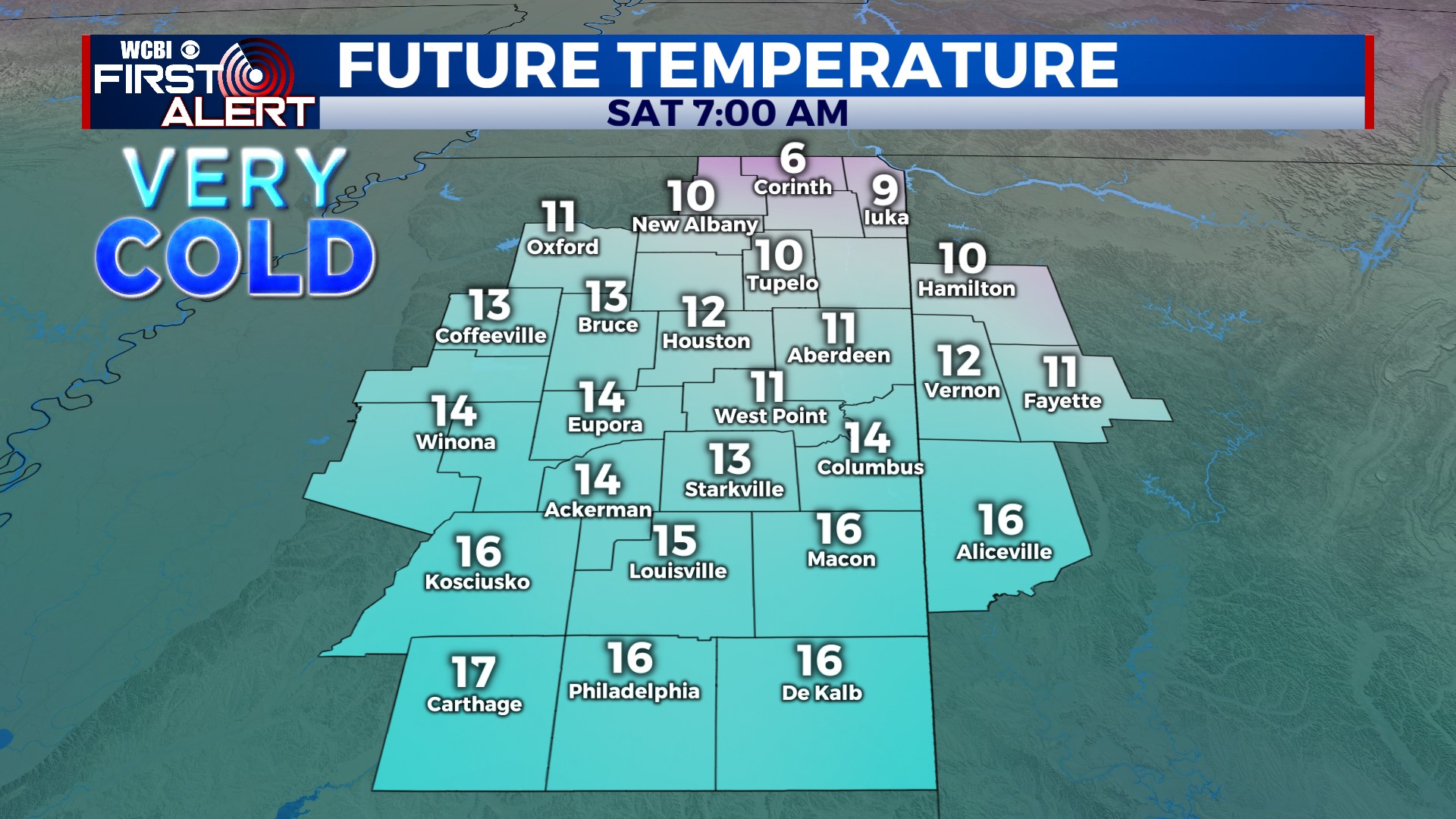
WEEKEND: COLD! High pressure brings a clear sky but more cold air. Saturday stays below freezing all day, and Saturday night will be the coldest w/single digits to low 10s for temps.
NEXT WEEK: We’ll see the pattern flip to warm, unsettled. Rain chances are back in the forecast late Monday and are likely to last most of the week. Temperatures will be in the 60s to near 70° by the middle of next week.