Heat & humidity coming back
SUMMARY: May-like warmth is slated to return by midweek. That means highs will be back into the 80s along with increased humidity. Rain chances will slowly creep back into the forecast.
MONDAY NIGHT: Stars and clouds. Cool and dry with lows in the mid 40s. Light wind.
TUESDAY: A mix of clouds & sun. Humidity stays low as comfortable highs in the mid 70s stick around. Winds SE 5-15 mph.
TUESDAY NIGHT: Variably cloudy. Lows in the mid 50s.
WEDNESDAY: Clouds and sun. Highs in the low 80s. Winds SSE 10-15 mph.
WEDNESDAY NIGHT: Partly cloudy. Lows in the upper 50s to around 60.
THURSDAY: Partly cloudy with a 20% chance of a shower or storm. Warmer highs in the mid 80s.
THURSDAY NIGHT: Partly cloudy. Lows in the low 60s.
FRIDAY: Partly cloudy. A 30-40% chance of showers and storms. Highs in the mid 80s.
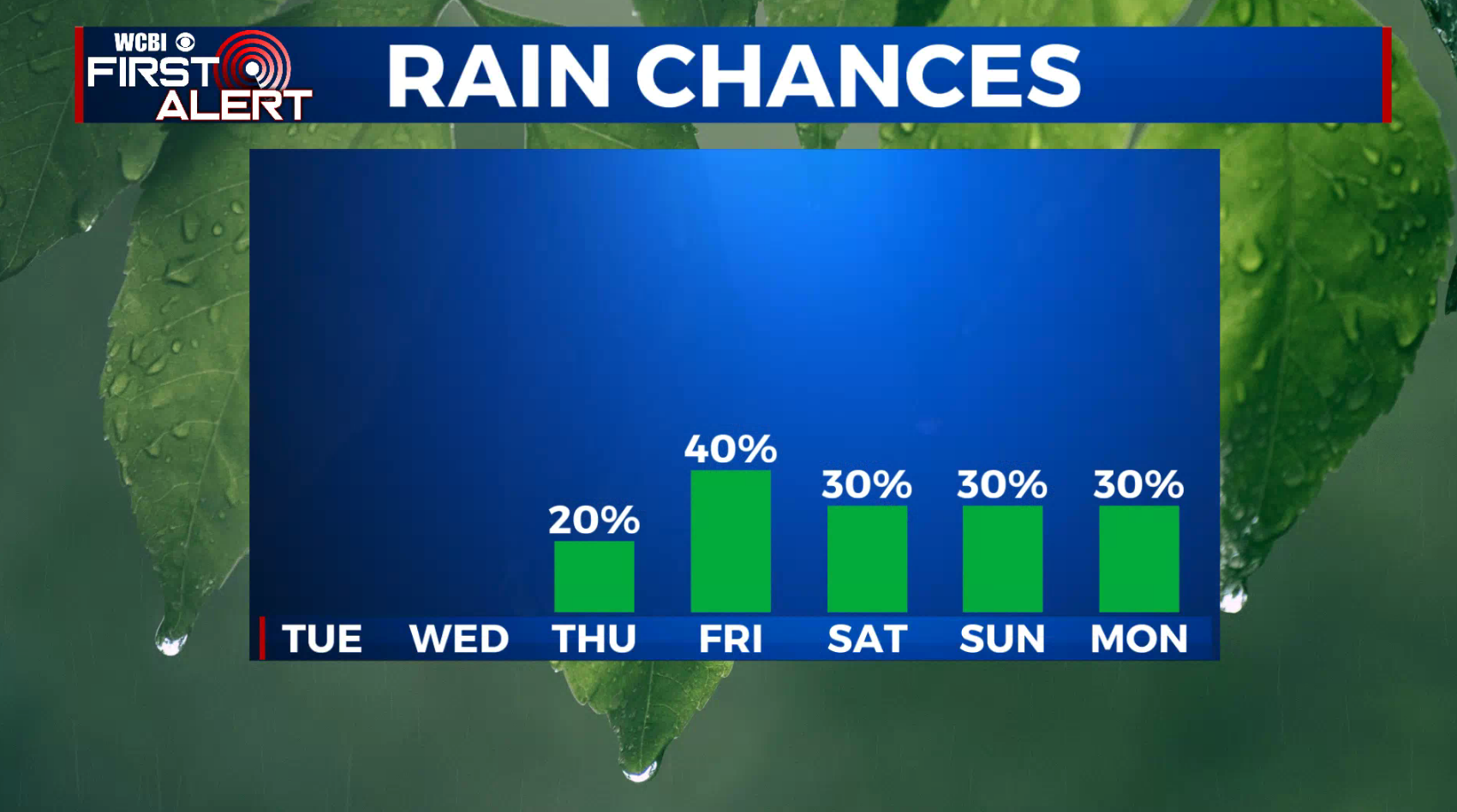
WEEKEND: Partly cloudy, warm humid… simply more summer-like. Highs in the mid to upper 80s and lows in the mid 60s. It doesn’t look like a washout on either day but rain and storm chances remain about 30%.
Follow @WCBIWEATHER on Facebook, Twitter, Instagram, and the WCBI News App


Leave a Reply