Heavy rain and potential strong storms through mid-week
COLUMBUS, Mississippi (WCBI) – Bouts of heavy rain and eventually strong storm potential will impact the region through Wednesday. We’ll quiet down late-week.
TUESDAY: Areas of locally heavy rain will continue much of the day, leading to some degree of at least nuisance flood risk across the region. Temperatures will stay in the 60s through the day.
TUESDAY NIGHT: While a brief break in the rain could occur in the evening, additional rain activity with embedded storms is expected to overspread the area late and last through much of the night. Additional rain amounts of 1-2″ are possible, continuing the flood risk.
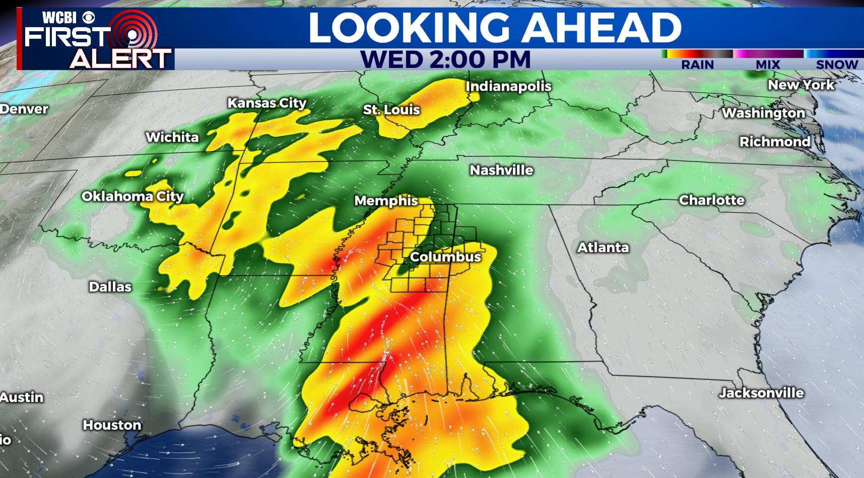
WEDNESDAY: This still looks to be the most impactful day, though uncertainty remains quite high as to the exact evolution of things. We expect widespread rain and embedded storms to move into the region by mid to late morning, lasting into the afternoon hours. If enough unstable air can return northward, a severe threat would accompany this activity; however, ongoing heavy rain to our south may block the inflow of such unstable air and reduce our severe threat. Another wild card is a faster evolution, with unstable air recovering quickly enough by late afternoon & evening to fuel new storms forming. Regardless, it’s a day you’ll want to be weather aware as there is a rarer level 4 risk in place across southern MS.
THURSDAY: The heavy rain/strong storm threat will be over by Thursday morning, leaving clouds and lingering showers the rest of the day. Temperatures will initially start in the 50s but should recover into the 60s.
FRI/WEEKEND: Finally, some sunshine! We expect increasingly warm afternoons with pleasant mornings and plentiful daytime sunshine.