Heavy rain and storms Wednesday
COLUMBUS, Mississippi (WCBI) – One last round of heavy rain & storms will move through Wednesday, ushering in more pleasant and DRY weather by late-week!
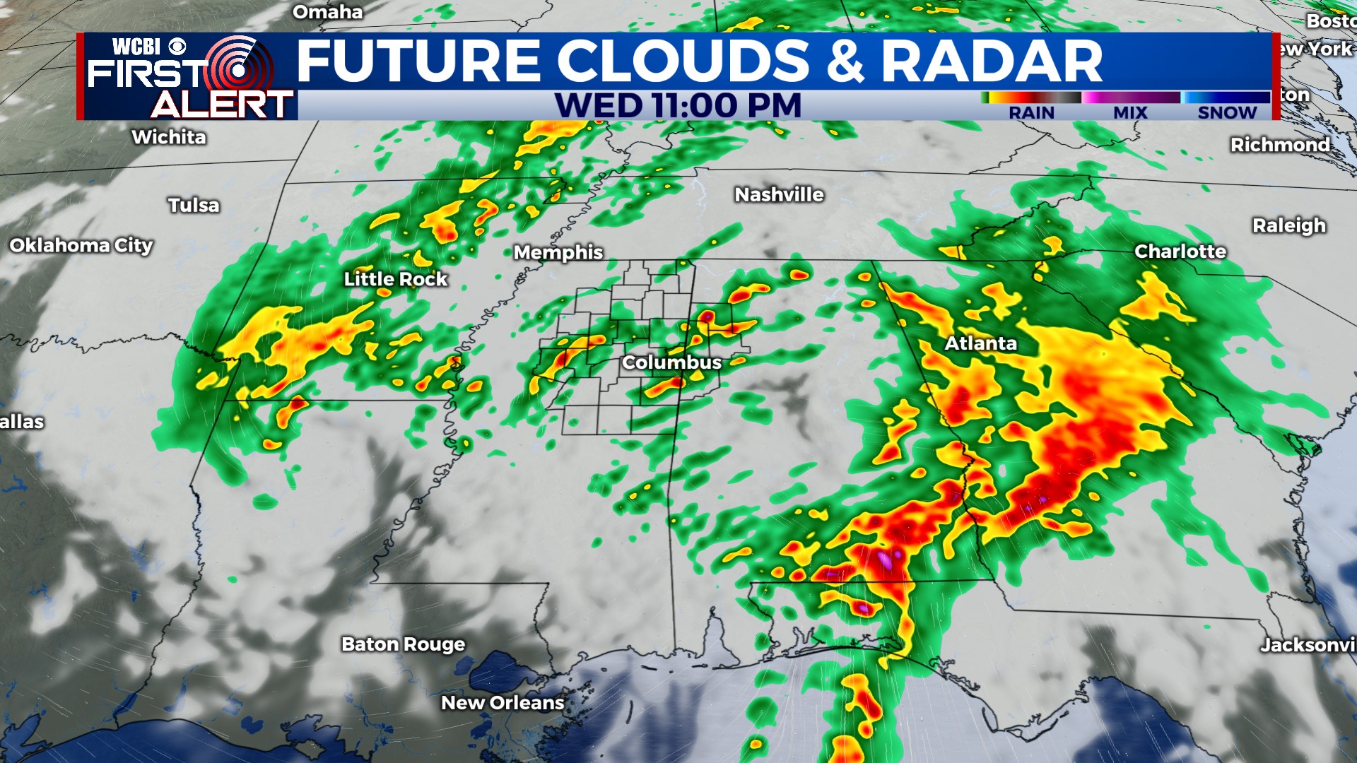
WEDNESDAY: Heavy rain and embedded strong storms are likely from the morning into the early afternoon hours, and a flood watch continues for the potential for areas of flash flooding. A limited severe risk will exist as well, but the most unstable air resides south of I-20 in the state. That being said, a rogue couple of strong to severe storms remain possible up this way during the day.
WEDNESDAY NIGHT: Immediately behind the heavy rain shield, some localized gusty winds over 40 mph with a potential wake low are possible. Additionally, scattered showers and storms may redevelop as the air recovers just a bit through the evening/overnight hours. This activity is not expected to be severe.
THURSDAY: Areas of rain are expected to start the day but will gradually shift east through the day. Clouds will persist as well but should clear by afternoon, with temperatures reaching the middle 60s…possibly upper 60s if clearing occurs faster. Winds could gust up to 20-30 mph at times as well.
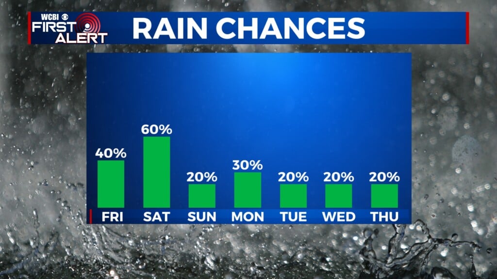
FRIDAY/WEEKEND: Finally, some sunshine! We’ll see mostly sunny & mild to warm days from Friday into the weekend. Sunday’s afternoon temps should return to the lower 80s.