Heavy rain chances move back in to begin 2020
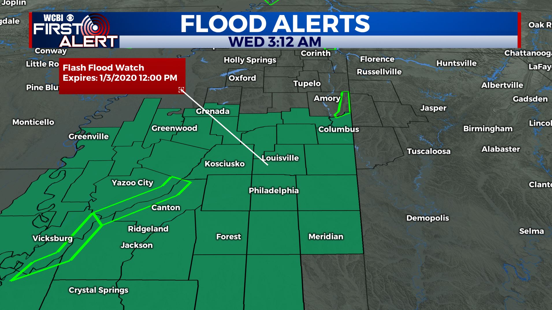
SUMMARY: A FLASH FLOOD WATCH IS IN EFFECT FROM 6 AM THURSDAY THROUGH NOON ON FRIDAY. New Year’s Day 2020 on Wednesday will be dry but more rain is on the way beginning late Wednesday night and lasting throughout the day on Thursday. Heavy rain is likely. Model data suggest anywhere between 2 and 5 inches may fall across the area and this may lead to more flooding concerns. While a few storms are possible, no severe weather is expected. A nice first weekend of 2020 is ahead with temperatures just a few degrees below average on Saturday.
WEDNESDAY: Happy New Year 2020!!! We’ll still have some sunshine, but clouds will build back in throughout the day. Highs in the mid 50s with a S wind 5-10 mph.
WEDNESDAY NIGHT: Cloudy skies with rain chances moving in after midnight. Overnight lows in the mid 40s. SE winds 5-10 mph.
THURSDAY: Widespread rain likely. A rumble of thunder is also possible. High temperatures near 60. SW winds 5-10 mph.
THURSDAY NIGHT: Areas of rain, heavy at times. Lows in the mid 50s.
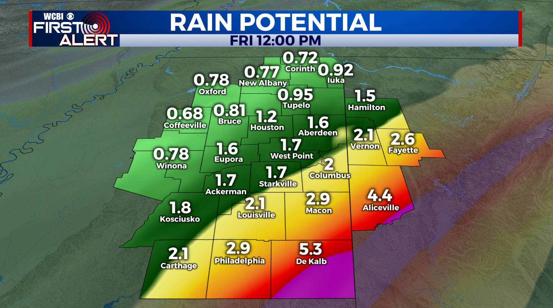
FRIDAY: Cloudy skies with lingering areas of rain and showers. Highs in the low 60s.
THIS WEEKEND: Clouds will start to break up on Saturday and we should be mostly sunny for Sunday. Highs will be a few degrees below average Saturday in the upper 40s with a brisk NW wind before going back up into the middle to upper 50s on Sunday. Overnight lows chilly in the 30s.
MONDAY: A sunny start to the new work week as many of us return back to work & school from holiday break. Highs in the upper 50s.
TUESDAY: A mix of sun and clouds with possible rain chances. Still a few days out to look at this. Highs in the lower 50s.
STAY WITH @WCBIWEATHER ON FACEBOOK, INSTAGRAM, TWITTER AND ON THE WCBI MOBILE APP.


Leave a Reply