Heavy Rain Likely Later This Week
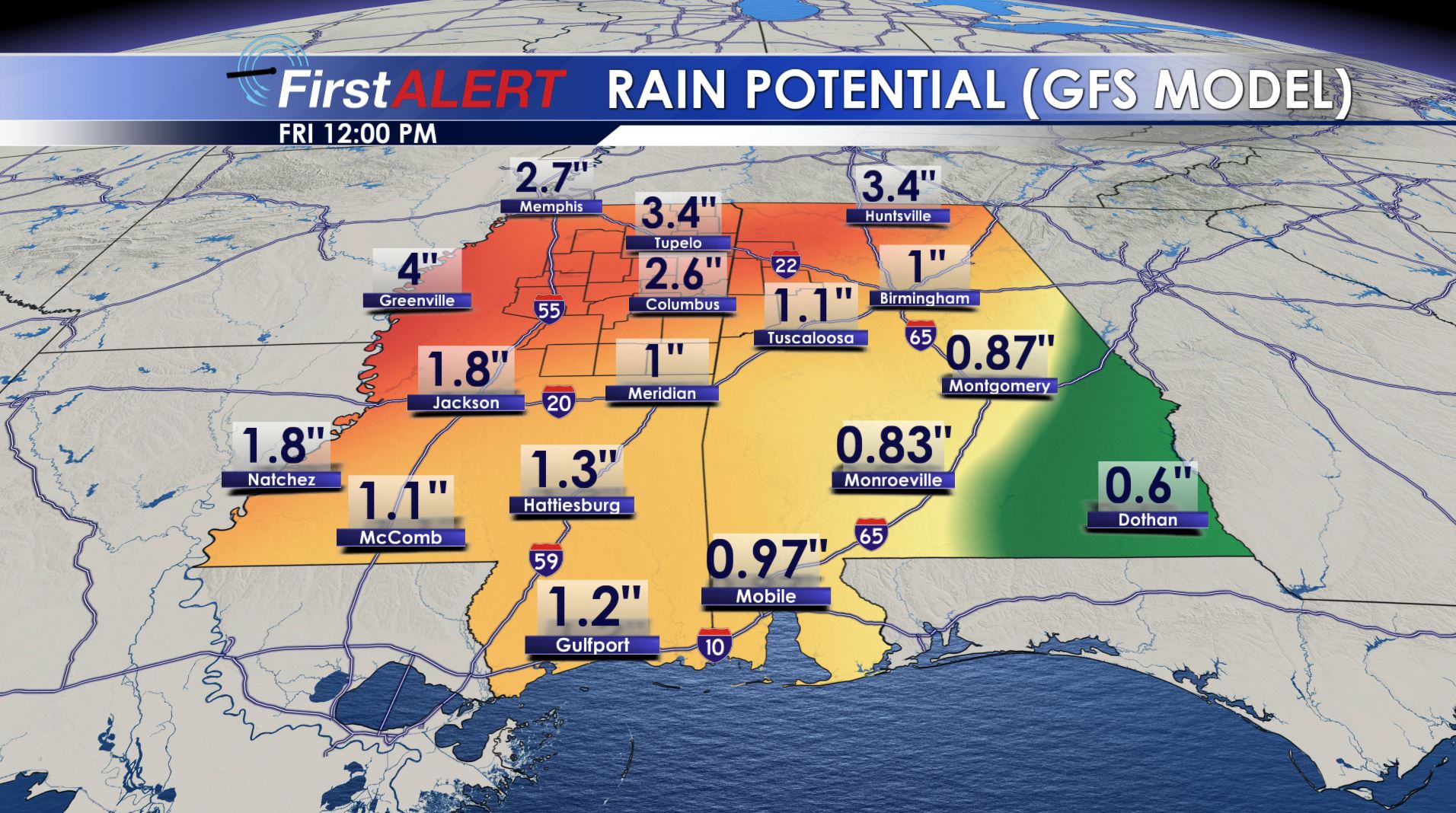
Rain Potential Wed & Thu
MONDAY NIGHT: Cloudy, cool, and breezy conditions continue. Lows will be in the lower 50s with southeasterly breezes between 10 and 15 mph.
TUESDAY: Look for a mostly cloudy and breezy day with forecast highs in the upper 60s to lower 70s. Winds continue from the southeast between 10 and 15 mph.
WEDNESDAY: Partly to mostly cloudy skies are likely with a 40% chance of afternoon rain and storms. Southerly winds should push afternoon highs into the mid and upper 70s. Cooler air may try to creep into our northwestern counties during the afternoon.
THURSDAY: Widespread rain is likely along with a few thunderstorms. Some rain may be heavy. Highs stay in the upper 60s to around 70. Total rainfall between Wednesday and Thursday may be between 1 and 4 inches (or more).
FRIDAY: There is a 20% chance for lingering showers under variably cloudy skies. Not much moisture is expected at this time. Highs in the upper 60s to around 70 are likely.
EASTER WEEKEND: Data suggests a fairly sunny and mild Saturday. Uncertainty exists for Sunday. At this point we’re going to keep the forecast dry and mild with highs in the 70s. Some wet and cooler air could return after Easter but it’s still up in the air. We’ll keep refining the forecast during the week so stay tuned.
Follow @WCBIWEATHER on Facebook, Twitter, Snapchat, and Instagram


Leave a Reply