Heavy rain, storm threat Friday PM
COLUMBUS, Mississippi (WCBI) – Another active weather day is expected Friday. Storm chances will stick around for the weekend, but next week is looking mostly dry.
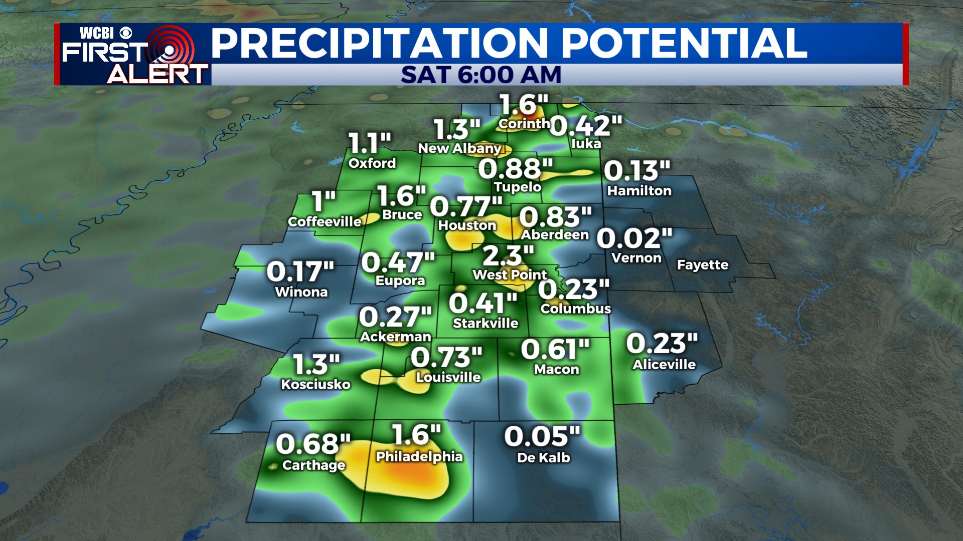
FRIDAY: After fog clears up in the morning, sunshine should warm the afternoon into the lower 90s. For areas along/south of US 82, chances of seeing the heat index at or above 105° are higher. This will lead to significant storm fuel, and showers and locally strong storms are expected to develop into northeastern MS after 1-2 PM. A few storms could reach severe limits with gusty winds the primary threat. The other inherent concern is heavy rain & flooding, as an additional 1-3″ of rain is possible across parts of the region.
FRIDAY NIGHT: The afternoon/early evening round of storms will weaken after sunset, but another round of storms could move in overnight from Arkansas. These should be weakening, but a few could hang on and reach northeast MS.
WEEKEND: After a mostly cloudy start Saturday, the sky should at least partially clear through the day. Additional storm development is possible in the afternoon, but it should be less widespread than Friday. More isolated storms are possible Sunday, but again the coverage should remain fairly widely spaced.
NEXT WEEK: Rain coverage becomes even less likely Monday as temperatures start climbing. By mid-week, we expect almost dry weather with highs inching into the middle 90s.


