Heavy rain and a few storms tonight and Saturday
Heavy rain will move into the area overnight tonight, with a few pop-up storms possible through the day on Saturday. Heavy rain and some flash flooding are the main concerns, but we can’t rule out some gusty winds tonight as well. Storms on Saturday could pose more of a threat for wind and hail, and a brief tornado can’t be completely ruled out.
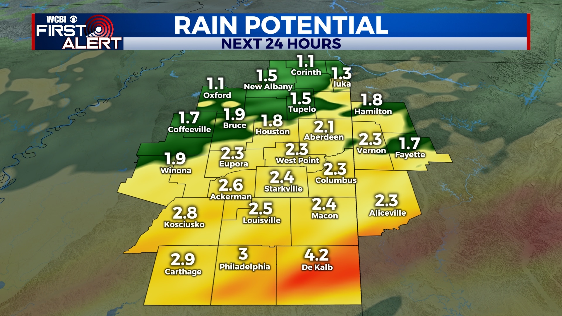
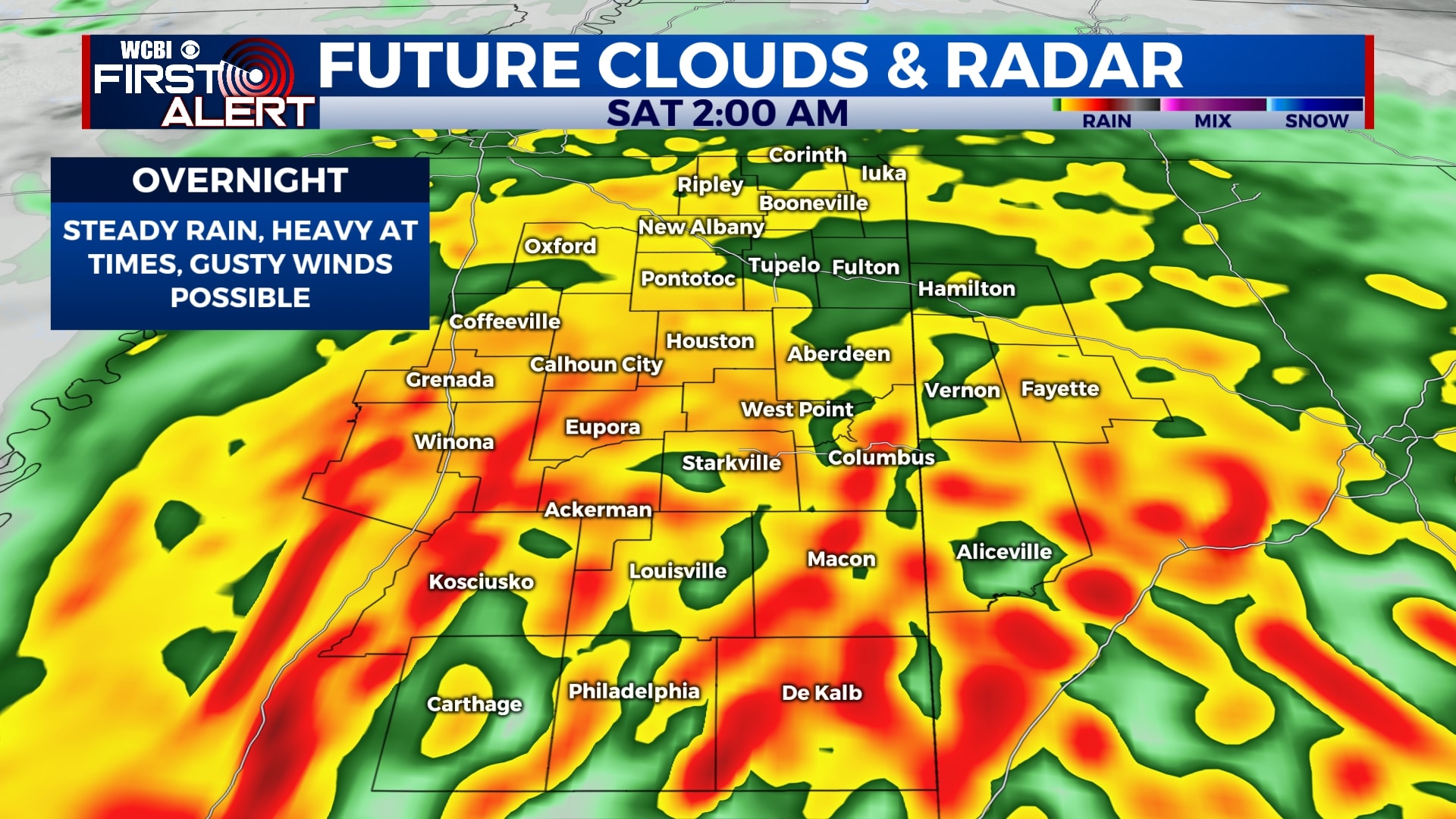
FRIDAY NIGHT: Rain will begin to pick up after 9pm, becoming more steady and heavy as the night goes on. Gusty winds and lightning are possible, but it appears the main severe weather threat will be to our south. 1-3″ of rain are possible before things taper off by sunrise Saturday. Lows will be in the mid 50s.
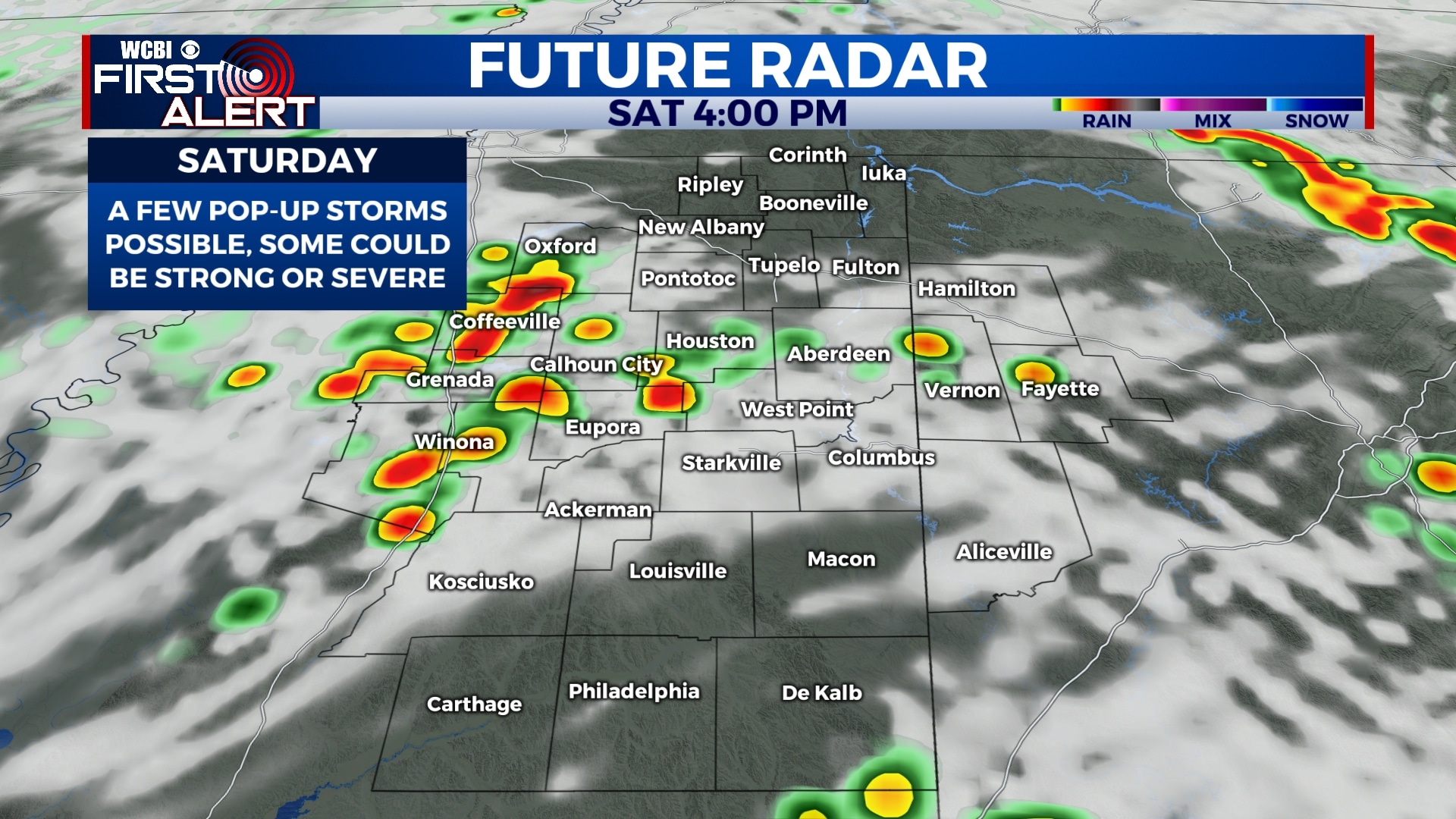
SATURDAY: While Saturday doesn’t appear to be an all-day washout, there will be a chance for some pop up showers and storms through about 7pm. Some of these storms could be on the stronger side with gusty winds and hail. The tornado threat is very low but we can’t rule out a brief one. Highs will be in the mid 70s.
SUNDAY-TUESDAY: Sunshine returns for the second half of the weekend and early next week. Temperatures will be warming up with highs in the 70s and 80s and lows in the 50s and 60s.
WEDNESDAY-FRIDAY: It looks like we’ll have another round of rain and storms to deal with either Wednesday night or during the day Thursday. Fortunately, things look to be clearing out by the end of the week and the weekend. Highs will remain in the low 70s.
Follow WCBI Weather on Facebook, Twitter, and Instagram
Follow Meteorologist Trevor Birchett on Facebook and Twitter


Leave a Reply