Very hot through Friday, slightly cooler weekend ahead
SUMMARY: The oppressive summer heat will stick around through Friday, with highs in the mid 90s and feels like temps well over 100. Rain chances will stay isolated. By the weekend, highs drop into the low 90s with scattered to numerous afternoon storms, a nice break from the heat! By next week, rain chances will stay elevated, potentially boosted by Tropical Storm Fred. Highs will stay in the upper 80s. Lows will be in the low to mid 70s for the foreseeable future. WEDNESDAY NIGHT: Warm and very muggy conditions will be in place tonight, any storms in the area will quickly end. Lows in the mid 70s under partly cloudy skies. THURSDAY: A very hot day in store with low rain chances. Highs in the mid to even upper 90s under partly cloudy skies, feeling well over 100 degrees in the afternoon. Only isolated evening storms expected. THURSDAY NIGHT: Rain and storms end, leaving us warm and muggy Thursday night. Partly cloudy skies with lows in the mid 70s. FRIDAY: Hot and humid again on Friday, but rain chances will be just a smidge higher in the afternoon, with isolated to perhaps scattered coverage of storms. Highs in the mid 90s, feeling like 100+. WEEKEND AND EARLY NEXT WEEK: This weekend we finally see some relief from the heat. Highs drop into the low 90s to around 90 degrees, with widespread showers and storms each afternoon. Lows stay in the low 70s. As we start next week, we could be seeing some impacts from Tropical Storm Fred, which is forecast to be in the northern gulf around this time. Where it comes ashore and how strong it will be is still up in the air, but for now expect increased rain chances and highs in the upper 80s for the beginning of next week. As always, we’ll keep you posted on Fred’s track! 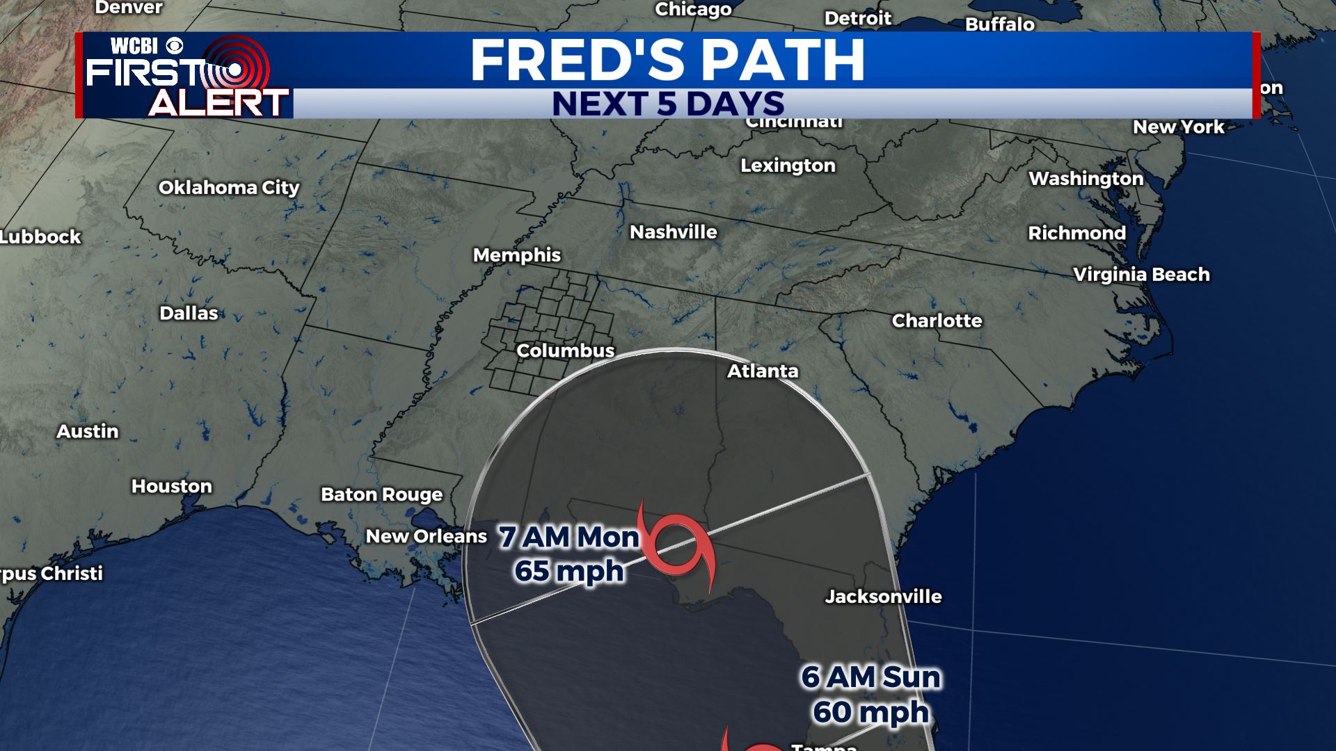 Stay connected with @WCBIWEATHER on Facebook, Twitter, Instagram and the WCBI News App


Leave a Reply