Hot & Humid Friday, Strong Storms Possible Friday Night
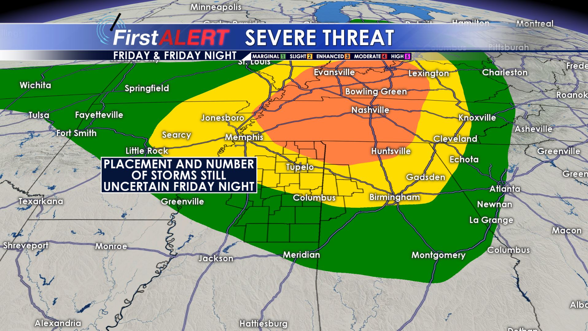
Friday Night Severe Threat
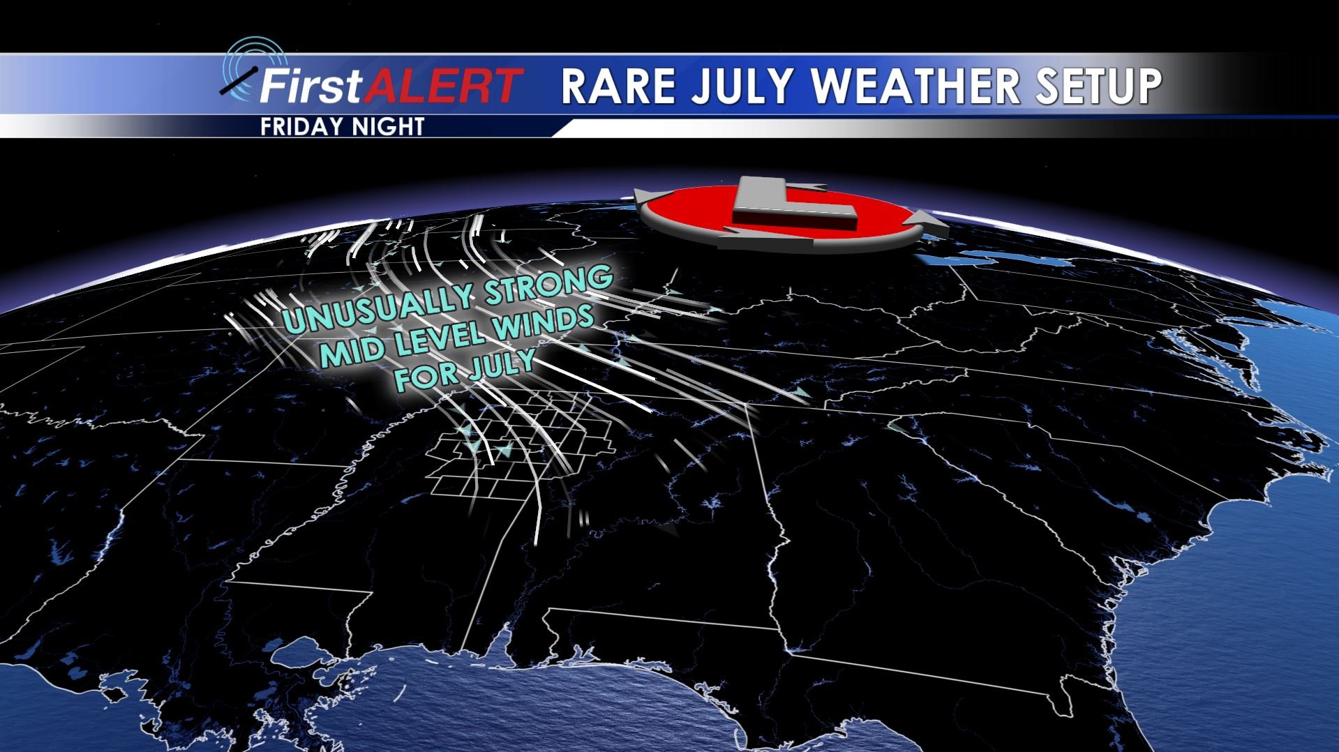
Fright Night Winds
THURSDAY NIGHT: We’re going to keep the chance of a few showers and storms going past the evening and into the overnight hours. Lows stay in the 70s with light wind.
FRIDAY: Look for highs well into the 90s with heat indices in the 100s. A shower or storm is possible at any time during the day. The chance of rain is 30%.
FRIDAY EVENING/NIGHT: There is the potential for a few clusters of strong to severe storms with damaging wind gusts being the primary threat. Some hail and an isolated tornado also can’t be ruled out. This is an unusual atmospheric setup for the middle of July here in the Deep South but the exact placement and number of storms remains up in the air. Stay tuned for more info on Friday once new information comes in. Temperatures bottom out in the 70s.
SATURDAY: Another warm day with highs in the low to mid 90s is expected. A few showers and storms are possible. We’re going to keep the rain chance at 30%.
SUNDAY: A partly cloudy and relatively rain free day is likely as we get in between weather systems. Plan on highs in the low 90s. The chance of rain is low at 20%.
NEXT WEEK: A meandering area of low pressure in the upper levels of the atmosphere will keep a daily chance of showers and storms going. Temperatures are going to be highly dependent on where storms actually form. In general, we anticipate highs around 90 and lows around 70.
Follow @WCBIWEATHER on Facebook, Twitter, Instagram, and Snapchat


Leave a Reply