Hot & humid work week coming
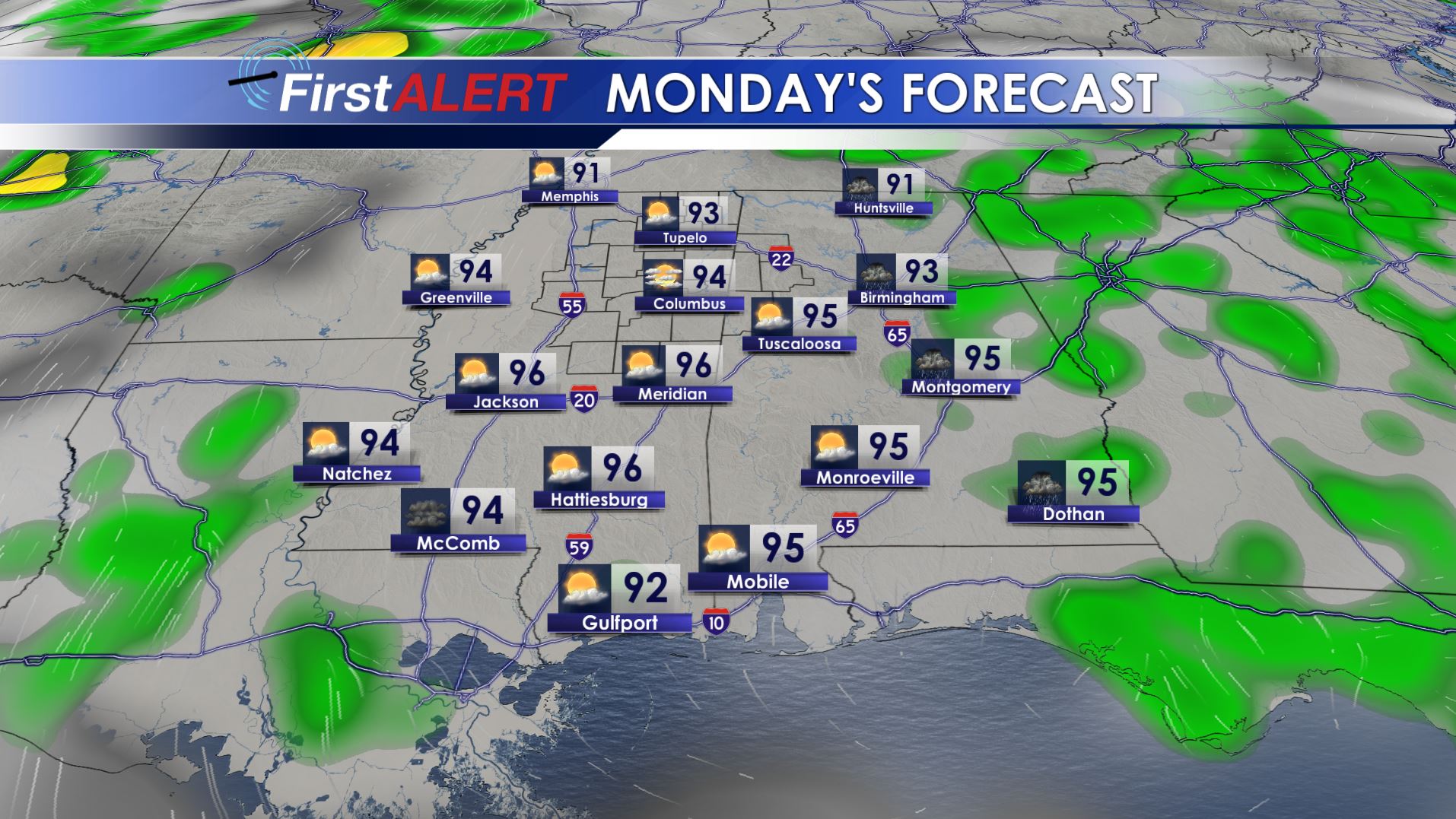
Monday’s Forecast
SUNDAY EVENING/NIGHT: Most of the area is likely going to remain warm, muggy, and quiet but there is still the chance of a shower or storm. Look for lows in the low to mid 70s.
MONDAY: A few showers and storms are possible, especially across our northern and eastern counties. We’re going to keep the chance of rain at 30% but many spots won’t get a drop. Daytime highs should be in the low to mid 90s. Heat indices are expected to push back into the low 100s. Lows Monday night should be in the mid 70s.
TUESDAY: We’ll stay hot and humid. Daytime highs in the mid 90s are likely along with heat indices in the 100s. The chance of a pop-up shower or storm is just 20%.
WEDNESDAY-SUNDAY: Hot & humid weather hangs on. Plan on daytime highs in the low to mid 90s with overnight lows in the 70s. A few pop-up showers and storms are certainly possible each day with slightly higher odds by the weekend.
Follow @WCBIWEATHER on Facebook, Twitter, Instagram, and Snapchat


Leave a Reply