Ida to bring heavy rain, wind to northeast Mississippi
SUMMARY: Hurricane Ida made landfall Sunday as a category 4 storm in Louisiana, and while it continues to weaken as it moves inland, impacts are likely across north MS and west AL today and Tuesday. Conditions will improve by Wednesday.
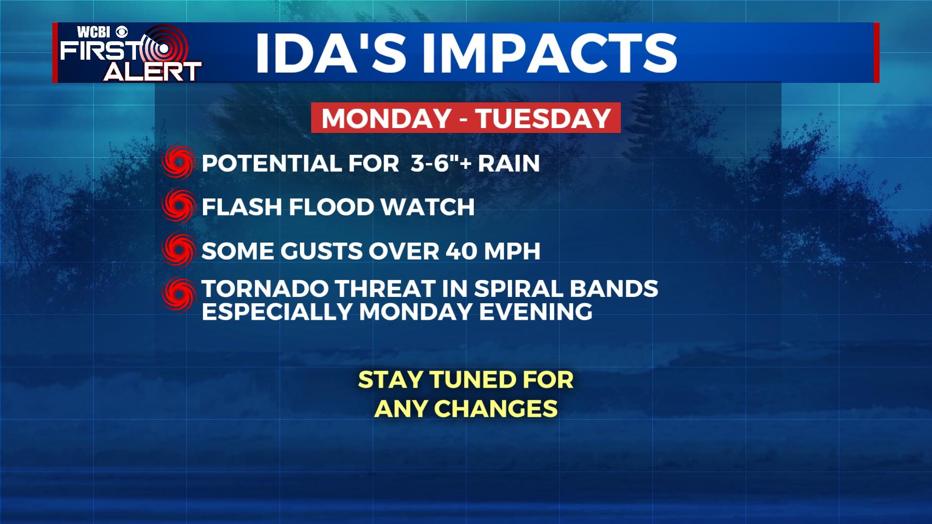
MONDAY: Conditions will gradually deteriorate as steady rain becomes heavier in the afternoon and evening hours. A spin-up tornado or two will be possible as well as wind shear increases.
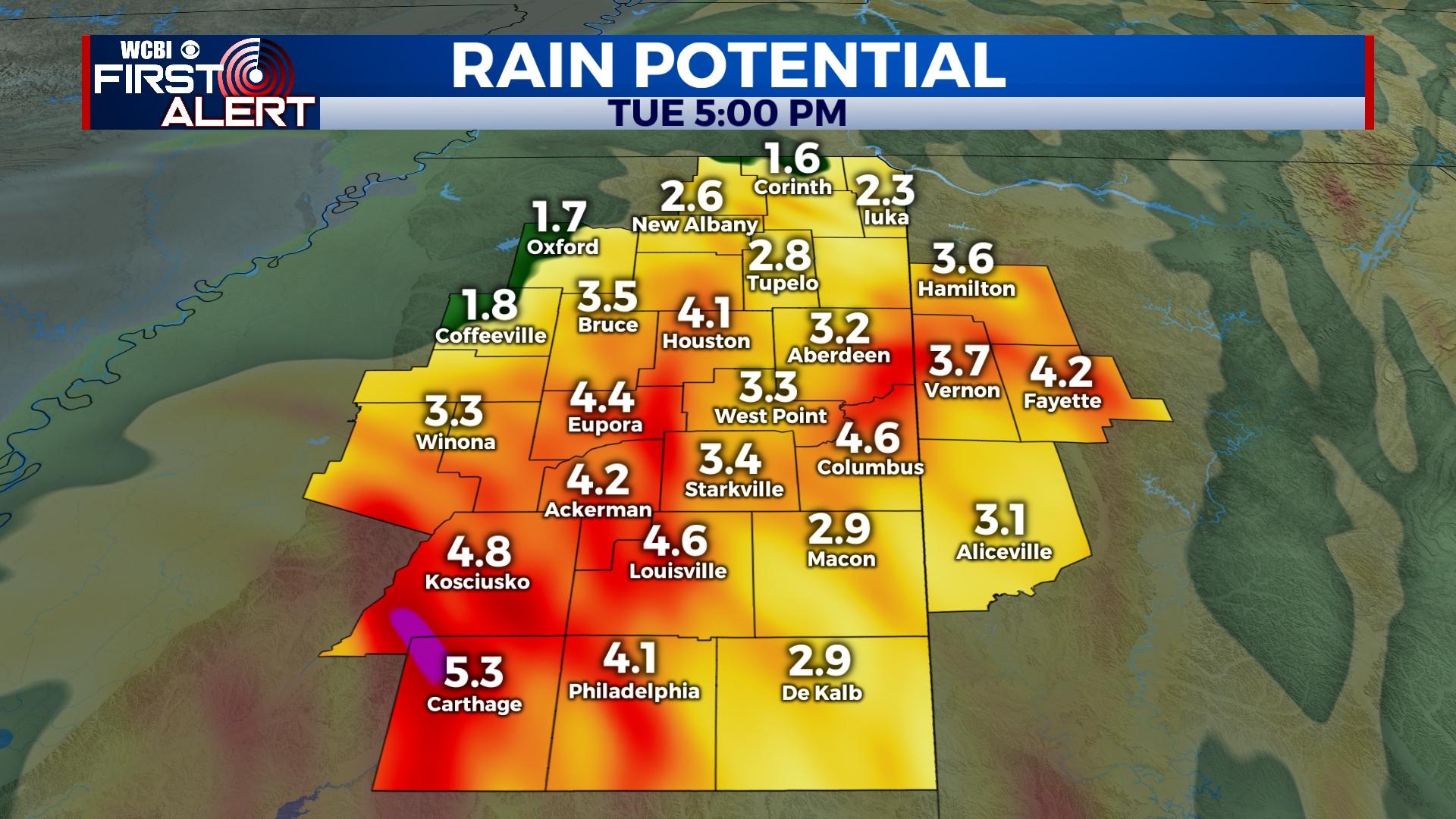
MONDAY NIGHT: Heavy rain and stronger wind gusts are expected as the center of Ida gets closer to the region. Tropical storm force (39 mph or greater) wind gusts are possible across a good portion of northeast MS, which could cause tree/power line damage. Rain totals will average 3-6″ across a good portion of the region, and a flash flood watch remains in effect. Lastly, isolated tornadoes within the larger rain shield and/or feeder bands will remain possible.
TUESDAY: The worst of the weather will be shifting east of the region by daybreak Tuesday, leaving scattered showers and northwest breezes for the rest of the day. Cloud cover will continue and likely hold high temperatures in the 70s.
WEDNESDAY: Gradual clearing is expected with highs back in the middle 80s.
LATE WEEK: Drier, LESS HUMID air is forecast to move in from the north, so Thursday and Friday look to be absolutely gorgeous with highs in the 80s and morning lows in the lower 60s or even upper 50s.
SATURDAY: Expect plenty of sun through the day with highs in the mid to upper 80s. Football home openers around here will have no weather concerns.


