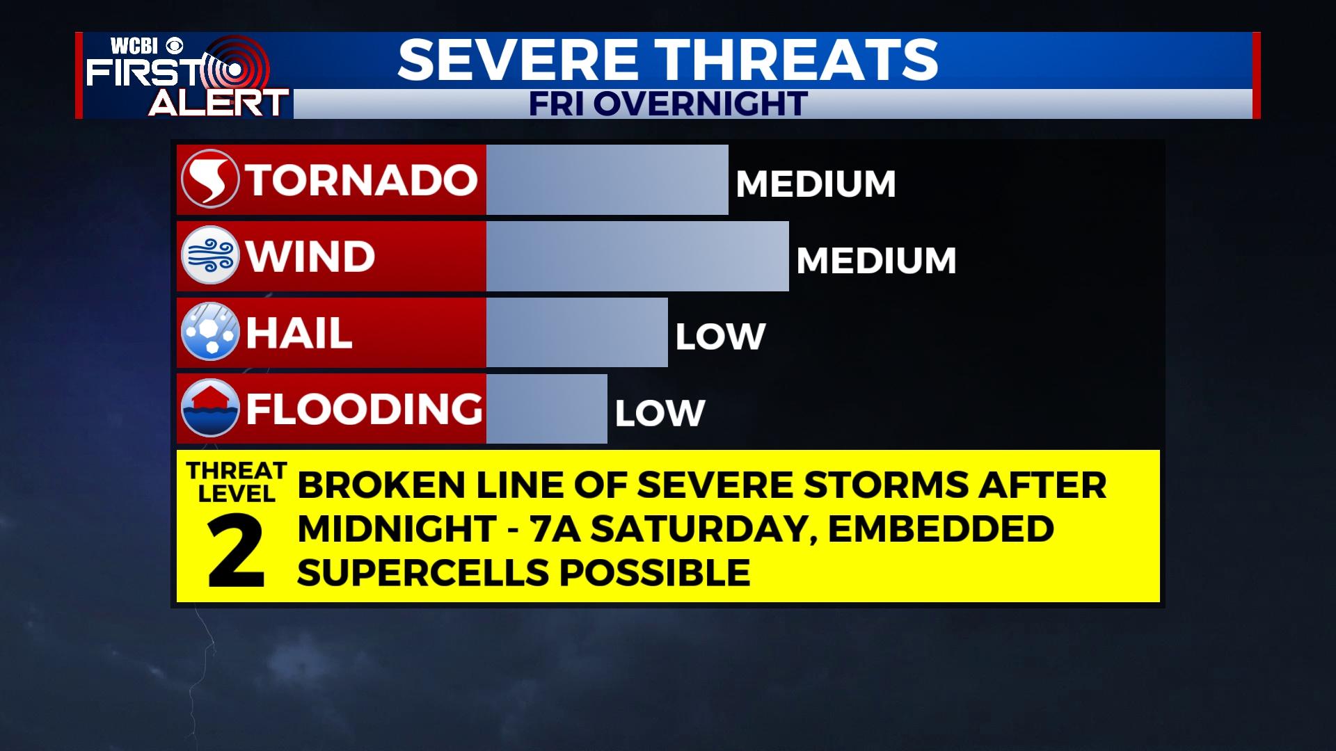
Increasingly warm and humid, severe storms late Friday night
COLUMBUS, Mississippi (WCBI) – Unseasonably warm air returns to the Twin States to end the week. Severe storms are possible late Friday night into early Saturday.
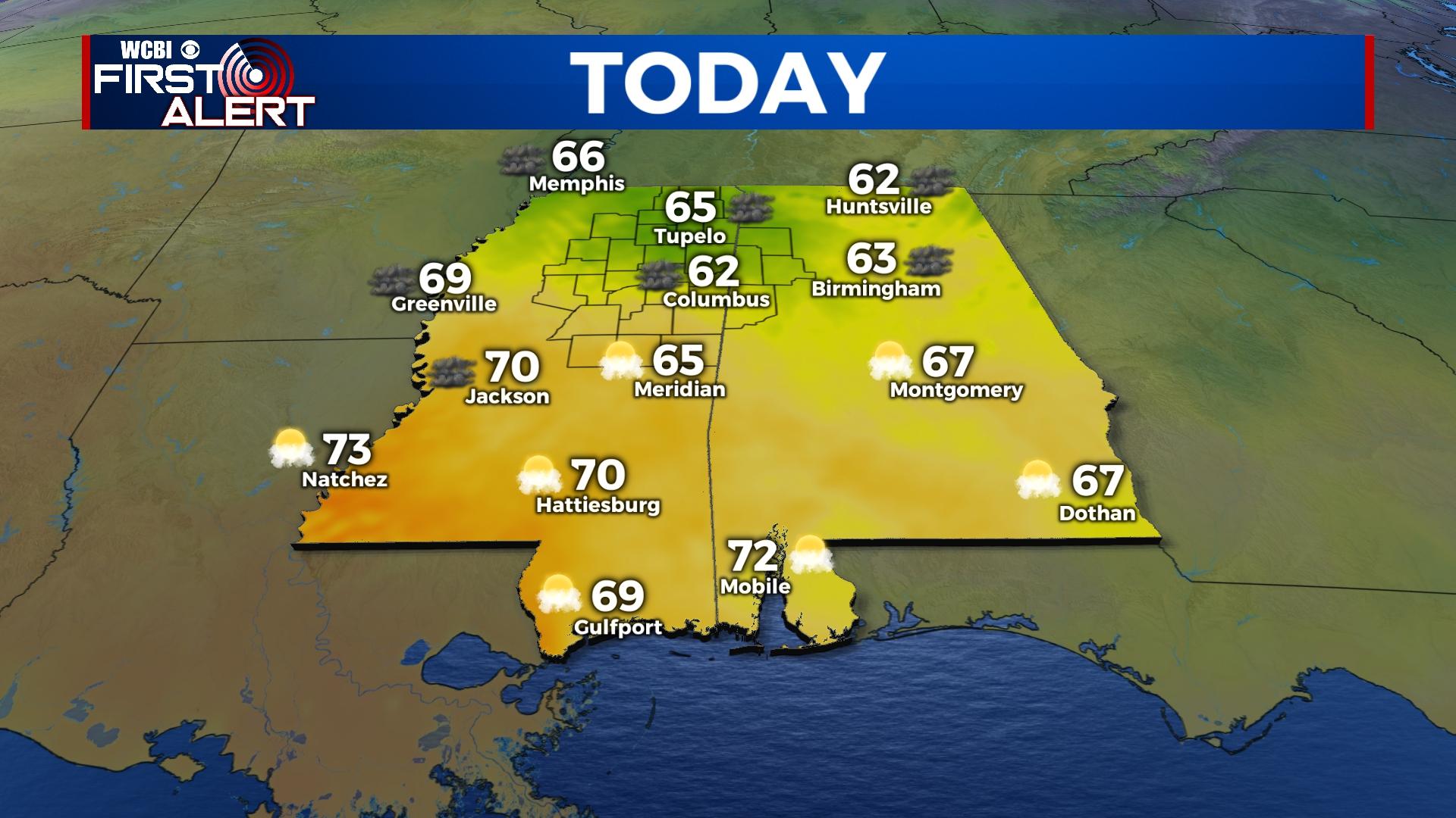
THURSDAY: After a cold start in the 30s, highs will still reach the low 60s as clouds build in quickly. Brief, spotty showers are possible this afternoon and evening as well.
THURSDAY NIGHT: A slightly better chance for showers and even a rumble or two will shift into Alabama late this evening and overnight. Temperatures may actually climb a degree or two, staying in the low 60s.
FRIDAY: Expect a mostly cloudy, warm, and breezy day with highs exceeding daily records. Temperatures may reach 80 degrees in a few spots. While spotty showers are possible, a good portion of the day should stay dry.
FRIDAY NIGHT: Warm and humid conditions along with the approach of a strong cold front will yield increasing severe weather potential, especially after midnight. While a few rogue storms are possible in the evening hours, generally NW of the Natchez Trace, things should stay quiet until the overnight hours. A broken line of strong to severe storms should pass through the region sometime after midnight through 7-9a Saturday. Damaging winds and a few tornadoes are the primary risks from this system.
SATURDAY: Any storms will exit the region by 9a, and gradual clearing is expected into the afternoon hours as temperatures fall into the 50s with gusty northwest winds.
SUNDAY: Temperatures will start near or just above freezing, but plenty of sun is on tap with highs in the 50s.
NEXT WEEK: Conditions stay mostly sunny, but yet another rebound in temperature is expected. Highs will once again top out in the 70s by Tuesday.


