Lots of Sunshine Today, Heavy Rain Starts Tomorrow
TODAY: We anticipate another mostly sunny day with some clouds here and there. Highs climb into the mid to upper 60s with breezy south and east winds 5-15 mph with gusts as high as 25 at times. The daytime stays dry, even with increasing clouds by the late afternoon.
TONIGHT: Clouds increase and we likely see some showers in the area by midnight. Areas of rain with a few embedded storms are possible, but no organized severe threat is anticipated right now. Temperatures fall only into the 50s.
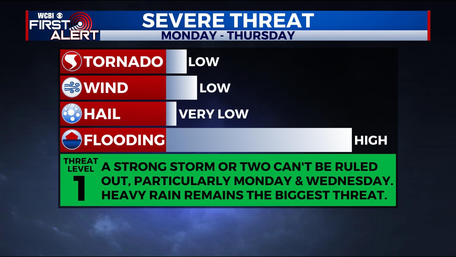
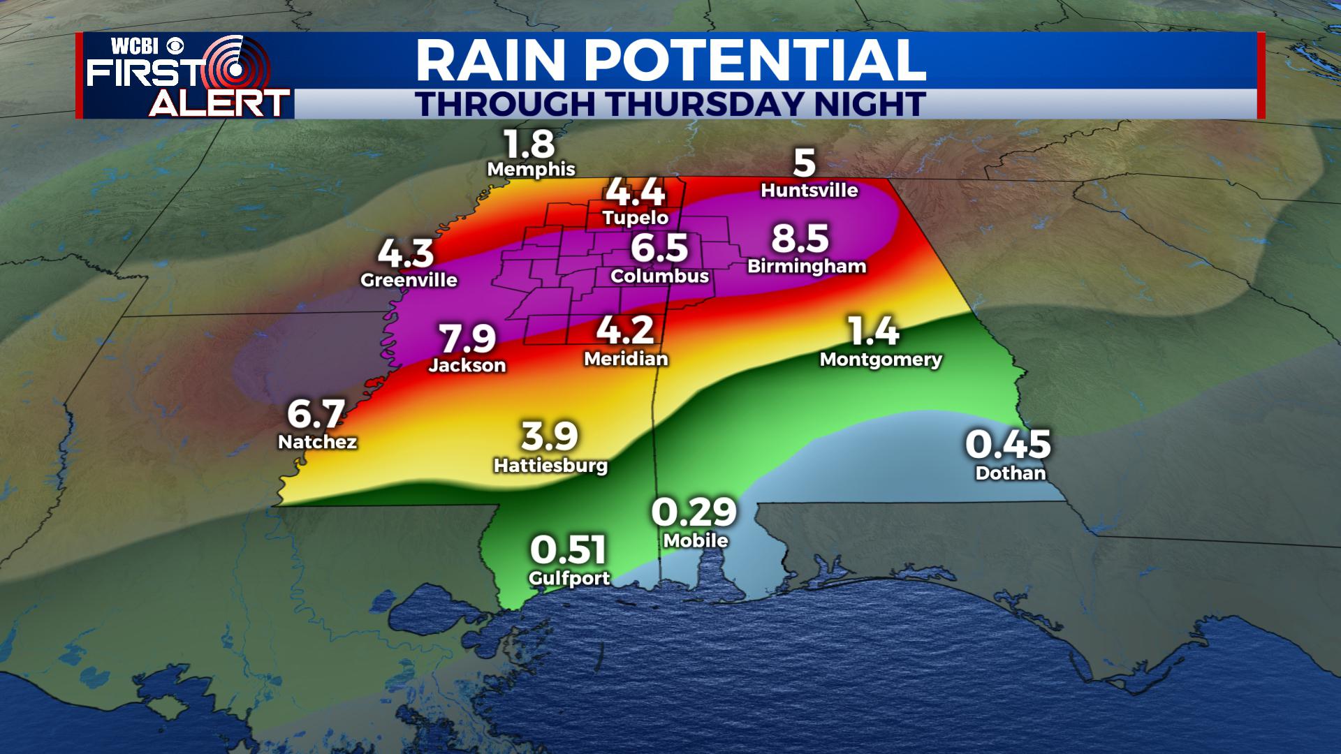
MONDAY: Areas of widespread rain and and storms are expected with highs in the mid 60s. Heavy rain is the main threat with any stronger storm, though a stronger gust of wind can’t be ruled out. 1-3 inches of rain may fall across the region. Lows Monday night fall into the 50s again with rain and storms continuing.
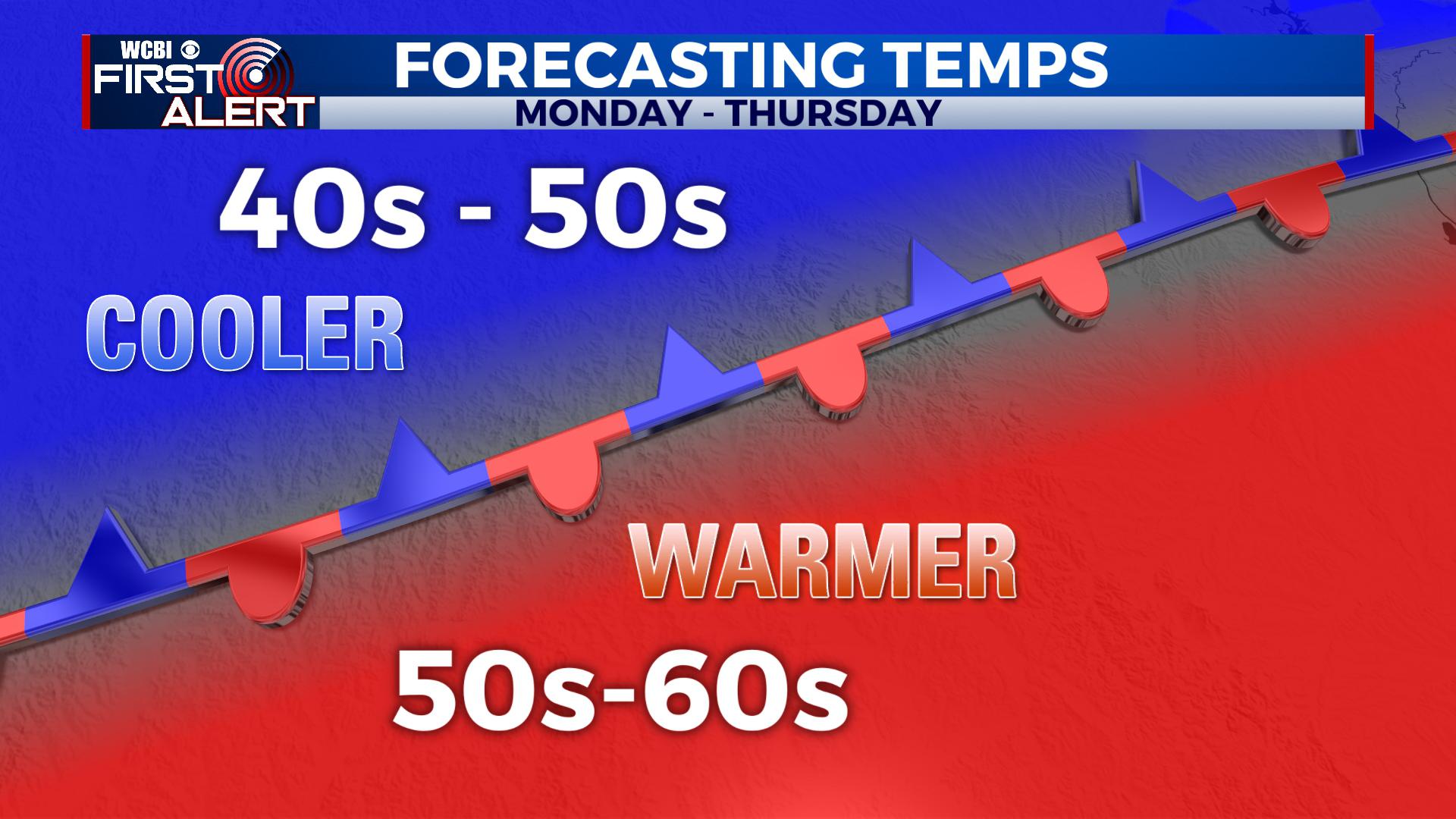
TUESDAY – THURSDAY: Additional waves of rain with some embedded thunder appear likely. Another 2-5 inches of rain may fall and that could lead to more flooding. Highs will vary throughout the period pending the placement of the boundary. Areas north of the boundary will be in the 40s and 50s while south of it in the 50s and 60s. A few stronger storms can’t be ruled out, particularly Wednesday into Wednesday Night, though uncertainty still remains with how that plays out. By Thursday Night, the rain will finally come to an end in the region.
FRIDAY – NEXT WEEKEND: Sunshine returns with some clouds in the area. Look for highs in the 50s and lows in the 30s. River flooding will likely be ongoing into the weekend.
STAY CONNECTED WITH THE FIRST ALERT FORECAST ON FACEBOOK, TWITTER AND INSTAGRAM, AND ON THE WCBI MOBILE APP.


Leave a Reply